File:Aerial view of Long Tail Point in Brown County, Wisconsin 2020.png
Jump to navigation
Jump to search

Size of this preview: 451 × 599 pixels. Other resolutions: 181 × 240 pixels | 361 × 480 pixels | 578 × 768 pixels | 771 × 1,024 pixels | 1,542 × 2,048 pixels | 9,470 × 12,577 pixels.
Original file (9,470 × 12,577 pixels, file size: 200.38 MB, MIME type: image/png)
Captions
Captions
Add a one-line explanation of what this file represents
| Warning | The original file is very high-resolution. It might not load properly or could cause your browser to freeze when opened at full size. |
|---|
| Description |
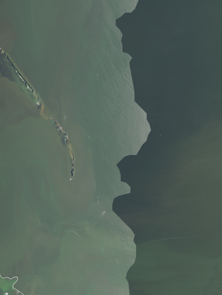
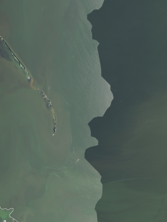
English: Aerial view of Long Tail Point, including the Long Tail Point Light (center and to the left, with a shadow pointing left) in Brown County, Wisconsin, taken July 28, 2020
Coordinates:
|
|||
| Date | ||||
| Source | converted to .png by Epiphyllumlover from the original .tif available as item M_4408725_NW_16_060_20200728 on EarthExplorer | |||
| Author | Aerial Photography Field Office (APFO) for NAIP, USGS; in contract with the Surdex Corporation | |||
| Permission (Reusing this file) |
|
File history
Click on a date/time to view the file as it appeared at that time.
| Date/Time | Thumbnail | Dimensions | User | Comment | |
|---|---|---|---|---|---|
| current | 02:05, 27 March 2022 | | 9,470 × 12,577 (200.38 MB) | Epiphyllumlover (talk | contribs) | c:User:Rillke/bigChunkedUpload.js: {{Information | Description = {{en|1=Aerial view of Long Tail Point, including the Long Tail Point Light (center and to the left, with a shadow pointing left) in Brown County, Wisconsin, taken July 28, 2020 Coordinates: *Center Latitude 44°35'38.41"N *Center Longitude 87°58'06.65"W *NW Corner Lat 44°37'39.56"N *NW Corner Long 88°00'17.60"W *NE Corner Lat 44°37'41.74"N *NE Corner Long 87°55'5... |
You cannot overwrite this file.
File usage on Commons
There are no pages that use this file.