File:Aerial photo of Port of Tacoma.jpg
Jump to navigation
Jump to search
Size of this preview: 800 × 534 pixels. Other resolutions: 320 × 214 pixels | 640 × 427 pixels | 1,024 × 683 pixels | 1,280 × 854 pixels | 2,560 × 1,708 pixels | 6,983 × 4,660 pixels.
Original file (6,983 × 4,660 pixels, file size: 10.47 MB, MIME type: image/jpeg)
Captions
Captions
Add a one-line explanation of what this file represents
Summary[edit]
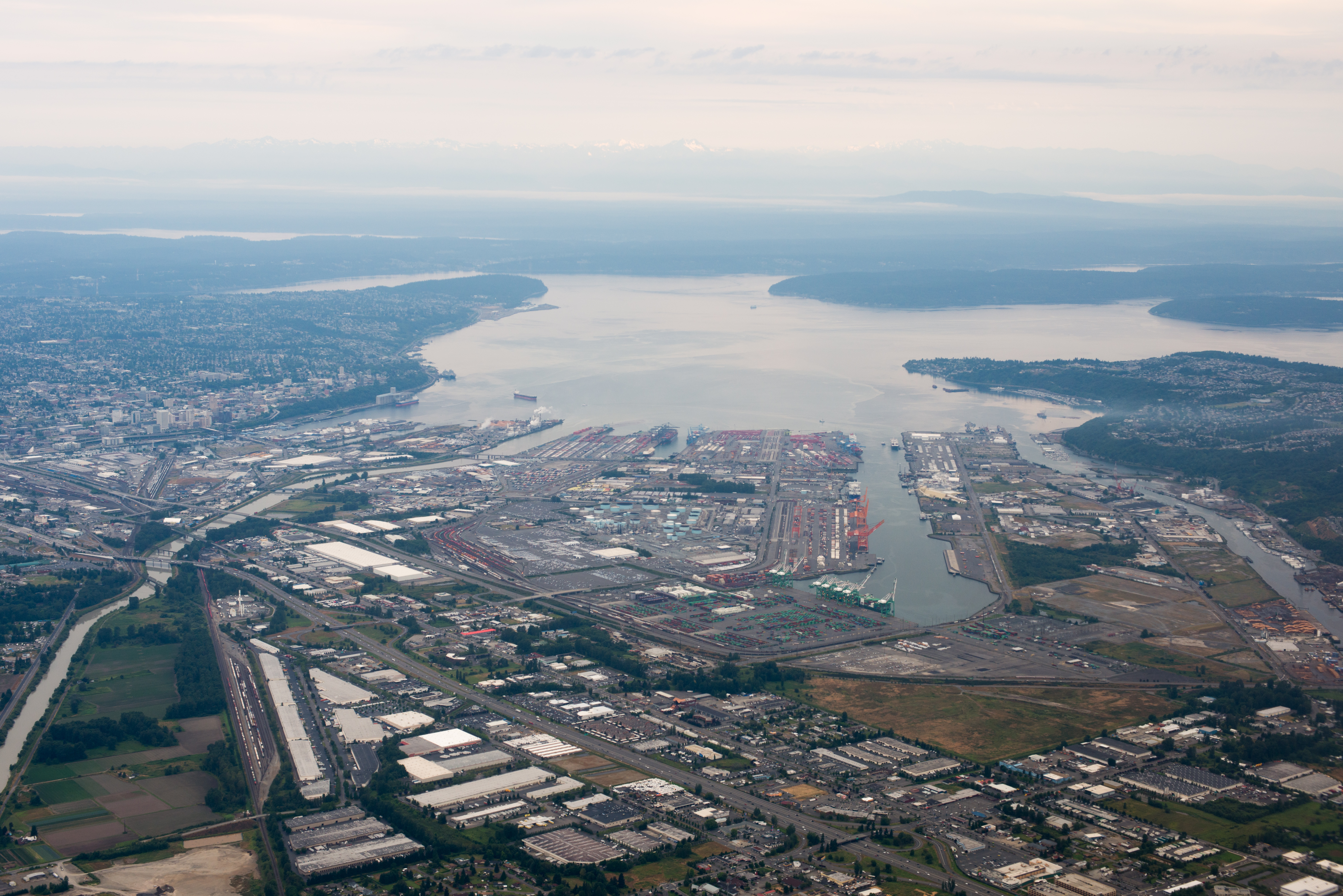
| Description | Port of Tacoma, where the Puyallup River (left) feeds into Commencement Bay. Harbor cranes line artificial waterways. Interstate highway I-5 crosses in the foreground, passing over Puyallup River on the Puyallup River Bridge. Behind it three more bridges cross, route 509, Lincoln Ave, and E 11th St. Downtown Tacoma is at upper-left. Across the bay is Vashon Island on right and the Olympic Penninsula on left in distance. |
| Date | |
| Source | Aerial photo of Port of Tacoma |
| Author | D Coetzee from Berkeley, CA, USA |
| Other versions | File:Aerial photo Puyallup River Commencement Bay.jpg |
Licensing[edit]
| This file is made available under the Creative Commons CC0 1.0 Universal Public Domain Dedication. | |
| The person who associated a work with this deed has dedicated the work to the public domain by waiving all of their rights to the work worldwide under copyright law, including all related and neighboring rights, to the extent allowed by law. You can copy, modify, distribute and perform the work, even for commercial purposes, all without asking permission.
|
| This image was originally posted to Flickr by D Coetzee at https://flickr.com/photos/29507259@N02/7642349014. It was reviewed on 19 October 2015 by FlickreviewR and was confirmed to be licensed under the terms of the cc-zero. |
File history
Click on a date/time to view the file as it appeared at that time.
| Date/Time | Thumbnail | Dimensions | User | Comment | |
|---|---|---|---|---|---|
| current | 17:09, 19 October 2015 | | 6,983 × 4,660 (10.47 MB) | Bri (talk | contribs) | Transferred from Flickr via Flickr2Commons |
You cannot overwrite this file.
File usage on Commons
The following page uses this file:
- File:Aerial photo of Port of Tacoma (7642349014) (2).jpg (file redirect)
_(2).jpg&redirect=no)
File usage on other wikis
The following other wikis use this file:
- Usage on bn.wikipedia.org
- Usage on nn.wikipedia.org
- Usage on ru.wikipedia.org