File:Aerial View of Vaughnsville.jpg
Jump to navigation
Jump to search

Size of this preview: 800 × 578 pixels. Other resolutions: 320 × 231 pixels | 640 × 462 pixels | 1,024 × 739 pixels | 1,280 × 924 pixels | 2,560 × 1,848 pixels | 3,992 × 2,882 pixels.
Original file (3,992 × 2,882 pixels, file size: 8.44 MB, MIME type: image/jpeg)
Captions
Captions
Add a one-line explanation of what this file represents
Summary[edit]
| Description |
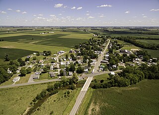
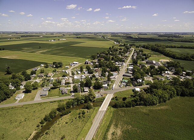
English: View looking east across Vaughnsville with the intersection of State Route 12, 189 and 115 seen from a DJI Phantom Professional 3 Drone |
| Date | |
| Source | Own work |
| Author | Southerntabitha |
| Camera location | | View this and other nearby images on: OpenStreetMap |
|---|
Licensing[edit]
I, the copyright holder of this work, hereby publish it under the following license:
This file is licensed under the Creative Commons Attribution-Share Alike 4.0 International license.
- You are free:
- to share – to copy, distribute and transmit the work
- to remix – to adapt the work
- Under the following conditions:
- attribution – You must give appropriate credit, provide a link to the license, and indicate if changes were made. You may do so in any reasonable manner, but not in any way that suggests the licensor endorses you or your use.
- share alike – If you remix, transform, or build upon the material, you must distribute your contributions under the same or compatible license as the original.
File history
Click on a date/time to view the file as it appeared at that time.
| Date/Time | Thumbnail | Dimensions | User | Comment | |
|---|---|---|---|---|---|
| current | 20:23, 19 September 2023 | | 3,992 × 2,882 (8.44 MB) | Beao (talk | contribs) | Cropped 4 % vertically using CropTool with lossless mode. |
| 01:56, 24 October 2016 |  | 3,992 × 2,992 (8.19 MB) | Southerntabitha (talk | contribs) | Cross-wiki upload from en.wikipedia.org |
You cannot overwrite this file.
File usage on Commons
The following 2 pages use this file:
File usage on other wikis
The following other wikis use this file:
- Usage on ceb.wikipedia.org
- Usage on ce.wikipedia.org
- Usage on en.wikipedia.org
- Usage on es.wikipedia.org
- Usage on lld.wikipedia.org
- Usage on pl.wikipedia.org
- Usage on pt.wikipedia.org
- Usage on sr.wikipedia.org
- Usage on tt.wikipedia.org
- Usage on uk.wikipedia.org
- Usage on www.wikidata.org