File:Aerial View of Horne Fire 2 (1c577576-257a-47cc-aa39-1844d6268b29).jpg
Jump to navigation
Jump to search

Size of this preview: 600 × 600 pixels. Other resolutions: 240 × 240 pixels | 480 × 480 pixels | 768 × 768 pixels | 1,024 × 1,024 pixels | 2,448 × 2,448 pixels.
Original file (2,448 × 2,448 pixels, file size: 916 KB, MIME type: image/jpeg)
Captions
Captions
Add a one-line explanation of what this file represents
| Camera location | | View this and other nearby images on: OpenStreetMap |
|---|
.jpg¶ms=048.176742_N_-088.474914_E_globe:Earth_type:camera_alt:630.6696_source:exif_heading:184.31&language=en)

|
The categories of this image need checking. You can do so here.
|
.jpg&action=edit&withJS=MediaWiki:Catcheck.js)
Summary[edit]
.jpg&action=edit§ion=1)
| English: Aerial View of Horne Fire 2 | ||||
|---|---|---|---|---|
| Photographer |
English: NPS Photo |
|||
| Title |
English: Aerial View of Horne Fire 2 |
|||
| Description |
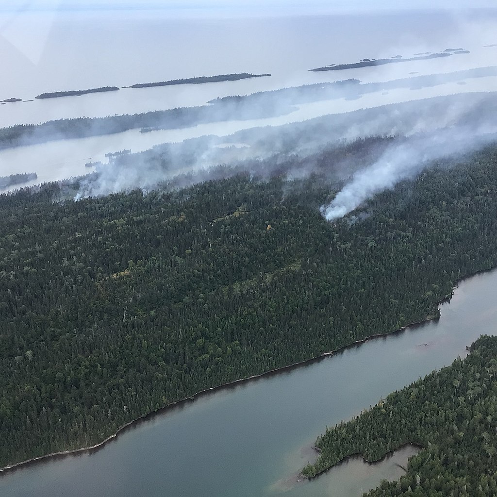
English: Smoke rises from a forest on an island in a lake. Aerial view of Horne Fire on the northeastern end of Isle Royale looking south.
|
|||
| Depicted place |
English: Isle Royale National Park, Keweenaw County, Michigan |
|||
| Date | Taken on 24 August 2021 | |||
| Accession number | ||||
| Source |
English: NPGallery |
|||
| Permission (Reusing this file) |
|
|||
| NPS Unit Code | ISRO | |||
File history
Click on a date/time to view the file as it appeared at that time.
| Date/Time | Thumbnail | Dimensions | User | Comment | |
|---|---|---|---|---|---|
| current | 15:38, 13 January 2022 | | 2,448 × 2,448 (916 KB) | BMacZeroBot (talk | contribs) | Batch upload (Commons:Batch uploading/NPGallery) |
You cannot overwrite this file.
File usage on Commons
The following page uses this file:
.jpg)
.jpg&oldid=782605597)