File:Adrianople Vilayet — Memalik-i Mahruse-i Shahane-ye Mahsus Mukemmel ve Mufassal Atlas (1907).jpg
Jump to navigation
Jump to search
Size of this preview: 785 × 600 pixels. Other resolutions: 314 × 240 pixels | 628 × 480 pixels | 1,005 × 768 pixels | 1,280 × 978 pixels | 2,121 × 1,621 pixels.
Original file (2,121 × 1,621 pixels, file size: 1.77 MB, MIME type: image/jpeg)
Captions
Captions
Add a one-line explanation of what this file represents
Summary[edit]
.jpg&action=edit§ion=1)
| Description |
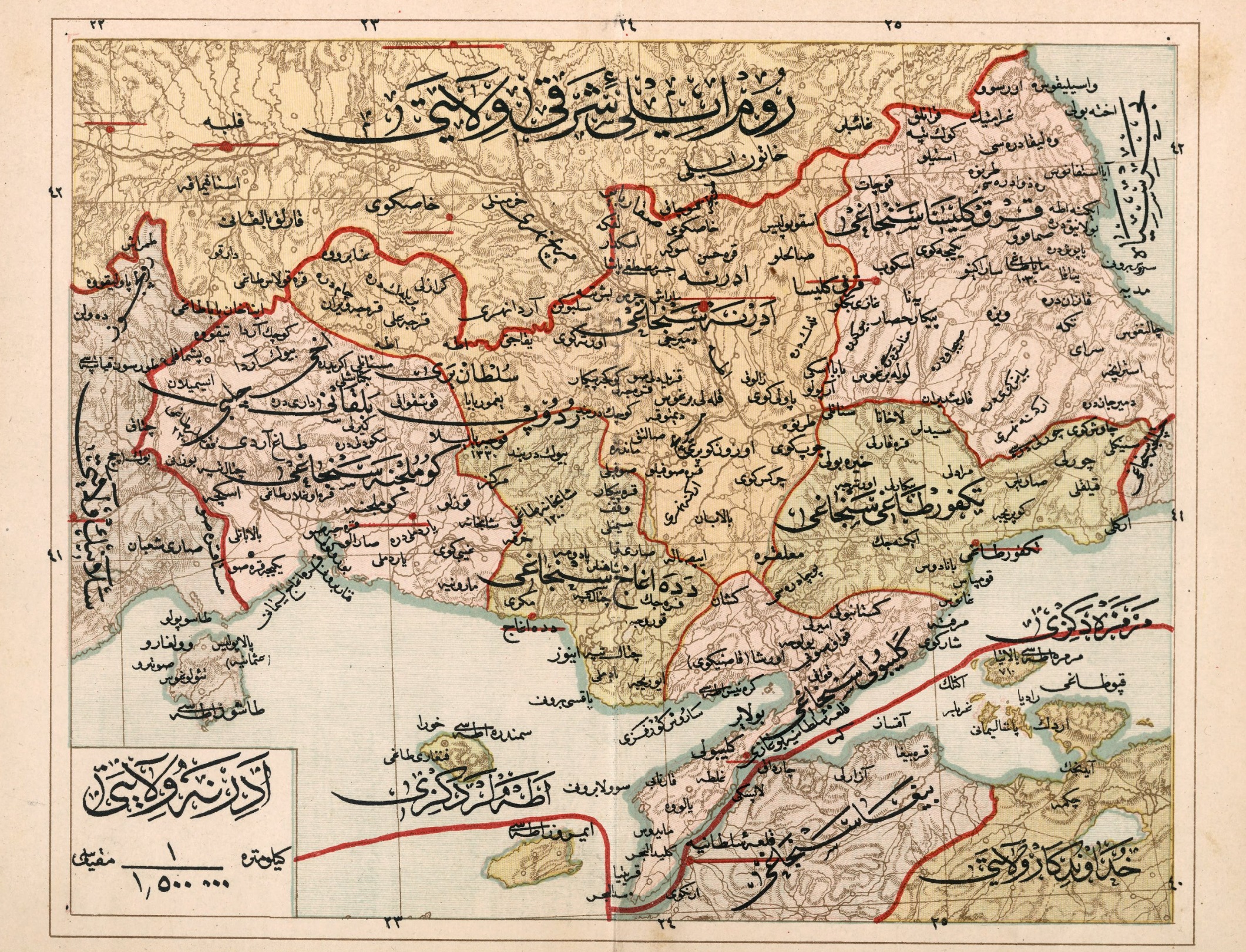
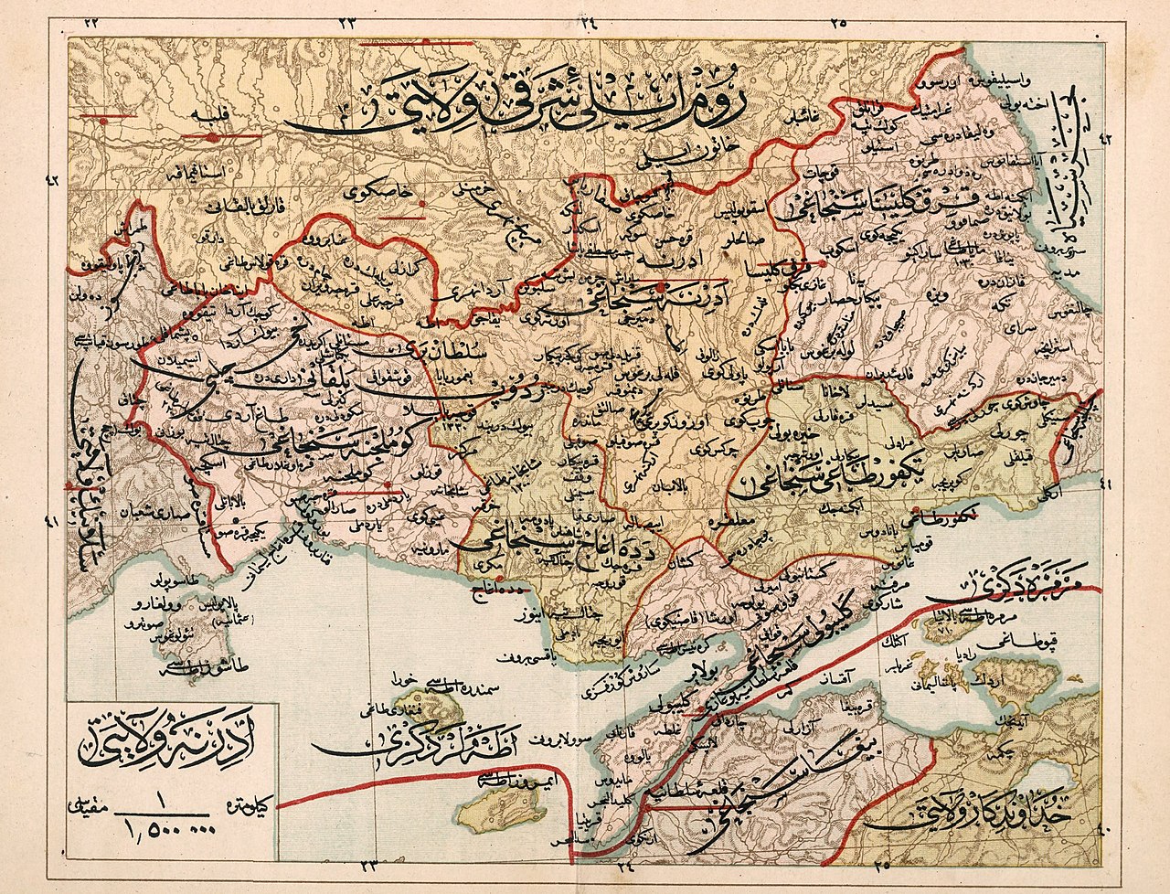
English: Adrianople Vilayet — Memalik-i Mahruse-i Şahaneye Mahsus Mukemmel ve Mufassal Atlas (1907); it was divided in five sanjaks: Edirne, Kirklaleri, Tekirdag, Callipoli, Alexandroupolis, and Komotini. |
| Date | |
| Source | http://www.bura.org.tr/haberler/haberoku.asp?hid=576 |
| Author | Mehmed Nasrullah, Mehmed Rüşdi, Mehmed Eşref |
Licensing[edit]
.jpg&action=edit§ion=2)
This media file is in the public domain in the United States. This applies to U.S. works where the copyright has expired, often because its first publication occurred prior to January 1, 1929, and if not then due to lack of notice or renewal. See this page for further explanation.
|
 | |
 |
This image might not be in the public domain outside of the United States; this especially applies in the countries and areas that do not apply the rule of the shorter term for US works, such as Canada, Mainland China (not Hong Kong or Macao), Germany, Mexico, and Switzerland. The creator and year of publication are essential information and must be provided. See Wikipedia:Public domain and Wikipedia:Copyrights for more details.
|
File history
Click on a date/time to view the file as it appeared at that time.
| Date/Time | Thumbnail | Dimensions | User | Comment | |
|---|---|---|---|---|---|
| current | 02:10, 4 February 2023 | | 2,121 × 1,621 (1.77 MB) | BasilLeaf (talk | contribs) | Higher quality of the same map |
| 23:29, 1 October 2011 |  | 1,100 × 859 (289 KB) | Underlying lk (talk | contribs) | == Summary == {{Information |Description ={{en|1=Adrianople Vilayet — Memalik-i Mahruse-i Şahaneye Mahsus Mukemmel ve Mufassal Atlas (1907)}} |Source =http://www.aa.tufs.ac.jp/~kuroki/map/frameM.html |Author =Mehmed Nasrullah, Mehmed |
You cannot overwrite this file.
File usage on Commons
The following page uses this file:
File usage on other wikis
The following other wikis use this file:
- Usage on ar.wikipedia.org
- Usage on bg.wikipedia.org
- Usage on el.wikipedia.org
- Usage on en.wikipedia.org
- Usage on es.wikipedia.org
- Usage on fr.wikipedia.org
- Usage on it.wikipedia.org
- Usage on mk.wikipedia.org
- Usage on ru.wikipedia.org
- Usage on sq.wikipedia.org
- Usage on tr.wikipedia.org
- Usage on uk.wikipedia.org
.jpg&oldid=782431262)