File:Admiralty Islands Topography with labels.png
Jump to navigation
Jump to search
Size of this preview: 800 × 416 pixels. Other resolutions: 320 × 166 pixels | 640 × 333 pixels | 1,024 × 532 pixels | 1,280 × 666 pixels | 2,554 × 1,328 pixels.
Original file (2,554 × 1,328 pixels, file size: 564 KB, MIME type: image/png)
Captions
Captions
Add a one-line explanation of what this file represents
Summary[edit]
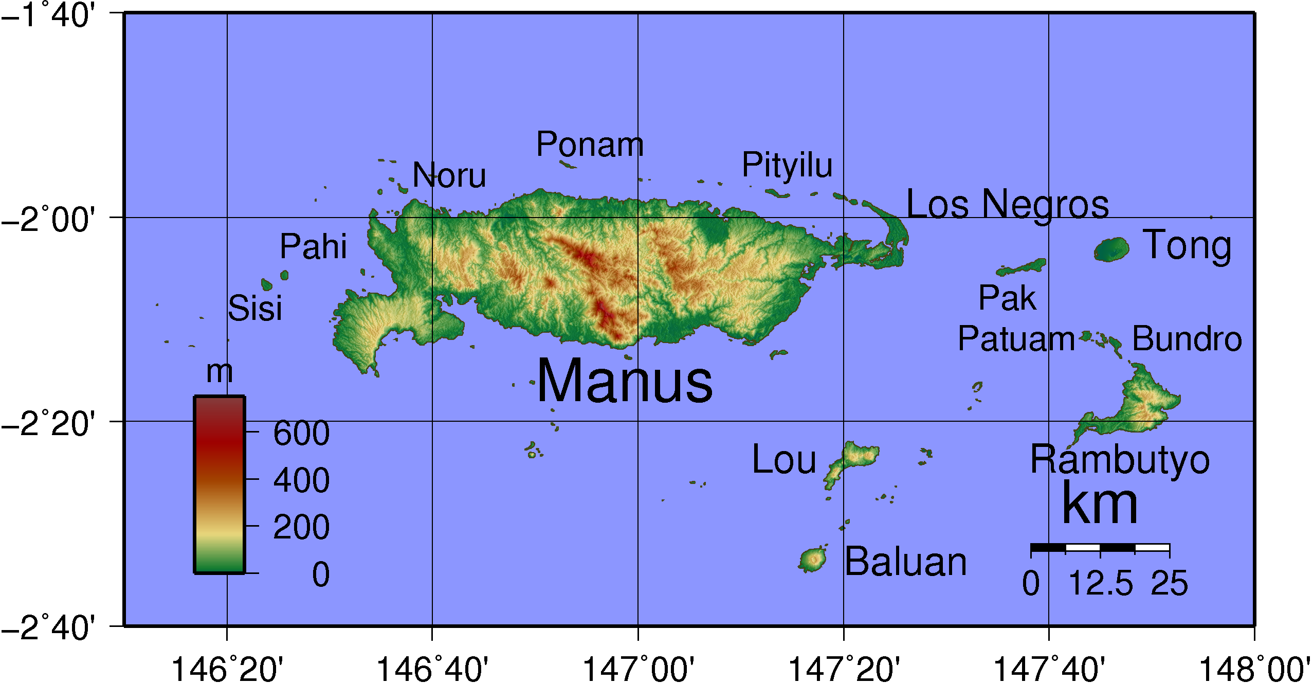
| Description | Topographical map of Admiralty Island in Papua New Guinea. Largest islands have been named. Created with GMT from publicly released SRTM data. |
| Date | |
| Source | Own work |
| Author | Sadalmelik |
Licensing[edit]
| I, the copyright holder of this work, release this work into the public domain. This applies worldwide. In some countries this may not be legally possible; if so: I grant anyone the right to use this work for any purpose, without any conditions, unless such conditions are required by law. |
File history
Click on a date/time to view the file as it appeared at that time.
| Date/Time | Thumbnail | Dimensions | User | Comment | |
|---|---|---|---|---|---|
| current | 20:54, 5 June 2007 | | 2,554 × 1,328 (564 KB) | Sadalmelik (talk | contribs) | |
| 20:21, 5 June 2007 |  | 2,554 × 1,328 (475 KB) | Sadalmelik (talk | contribs) | {{Information |Description=Topographical map of Admiralty Island in Papua New Guinea. Largest islands have been named. Created with GMT from publicly released SRTM data. |Source=self-made |Date=June 5, 2007 |Author= User:Sadalmelik }} [[Category:Map |
You cannot overwrite this file.
File usage on Commons
The following 2 pages use this file:
File usage on other wikis
The following other wikis use this file:
- Usage on af.wikipedia.org
- Usage on als.wikipedia.org
- Usage on ar.wikipedia.org
- Usage on ast.wikipedia.org
- Usage on bg.wikipedia.org
- Usage on br.wikipedia.org
- Usage on ca.wikipedia.org
- Usage on ceb.wikipedia.org
- Usage on cs.wikipedia.org
- Usage on da.wikipedia.org
- Usage on de.wikipedia.org
- Usage on en.wikipedia.org
- Usage on eo.wikipedia.org
- Usage on es.wikipedia.org
- Usage on eu.wikipedia.org
- Usage on fa.wikipedia.org
- Usage on fi.wikipedia.org
- Usage on fi.wiktionary.org
- Usage on fr.wikipedia.org
View more global usage of this file.