File:Admiralty Chart No 1530 Strait of Samos, Greece 1880, Published 1844.jpg
Jump to navigation
Jump to search

Size of this preview: 800 × 590 pixels. Other resolutions: 320 × 236 pixels | 640 × 472 pixels | 1,024 × 756 pixels | 1,280 × 944 pixels | 2,560 × 1,889 pixels | 8,562 × 6,317 pixels.
Original file (8,562 × 6,317 pixels, file size: 5.62 MB, MIME type: image/jpeg)
Captions
Captions
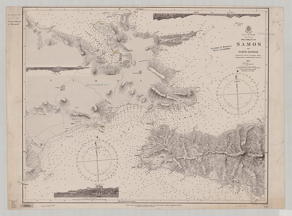
Nautical chart of the Strait of Samos, Greece
Summary
[edit]
| Description |
English: Nautical chart of the Strait of Samos, Greece. Surveyed by Lieut. Saumarez Brock under the orders of Commander Richard Copeland, 1835. Not current - not to be used for navigation! |
||||||||||
| Date | |||||||||||
| Source | https://collections.lib.uwm.edu/digital/collection/agdm/id/8817/rec/285 | ||||||||||
| Creator |
|
||||||||||
| Geotemporal data | |||||||||||
| Bounding box |
|
||||||||||
| Georeferencing | |||||||||||
Licensing
[edit]
This work created by the United Kingdom Government is in the public domain.
This is because it is one of the following:
HMSO has declared that the expiry of Crown Copyrights applies worldwide (ref: HMSO Email Reply)
|
 |
File history
Click on a date/time to view the file as it appeared at that time.
| Date/Time | Thumbnail | Dimensions | User | Comment | |
|---|---|---|---|---|---|
| current | 21:06, 25 November 2019 | | 8,562 × 6,317 (5.62 MB) | Kognos (talk | contribs) | User created page with UploadWizard |
You cannot overwrite this file.
File usage on Commons
There are no pages that use this file.