File:Administrative divisions of the Republic of Artsakh.svg
Jump to navigation
Jump to search

Size of this PNG preview of this SVG file: 460 × 599 pixels. Other resolutions: 184 × 240 pixels | 368 × 480 pixels | 589 × 768 pixels | 786 × 1,024 pixels | 1,572 × 2,048 pixels | 825 × 1,075 pixels.
Original file (SVG file, nominally 825 × 1,075 pixels, file size: 1.08 MB)
Captions
Captions
Administrative divisions of the Republic of Artsakh
Summary[edit]
| Description |
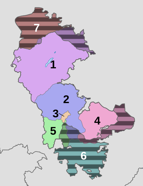
English: Administrative divisions of the Republic of Artsakh.
Black striped regions are regions claimed as an integral part of Republic of Artsakh controlled by Azerbaijan. |
| Date | |
| Source | Own work (borders of Artsakh come from File:2020 Nagorno-Karabakh ceasefire map.svg by Mapeh) |
| Author | Spesh531 |
| Other versions |
 |
Licensing[edit]
This file is licensed under the Creative Commons Attribution-Share Alike 4.0 International license.
- You are free:
- to share – to copy, distribute and transmit the work
- to remix – to adapt the work
- Under the following conditions:
- attribution – You must give appropriate credit, provide a link to the license, and indicate if changes were made. You may do so in any reasonable manner, but not in any way that suggests the licensor endorses you or your use.
- share alike – If you remix, transform, or build upon the material, you must distribute your contributions under the same or compatible license as the original.
File history
Click on a date/time to view the file as it appeared at that time.
| Date/Time | Thumbnail | Dimensions | User | Comment | |
|---|---|---|---|---|---|
| current | 14:17, 26 August 2022 | | 825 × 1,075 (1.08 MB) | Golden (talk | contribs) | rmv Lachin corridor as it was handed over |
| 00:00, 7 April 2021 |  | 825 × 1,075 (1.09 MB) | Spesh531 (talk | contribs) | Uploaded a work by Spesh531 from Own work (borders of Artsakh come from File:2020 Nagorno-Karabakh ceasefire map.svg by Mapeh) with UploadWizard |
You cannot overwrite this file.
File usage on Commons
The following page uses this file:
File usage on other wikis
The following other wikis use this file:
- Usage on en.wikipedia.org
- Usage on fr.wikipedia.org
- Usage on he.wikipedia.org
- Usage on ja.wikipedia.org
- Usage on pl.wikipedia.org
- Usage on vi.wikipedia.org
- Usage on zh.wikipedia.org