File:Administrative Divisions of Zimbabwe.svg
Jump to navigation
Jump to search

Size of this PNG preview of this SVG file: 630 × 490 pixels. Other resolutions: 309 × 240 pixels | 617 × 480 pixels | 988 × 768 pixels | 1,280 × 996 pixels | 2,560 × 1,991 pixels.
Original file (SVG file, nominally 630 × 490 pixels, file size: 308 KB)
Captions
Captions
Add a one-line explanation of what this file represents
Summary[edit]
| Description |
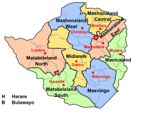
English: A map showing the administrative divisions of Zimbabwe |
| Date | |
| Source | Own work |
| Author | Mangwanani |
| Permission (Reusing this file) |
Own Work - free to use |
Licensing[edit]
| I, the copyright holder of this work, release this work into the public domain. This applies worldwide. In some countries this may not be legally possible; if so: I grant anyone the right to use this work for any purpose, without any conditions, unless such conditions are required by law. |
File history
Click on a date/time to view the file as it appeared at that time.
| Date/Time | Thumbnail | Dimensions | User | Comment | |
|---|---|---|---|---|---|
| current | 14:53, 29 August 2018 | | 630 × 490 (308 KB) | Gajmar (talk | contribs) | Changed borders from constituencies to actual districts |
| 15:34, 27 October 2011 |  | 630 × 490 (386 KB) | Hel-hama (talk | contribs) | Slight improvements to make the map more readable. | |
| 17:20, 11 December 2008 |  | 630 × 490 (250 KB) | Mangwanani (talk | contribs) | added lupane | |
| 17:11, 11 December 2008 |  | 630 × 490 (249 KB) | Mangwanani (talk | contribs) | == Summary == {{Information |Description={{en|1=A map showing the administrative divisions of Zimbabwe}} |Source=Own work by uploader |Author=Mangwanani |Date=2008/12/08 |Permission=Own Work - free to use |other_versions= }} <!--{{Ima |
You cannot overwrite this file.
File usage on Commons
There are no pages that use this file.
File usage on other wikis
The following other wikis use this file:
- Usage on ast.wikipedia.org
- Usage on ca.wikipedia.org
- Usage on de.wikipedia.org
- Usage on en.wikipedia.org
- Usage on eu.wikipedia.org
- Usage on fa.wikipedia.org
- Usage on fi.wikipedia.org
- Usage on id.wikipedia.org
- Usage on is.wikipedia.org
- Usage on it.wikipedia.org
- Usage on ja.wikipedia.org
- Usage on ko.wikipedia.org
- Usage on li.wikipedia.org
- Usage on lv.wikipedia.org
- Usage on ms.wikipedia.org
- Usage on mzn.wikipedia.org
- Usage on nl.wikipedia.org
- Usage on simple.wikipedia.org
- Usage on sn.wikipedia.org
- Usage on th.wikipedia.org
- Usage on tum.wikipedia.org
- Usage on vi.wikipedia.org
- Usage on www.wikidata.org
- Usage on zh.wikipedia.org
- Usage on zu.wikipedia.org