File:Adams Mills Lock 28.jpg
Jump to navigation
Jump to search
Size of this preview: 800 × 450 pixels. Other resolutions: 320 × 180 pixels | 640 × 360 pixels | 1,024 × 576 pixels | 1,280 × 720 pixels | 2,816 × 1,584 pixels.
Original file (2,816 × 1,584 pixels, file size: 1.77 MB, MIME type: image/jpeg)
Captions
Captions
Add a one-line explanation of what this file represents
|
This is an image of a place or building that is listed on the National Register of Historic Places in the United States of America. Its reference number is 07000025. |
| Camera location | | View this and other nearby images on: OpenStreetMap |
|---|
| Description |
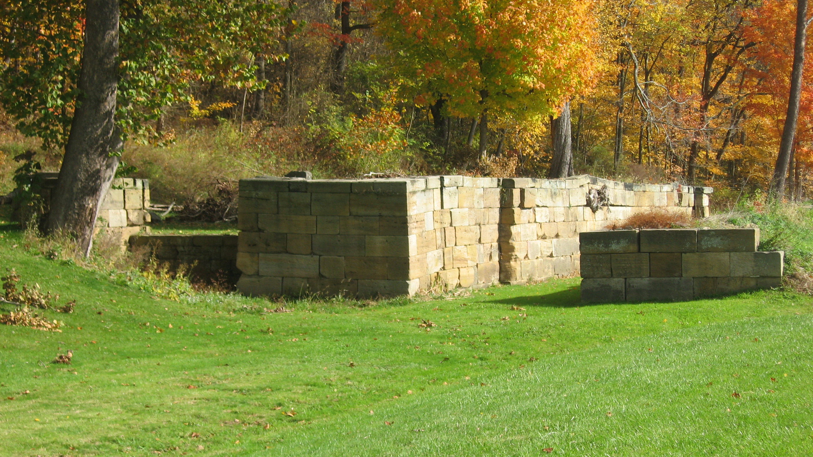
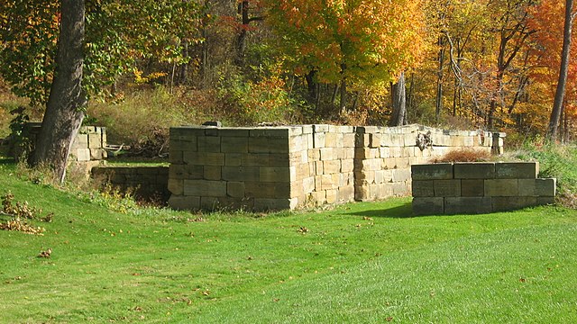
English: Lower end of Lock 28 on the Ohio and Erie Canal, located on the northern side of State Route 16 at Adams Mills in Cass Township, Muskingum County, Ohio, United States. The lock is part of the Muskingum River Navigation Historic District, a historic district that is listed on the National Register of Historic Places. |
||
| Date | Taken on 19 October 2012 | ||
| Source | Own work | ||
| Author | Nyttend | ||
| Permission (Reusing this file) |
|
File history
Click on a date/time to view the file as it appeared at that time.
| Date/Time | Thumbnail | Dimensions | User | Comment | |
|---|---|---|---|---|---|
| current | 05:17, 28 October 2012 | | 2,816 × 1,584 (1.77 MB) | Nyttend (talk | contribs) | {{NRHP|07000025}} {{Location|40|9|27|N|81|56|41|W}} {{Information |Description={{en|Lower end of Lock 28 on the {{w|Ohio and Erie Canal}}, located on the northern side of {{w|Ohio State Route 16|State Route 16}} at {{w|Adams Mills, Ohio|Adams Mills}} i... |
You cannot overwrite this file.
File usage on Commons
There are no pages that use this file.
File usage on other wikis
The following other wikis use this file:
- Usage on en.wikipedia.org