File:Accurate Map of the District of Great Britain called England & Wales, etc. from the latest & most correct surveys (BM 1871,1209.5269).jpg

Original file (2,084 × 2,500 pixels, file size: 815 KB, MIME type: image/jpeg)
Captions
Captions
Summary[edit]
.jpg&action=edit§ion=1)
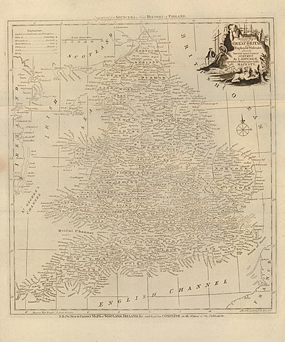
| Accurate Map of the District of Great Britain called England & Wales, &c, from the latest & most correct surveys
( |
||||||||||||||||||||||||
|---|---|---|---|---|---|---|---|---|---|---|---|---|---|---|---|---|---|---|---|---|---|---|---|---|
| Artist |
Print made by: Thomas Kitchin
|
|||||||||||||||||||||||
| Title |
Accurate Map of the District of Great Britain called England & Wales, &c, from the latest & most correct surveys |
|||||||||||||||||||||||
| Description |
English: The map of Great Britain; the title at top right with a lion below the text and two men conversing to left; illustration to Spencer's 'New History of England'.
Etching |
|||||||||||||||||||||||
| Depicted people | Illustration to: George William Spencer | |||||||||||||||||||||||
| Date | circa 1794 | |||||||||||||||||||||||
| Medium | paper | |||||||||||||||||||||||
| Dimensions |
|
|||||||||||||||||||||||
| Collection |
|
|||||||||||||||||||||||
| Current location |
Prints and Drawings |
|||||||||||||||||||||||
| Accession number |
1871,1209.5269 |
|||||||||||||||||||||||
| Source/Photographer | https://www.britishmuseum.org/collection/object/P_1871-1209-5269 | |||||||||||||||||||||||
| Permission (Reusing this file) |
© The Trustees of the British Museum, released as CC BY-NC-SA 4.0 | |||||||||||||||||||||||
Licensing[edit]
.jpg&action=edit§ion=2)
This image is in the public domain because it is a mere mechanical scan or photocopy of a public domain original, or – from the available evidence – is so similar to such a scan or photocopy that no copyright protection can be expected to arise. The original itself is in the public domain for the following reason:
This tag is designed for use where there may be a need to assert that any enhancements (eg brightness, contrast, colour-matching, sharpening) are in themselves insufficiently creative to generate a new copyright. It can be used where it is unknown whether any enhancements have been made, as well as when the enhancements are clear but insufficient. For known raw unenhanced scans you can use an appropriate {{PD-old}} tag instead. For usage, see Commons:When to use the PD-scan tag.  | ||||
File history
Click on a date/time to view the file as it appeared at that time.
| Date/Time | Thumbnail | Dimensions | User | Comment | |
|---|---|---|---|---|---|
| current | 19:43, 15 May 2020 | | 2,084 × 2,500 (815 KB) | Copyfraud (talk | contribs) | British Museum public domain uploads (Copyfraud/BM) Maps in the British Museum 1794 #183/703 |
You cannot overwrite this file.
File usage on Commons
The following page uses this file:
.jpg)
.jpg&oldid=857593024)