File:A CIA map of the guantanamo region, as of 1996.jpg
Jump to navigation
Jump to search
Size of this preview: 567 × 599 pixels. Other resolutions: 227 × 240 pixels | 454 × 480 pixels | 727 × 768 pixels | 969 × 1,024 pixels | 1,769 × 1,869 pixels.
Original file (1,769 × 1,869 pixels, file size: 1.6 MB, MIME type: image/jpeg)
Captions
Captions
Add a one-line explanation of what this file represents
| Description |
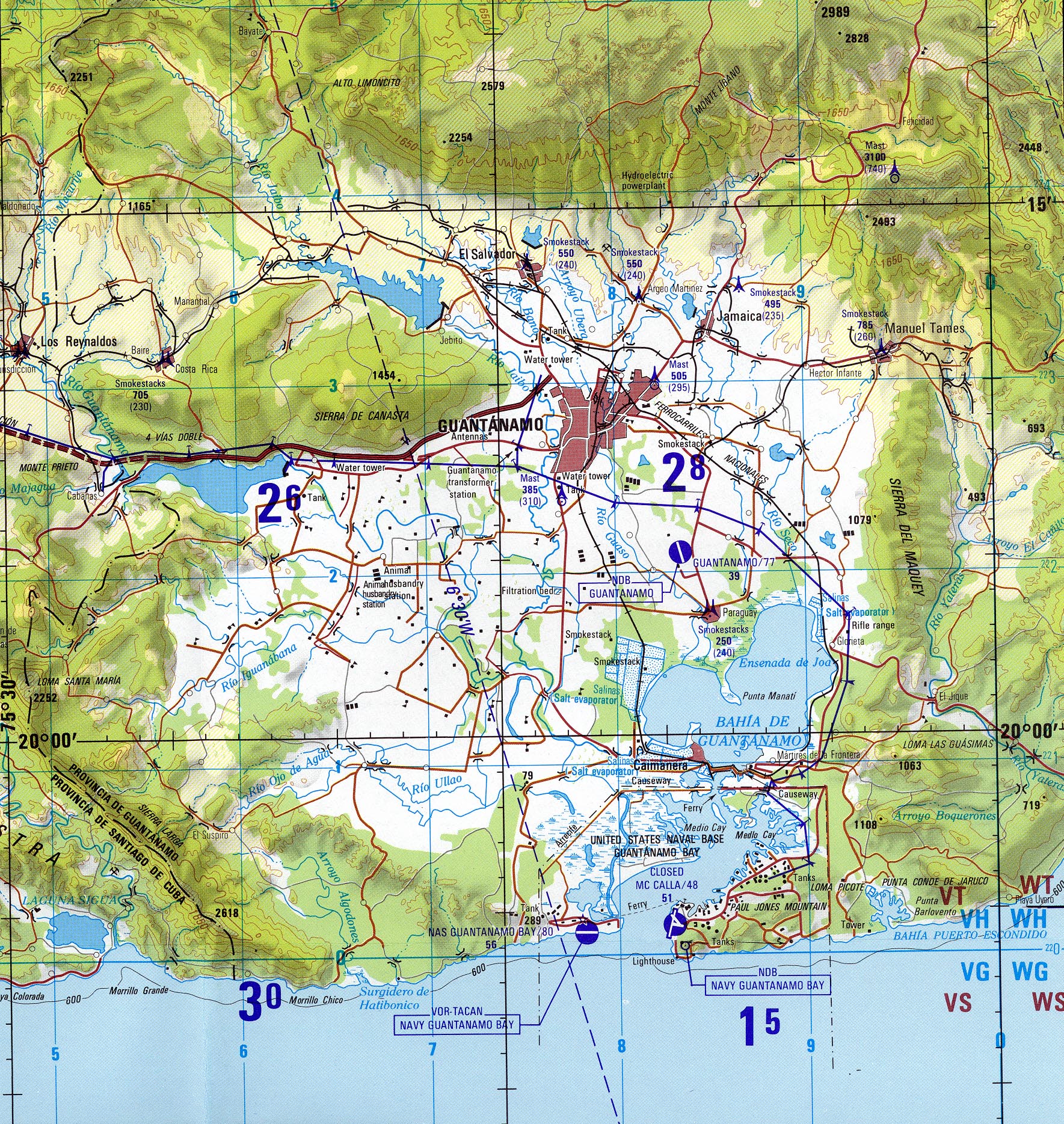
A CIA map of the guantanamo region, as of 1996.jpg The original page says: "The following maps were produced by the U.S. Central Intelligence Agency, unless otherwise indicated." The original page says: "Guantanamo (Joint Operations Graphic) 1996 (1.6MB) Portion of Santiago De Cuba, Cuba, Joint Operations Graphic (AIR), Series 1501 AIR, Sheet NF 18-14, Edition 5. Original scale 1:250,000. U.S. National Imagery and Mapping Agency, compiled April 1988, revised July 1995, air information current through 27 July 1996. Not for navigational use " |
|||
| Date | ||||
| Source | http://www.lib.utexas.edu/maps/cuba.html | |||
| Author | CIA | |||
| Permission (Reusing this file) |
|

File history
Click on a date/time to view the file as it appeared at that time.
| Date/Time | Thumbnail | Dimensions | User | Comment | |
|---|---|---|---|---|---|
| current | 21:57, 6 April 2011 | | 1,769 × 1,869 (1.6 MB) | Geo Swan (talk | contribs) | {{Information |Description=A CIA map of the guantanamo region, as of 1996.jpg The original page says: ''"The following maps were produced by the U.S. Central Intelligence Agency, unless otherwise indicated."'' The original page says: ''"Guantanamo (Join |
You cannot overwrite this file.
File usage on Commons
There are no pages that use this file.
File usage on other wikis
The following other wikis use this file:
- Usage on es.wikipedia.org