File:A 360-degree photo from Lassen Volcanic National Park Highway of Upper Kings Creek Meadow with a view of Lassen Peak and Reading (ca7cd306-9c26-4984-ac9d-9826d6581f63).JPG
Jump to navigation
Jump to search

Size of this preview: 800 × 400 pixels. Other resolutions: 320 × 160 pixels | 640 × 320 pixels | 1,024 × 512 pixels | 1,280 × 640 pixels | 2,560 × 1,280 pixels | 5,376 × 2,688 pixels.
Original file (5,376 × 2,688 pixels, file size: 4.06 MB, MIME type: image/jpeg)
Captions
Captions
Add a one-line explanation of what this file represents
| 360° | View in 360° panoramic viewer
|
|---|
.JPG)
| Camera location | | View this and other nearby images on: OpenStreetMap |
|---|
.JPG¶ms=040.459986_N_-121.466606_E_globe:Earth_type:camera_alt:2221.84_source:exif_heading:225.00&language=en)
Summary[edit]
.JPG&action=edit§ion=1)
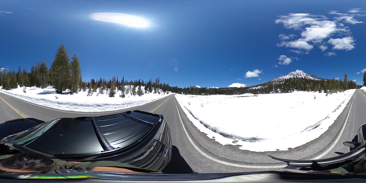
| English: Kings Creek 360 | ||||
|---|---|---|---|---|
| Photographer |
English: Amanda Sweeney |
|||
| Title |
English: Kings Creek 360 |
|||
| Description |
English: A 360-degree photo of a snow-covered meadow lined by green trees with two snow-covered mountains in the distance. A 360-degree photo from Lassen Volcanic National Park Highway of Upper Kings Creek Meadow with a view of Lassen Peak and Reading Peak.
|
|||
| Depicted place |
English: Latitude: 40.4599861, Longitude: -121.46660555, Elevation: 2221.84; Lassen Volcanic National Park, California; Latitude: 40.4861793518066, Longitude: -121.412101745605 |
|||
| Date | Taken on 22 May 2020 | |||
| Accession number | ||||
| Source |
English: NPGallery |
|||
| Permission (Reusing this file) |
|
|||
| Collector | English: Amanda Sweeney |
|||
| NPS Unit Code | LAVO | |||
File history
Click on a date/time to view the file as it appeared at that time.
| Date/Time | Thumbnail | Dimensions | User | Comment | |
|---|---|---|---|---|---|
| current | 09:13, 16 January 2022 | | 5,376 × 2,688 (4.06 MB) | BMacZeroBot (talk | contribs) | Batch upload (Commons:Batch uploading/NPGallery) |
You cannot overwrite this file.
File usage on Commons
The following page uses this file:
.JPG)
.JPG&oldid=866769291)