File:AMH-7505-KB Map of the mouth of the Baldivia River.jpg

Original file (2,400 × 1,696 pixels, file size: 783 KB, MIME type: image/jpeg)
Captions
Captions
Summary[edit]
Nederlands: Kaart van de monding van de rivier Baldivia
English: Map of the mouth of the Baldivia River( |
|||||||||||||||||||||||
|---|---|---|---|---|---|---|---|---|---|---|---|---|---|---|---|---|---|---|---|---|---|---|---|
| Author |
Nederlands: Anoniem / Anonymous (landmeter / kaartenmaker), Broer Jansz (uitgever)
English: Anoniem / Anonymous (land surveyor / mapmaker), Broer Jansz (publisher) |
||||||||||||||||||||||
| Title |
Nederlands: Kaart van de monding van de rivier Baldivia
English: Map of the mouth of the Baldivia River |
||||||||||||||||||||||
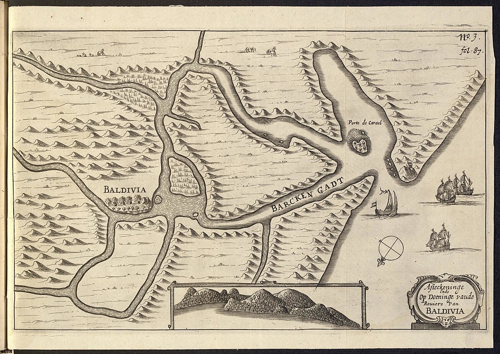
| Description |
Nederlands: Kaart van de monding van de rivier Baldivia.
Afteckeninge Ende Op Doeninge vaude Reuiere van Baldivia. Rechtsboven: no. 3 fol. 87. Middenonder een inzet met een aanzicht van een onbekende kust.English: Map of the mouth of the Baldivia River.
Afteckeninge Ende Op Doeninge vaude Reuiere van Baldivia. Top right: no. 3 fol. 87. Bottom centre an inset showing a view of an unknown coast. |
||||||||||||||||||||||
| Date | 1646 | ||||||||||||||||||||||
| Medium |
Nederlands: gravure op papier
English: engraving on paper |
||||||||||||||||||||||
| Dimensions | height: 27 cm (10.6 in); width: 19 cm (7.4 in) | ||||||||||||||||||||||
| Collection |
|
||||||||||||||||||||||
| Accession number |
562 D 26 na p. 86 |
||||||||||||||||||||||
| Inscriptions |
Afteckeninge Ende Op Doeninge vaude Reuiere van Baldivia
|
||||||||||||||||||||||
| Notes |
English: Subjects: chart / map / plan, banderole / cartouche / ornamentation, compass / dial, survey / view, ship / vessel, fauna, house, building
Nederlands: Onderwerpen: plattegrond / kaart, banderol / cartouche / versiering, kompas / windroos, overzicht / aanzicht, schip / vaartuig, fauna, huis / woonhuis, gebouw
English: Post: this image is related to a WIC trading post called Valdívia |
||||||||||||||||||||||
| Source/Photographer |
|
||||||||||||||||||||||
| Permission (Reusing this file) |
|
||||||||||||||||||||||

| Object location | | View this and other nearby images on: OpenStreetMap |
|---|
File history
Click on a date/time to view the file as it appeared at that time.
| Date/Time | Thumbnail | Dimensions | User | Comment | |
|---|---|---|---|---|---|
| current | 14:30, 10 June 2014 | | 2,400 × 1,696 (783 KB) | HuskyBot (talk | contribs) | == {{int:filedesc}} == {{Artwork |title = {{nl|1=Kaart van de monding van de rivier Baldivia}} {{en|1=Map of the mouth of the Baldivia River}} |description = {{nl|1=Kaart van de monding van de rivier Baldivia.... |
You cannot overwrite this file.
File usage on Commons
The following page uses this file:
File usage on other wikis
The following other wikis use this file:
- Usage on nl.wikipedia.org