File:AFRICA XXV NOVA TABULA.jpg
Jump to navigation
Jump to search

Size of this preview: 756 × 600 pixels. Other resolutions: 303 × 240 pixels | 605 × 480 pixels | 968 × 768 pixels | 1,280 × 1,015 pixels | 1,770 × 1,404 pixels.
Original file (1,770 × 1,404 pixels, file size: 1.06 MB, MIME type: image/jpeg)
Captions
Captions
Add a one-line explanation of what this file represents
Summary[edit]
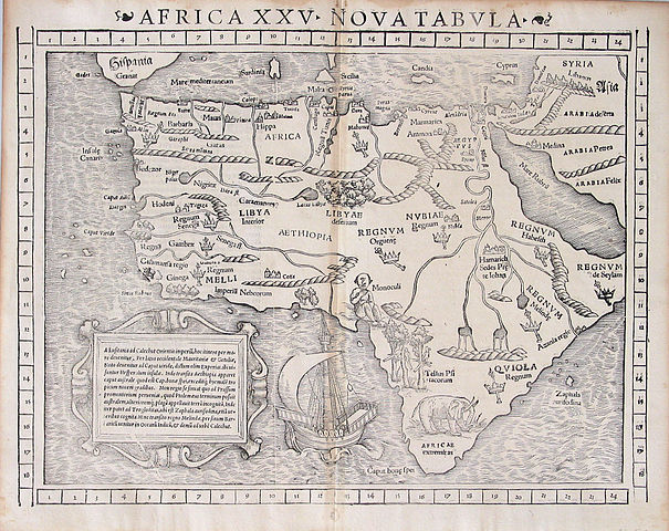
| Description |
First map to show the entire continent of Africa. Uncolored 257 x 345 mm Appeared in Munster's edition of Claudius Ptolemy's Geographia in 1540 |
|||||||||||||||||||||||
| Date | ||||||||||||||||||||||||
| Source | http://www.betzmaps.com/AF-550.html | |||||||||||||||||||||||
| Author |
|
|||||||||||||||||||||||
| Permission (Reusing this file) |
Public Domain | |||||||||||||||||||||||
| Other versions |
|
|||||||||||||||||||||||
.jpg)
_p_120.jpg)

.jpg)
Licensing[edit]
|
This work is in the public domain in its country of origin and other countries and areas where the copyright term is the author's life plus 100 years or fewer. | |
| This file has been identified as being free of known restrictions under copyright law, including all related and neighboring rights. | |
File history
Click on a date/time to view the file as it appeared at that time.
| Date/Time | Thumbnail | Dimensions | User | Comment | |
|---|---|---|---|---|---|
| current | 17:41, 4 February 2007 | | 1,770 × 1,404 (1.06 MB) | Tarawneh (talk | contribs) | {{Information |Description= First map to show the entire continent of Africa. <br>Uncolored <br>257 x 345 mm <br>Appeared in Munster's edition of Claudius Ptolemy's Geographia in 1540 |Source= http://www.betzmaps.com/AF-550.html |Date= 1552 |Author= Seb |
You cannot overwrite this file.
File usage on Commons
The following 3 pages use this file: