File:A31RtMap.png
Jump to navigation
Jump to search
Size of this preview: 800 × 390 pixels. Other resolutions: 320 × 156 pixels | 640 × 312 pixels | 1,024 × 499 pixels | 1,280 × 624 pixels | 3,044 × 1,483 pixels.
Original file (3,044 × 1,483 pixels, file size: 486 KB, MIME type: image/png)
Captions
Captions
Add a one-line explanation of what this file represents
Summary[edit]
| Description |
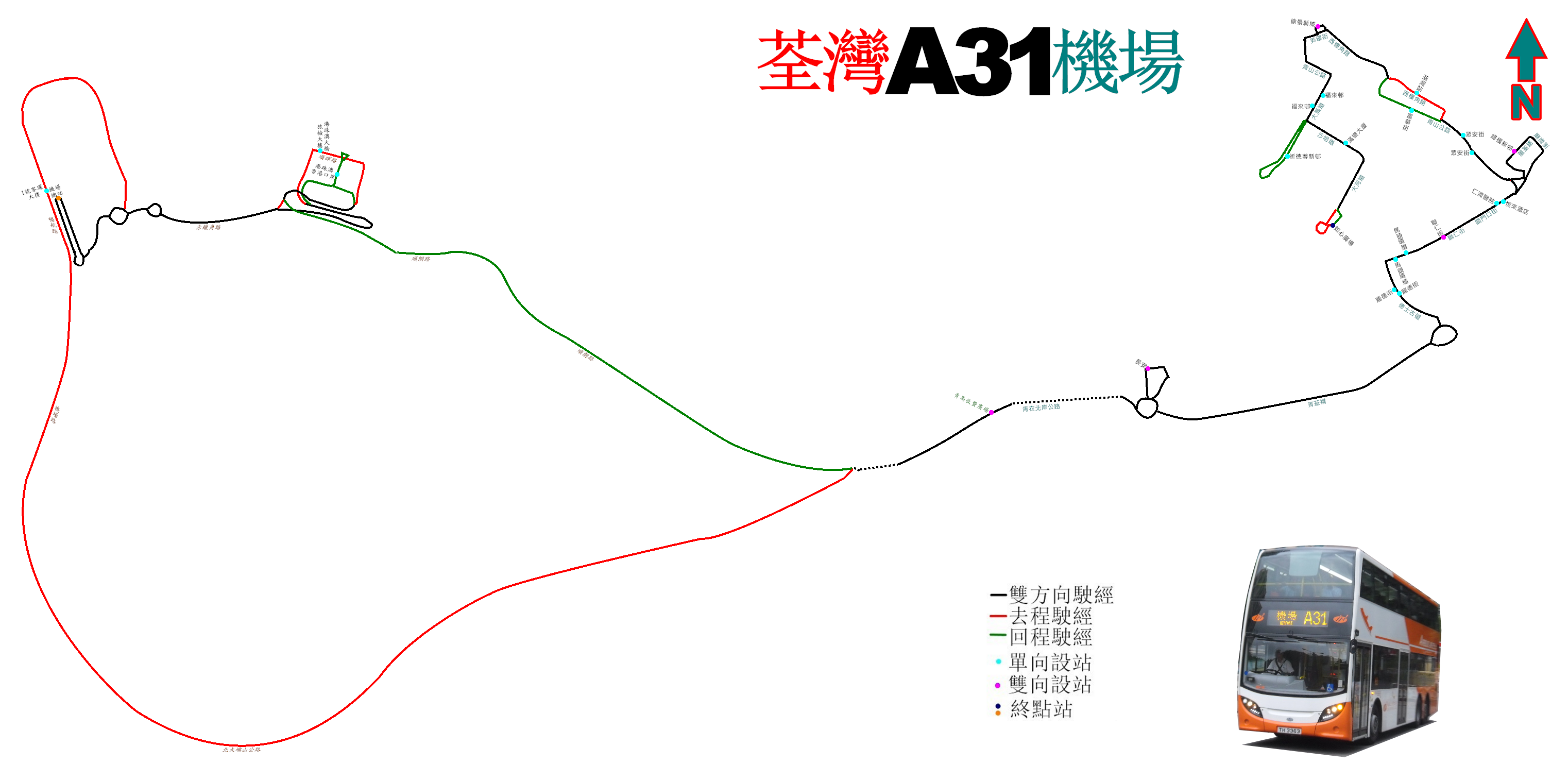
中文(香港):龍運巴士A31線的走線圖 |
| Date | |
| Source | Own work |
| Author | ATR50 |
Licensing[edit]
I, the copyright holder of this work, hereby publish it under the following license:
This file is licensed under the Creative Commons Attribution-Share Alike 3.0 Unported license.
- You are free:
- to share – to copy, distribute and transmit the work
- to remix – to adapt the work
- Under the following conditions:
- attribution – You must give appropriate credit, provide a link to the license, and indicate if changes were made. You may do so in any reasonable manner, but not in any way that suggests the licensor endorses you or your use.
- share alike – If you remix, transform, or build upon the material, you must distribute your contributions under the same or compatible license as the original.
File history
Click on a date/time to view the file as it appeared at that time.
| Date/Time | Thumbnail | Dimensions | User | Comment | |
|---|---|---|---|---|---|
| current | 14:45, 13 December 2019 | | 3,044 × 1,483 (486 KB) | ATR50~commonswiki (talk | contribs) | 2019年11月尾不再經2號客運大樓 |
| 02:26, 5 December 2018 |  | 3,044 × 1,483 (490 KB) | ATR50~commonswiki (talk | contribs) | 往荃灣方向改經順朗路直上北嶼 | |
| 16:34, 27 October 2018 |  | 1,955 × 914 (424 KB) | ATR50~commonswiki (talk | contribs) | 修正 | |
| 17:26, 26 October 2018 |  | 1,955 × 914 (422 KB) | ATR50~commonswiki (talk | contribs) | 配合港珠澳大橋香港口岸啟用,來回程皆繞經該處 | |
| 16:49, 7 December 2016 |  | 1,955 × 914 (415 KB) | ATR50~commonswiki (talk | contribs) | 2016年12月因A32開辦而大幅修改走線,不再經葵芳及青衣南 | |
| 03:19, 17 June 2016 |  | 2,882 × 1,826 (644 KB) | ATR50~commonswiki (talk | contribs) | 2016年6月改良 | |
| 17:29, 13 May 2014 |  | 2,882 × 1,826 (621 KB) | ATR50~commonswiki (talk | contribs) | User created page with UploadWizard |
You cannot overwrite this file.
File usage on Commons
The following 27 pages use this file:
- User:Chumwa/OgreBot/Potential transport maps/2016 December 1-10
- User:Chumwa/OgreBot/Potential transport maps/2016 June 11-20
- User:Chumwa/OgreBot/Potential transport maps/2018 December 1-10
- User:Chumwa/OgreBot/Potential transport maps/2018 October 21-31
- User:Chumwa/OgreBot/Potential transport maps/2019 December 11-20
- User:Chumwa/OgreBot/Public transport information/2016 December 1-10
- User:Chumwa/OgreBot/Public transport information/2016 June 11-20
- User:Chumwa/OgreBot/Public transport information/2018 December 1-10
- User:Chumwa/OgreBot/Public transport information/2018 October 21-31
- User:Chumwa/OgreBot/Public transport information/2019 December 11-20
- User:Chumwa/OgreBot/Transport Maps/2016 December 1-10
- User:Chumwa/OgreBot/Transport Maps/2016 June 11-20
- User:Chumwa/OgreBot/Transport Maps/2018 December 1-10
- User:Chumwa/OgreBot/Transport Maps/2018 October 21-31
- User:Chumwa/OgreBot/Transport Maps/2019 December 11-20
- User:Chumwa/OgreBot/Travel and communication maps/2016 December 1-10
- User:Chumwa/OgreBot/Travel and communication maps/2016 June 11-20
- User:Chumwa/OgreBot/Travel and communication maps/2018 December 1-10
- User:Chumwa/OgreBot/Travel and communication maps/2018 October 21-31
- User:Chumwa/OgreBot/Travel and communication maps/2019 December 11-20
- User:OgreBot/Watercraft/2016 December 7
- User:OgreBot/Watercraft/2016 June 16-20
- User:OgreBot/Watercraft/2018 December 5
- User:OgreBot/Watercraft/2018 October 26
- User:OgreBot/Watercraft/2018 October 27
- User:Pechristener/Bridges/2014 May 11-20
- Commons:WikiProject Aviation/recent uploads/2019 December 13
File usage on other wikis
The following other wikis use this file:
- Usage on zh.wikipedia.org