File:A-5. Sulphur Springs (5 miles east of Soda Springs, ID) on the California and Oregon National Historic Trail (2003) (81cc21aa-0748-43d6-a6fb-6f6c5319dd20).JPG
Jump to navigation
Jump to search

Size of this preview: 800 × 600 pixels. Other resolutions: 320 × 240 pixels | 640 × 480 pixels | 1,024 × 768 pixels | 1,280 × 960 pixels | 2,560 × 1,920 pixels.
Original file (2,560 × 1,920 pixels, file size: 2.88 MB, MIME type: image/jpeg)
Captions
Captions
Add a one-line explanation of what this file represents

|
The categories of this image need checking. You can do so here.
|
_on_the_California_and_Oregon_National_Historic_Trail_(2003)_(81cc21aa-0748-43d6-a6fb-6f6c5319dd20).JPG&action=edit&withJS=MediaWiki:Catcheck.js)
Summary[edit]
_on_the_California_and_Oregon_National_Historic_Trail_(2003)_(81cc21aa-0748-43d6-a6fb-6f6c5319dd20).JPG&action=edit§ion=1)
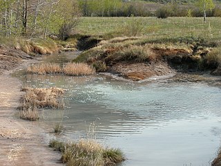
| English: A-5. Sulphur Springs (5 miles east of Soda Springs, ID) on the California and Oregon National Historic Trail (2003) | ||||
|---|---|---|---|---|
| Photographer |
English: NPS Staff (Photo Credit: NPS) |
|||
| Title |
English: A-5. Sulphur Springs (5 miles east of Soda Springs, ID) on the California and Oregon National Historic Trail (2003) |
|||
| Description |
English: ATR-Along the Snake River Plain Through Idaho-A-5
|
|||
| Depicted place |
English: Soda Springs, Caribou County, Idaho |
|||
| Date | Taken on 21 May 2003 | |||
| Accession number | ||||
| Source |
English: NPGallery |
|||
| Permission (Reusing this file) |
|
|||
| Contacts | English: Organization: National Trails Intermountain Region Address: National Trails Intermountain Region PO Box 728 Santa Fe, NM 87504-0728 Email: lodi_administration@nps.gov |
|||
| NPS Unit Code | CALI, OREG | |||
File history
Click on a date/time to view the file as it appeared at that time.
| Date/Time | Thumbnail | Dimensions | User | Comment | |
|---|---|---|---|---|---|
| current | 19:53, 6 July 2019 | | 2,560 × 1,920 (2.88 MB) | BMacZeroBot (talk | contribs) | Batch upload (Commons:Batch uploading/NPGallery) |
You cannot overwrite this file.
File usage on Commons
The following page uses this file:
_on_the_California_and_Oregon_National_Historic_Trail_(2003)_(81cc21aa-0748-43d6-a6fb-6f6c5319dd20).JPG)
_on_the_California_and_Oregon_National_Historic_Trail_(2003)_(81cc21aa-0748-43d6-a6fb-6f6c5319dd20).JPG&oldid=772959611)