File:759x599-Carte-09-Ariège-A.svg
Jump to navigation
Jump to search

Size of this PNG preview of this SVG file: 759 × 599 pixels. Other resolutions: 304 × 240 pixels | 608 × 480 pixels | 973 × 768 pixels | 1,280 × 1,010 pixels | 2,560 × 2,020 pixels.
Original file (SVG file, nominally 759 × 599 pixels, file size: 22 KB)
Captions
Captions
Add a one-line explanation of what this file represents
Summary[edit]
| Description |
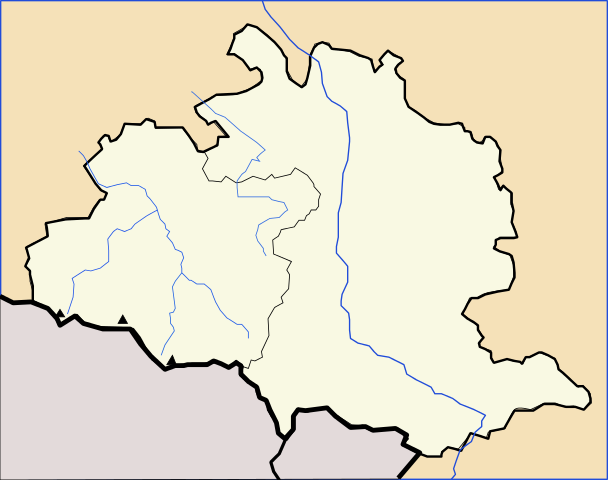
Français : *Carte 09 Ariège Administrative |
| Date | Aujourd'hui: Wikisoft* @@@-fr 10:44, 18 November 2010 (UTC) |
| Source | Travail personnel Wikisoft* @@@-fr 10:44, 18 November 2010 (UTC) |
| Author | Moi: Wikisoft* @@@-fr 10:44, 18 November 2010 (UTC) |
| Other versions |
|

Licensing[edit]
The map has been created with the Generic Mapping Tools: https://www.generic-mapping-tools.org/ using one or more of these public-domain datasets for the relief:
|

|
Permission is granted to copy, distribute and/or modify this document under the terms of the GNU Free Documentation License, Version 1.2 or any later version published by the Free Software Foundation; with no Invariant Sections, no Front-Cover Texts, and no Back-Cover Texts. A copy of the license is included in the section entitled GNU Free Documentation License. |
This file is licensed under the Creative Commons Attribution-Share Alike 1.0 Generic license.
- You are free:
- to share – to copy, distribute and transmit the work
- to remix – to adapt the work
- Under the following conditions:
- attribution – You must give appropriate credit, provide a link to the license, and indicate if changes were made. You may do so in any reasonable manner, but not in any way that suggests the licensor endorses you or your use.
- share alike – If you alter, transform, or build upon this work, you must distribute the resulting work under the same license as the original.
File history
Click on a date/time to view the file as it appeared at that time.
| Date/Time | Thumbnail | Dimensions | User | Comment | |
|---|---|---|---|---|---|
| current | 10:44, 18 November 2010 | | 759 × 599 (22 KB) | Wikisoft* (talk | contribs) | {{Information |Description={{fr|1=*Carte Arège Administrative}} |Source=Travail personnel ~~~~ |Author=Moi: ~~~~ |Date=Aujourd'hui: ~~~~ |Permission={{GFDL-GMT}}{{CC-BY-SA}} |other_versions={{:fr:Modèle:Géolocalisation/Ariège]]}} }} [[Ca |
You cannot overwrite this file.
File usage on Commons
The following 2 pages use this file:
File usage on other wikis
The following other wikis use this file:
- Usage on ru.wikipedia.org
- Фуа (город)
- Сен-Жирон
- Перль-э-Кастеле
- Л’Оспитале-пре-л’Андорр
- Савиньяк-лез-Ормо
- Меран-ле-Валь
- Монтайю
- Соржа
- Иньо (коммуна)
- Тиньяк
- Орже (коммуна)
- Маллеон
- Кальзан
- Сен-Феликс-де-Рьётор
- Кусса
- Казо
- Сен-Бозей
- Гюда
- Монтегю-Планторель
- Далу (коммуна)
- Крампанья
- Рьё-де-Пельпор
- Лубан (Арьеж)
- Сегюра
- Сигер (коммуна)
- Сюк-э-Сантенак
- Жестьес
- Орю
- Леркуль
- Гулье
- Сам (коммуна)
- Лез-Иссар
- Ле-Пюжоль
- Ле-Карларе
- Людьес
- Сент-Амаду
- Ла-Тур-дю-Криё
- Сен-Жан-дю-Фальга
- Эскос (Арьеж)
- Сен-Мартен-д’Уад
- Мадьер
- Сен-Виктор-Рузо
- Сен-Мишель (Арьеж)
- Лескус
- Юнзан
- Сент-Аман (Арьеж)
- Мижанес
- Керигю
- Ле-Пюш
- Ле-Пла
View more global usage of this file.