File:48 and 401 cloverleaf.png
Jump to navigation
Jump to search
No higher resolution available.
48_and_401_cloverleaf.png (722 × 543 pixels, file size: 516 KB, MIME type: image/png)
Captions
Captions
Add a one-line explanation of what this file represents
| Description |
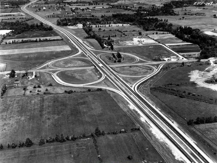
English: An Aerial photograph of the original cloverleaf between w:Highway 48 and the Toronto Bypass (w:Highway 401) prior to the suburban development of Scarborough / Malvern |
||||||
| Date | June, 1961 | ||||||
| Source | Archives of Ontario Series RG-14-151-5-17 Neg. #1328 | ||||||
| Author | Department of Highways | ||||||
| Permission (Reusing this file) |
|
||||||

File history
Click on a date/time to view the file as it appeared at that time.
| Date/Time | Thumbnail | Dimensions | User | Comment | |
|---|---|---|---|---|---|
| current | 17:06, 11 November 2011 | | 722 × 543 (516 KB) | Floydian (talk | contribs) | {{Information |Description = An Aerial photograph of the original cloverleaf between Highway 48 and the Toronto Bypass (Highway 401) prior to the suburban development of Scarborough / Malvern |Source = Archives of Ontario Series RG-14-1 |
You cannot overwrite this file.
File usage on Commons
The following page uses this file: