File:380 kV Doetinchem-Wesel power line Oude IJsselstreek NL 2017.jpg
From Wikimedia Commons, the free media repository
Jump to navigation
Jump to search
Size of this preview: 800 × 456 pixels. Other resolutions: 320 × 182 pixels | 640 × 364 pixels | 1,024 × 583 pixels | 1,280 × 729 pixels | 2,560 × 1,458 pixels | 6,000 × 3,417 pixels.
Original file (6,000 × 3,417 pixels, file size: 18.82 MB, MIME type: image/jpeg)
File information
Structured data
Captions
Description380 kV Doetinchem-Wesel power line Oude IJsselstreek NL 2017.jpg |
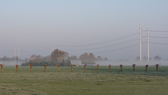
English: Landscape and Wintrack pylons of the new 380 kV Doetinchem–Wesel power line near Etten/Ulft, Oude IJsselstreek, Netherlands.
Nederlands: Zondag 9 april 2017 begon met vorst aan de grond en de temperatuur liep in de middag op naar 21 graden. Vroeg in de morgen was er ochtenddauw te zien in het Achterhoekse Etten. Ook is de in aanbouw zijnde 380 kV lijn tussen Doetinchem en het Duitse Wesel te zien. |
||
Date | |||
Source | Etten in ochtenddauw | ||
Author | Rob Dammers | ||
Permission (Reusing this file) |
This file is licensed under the Creative Commons Attribution 2.0 Generic license. Attribution: Rob Dammers
|
Camera location | 51° 54′ 20.03″ N, 6° 21′ 33.85″ E | View this and other nearby images on: OpenStreetMap | 51.905564; 6.359403 |
---|
File history
Click on a date/time to view the file as it appeared at that time.
Date/Time | Thumbnail | Dimensions | User | Comment | |
---|---|---|---|---|---|
current | 23:54, 30 January 2018 | 6,000 × 3,417 (18.82 MB) | Te750iv (talk | contribs) | {{Information |Description={{en|1=Landscape and Wintrack pylons of the new 380 kV Doetinchem–Wesel power line near Etten/Ulft, Oude IJsselstreek, Netherlands.}} {{nl|1=Zondag 9 april 2017 begon met vorst aan de grond en de temperatuur liep in de midd... |
You cannot overwrite this file.
File usage on Commons
The following page uses this file:
File usage on other wikis
The following other wikis use this file:
- Usage on nl.wikipedia.org
- Usage on www.wikidata.org
Metadata
This file contains additional information such as Exif metadata which may have been added by the digital camera, scanner, or software program used to create or digitize it. If the file has been modified from its original state, some details such as the timestamp may not fully reflect those of the original file. The timestamp is only as accurate as the clock in the camera, and it may be completely wrong.
Camera manufacturer | NIKON CORPORATION |
---|---|
Camera model | NIKON D7100 |
Author | Rob Dammers |
Copyright holder |
|
Exposure time | 1/200 sec (0.005) |
F-number | f/8 |
ISO speed rating | 200 |
Date and time of data generation | 07:47, 9 April 2017 |
Lens focal length | 50 mm |
Latitude | 51° 54′ 20.03″ N |
Longitude | 6° 21′ 33.85″ E |
Altitude | 14 meters above sea level |
City shown | Ulft |
Horizontal resolution | 300 dpi |
Vertical resolution | 300 dpi |
Software used | Adobe Photoshop Lightroom 6.9 (Windows) |
File change date and time | 20:59, 9 April 2017 |
Exposure Program | Shutter priority |
Exif version | 2.3 |
Date and time of digitizing | 07:47, 9 April 2017 |
APEX shutter speed | 7.643856 |
APEX aperture | 6 |
APEX exposure bias | 0 |
Maximum land aperture | 3 APEX (f/2.83) |
Metering mode | Pattern |
Light source | Unknown |
Flash | Flash did not fire, compulsory flash suppression |
DateTimeOriginal subseconds | 10 |
DateTimeDigitized subseconds | 10 |
Color space | sRGB |
Focal plane X resolution | 2,558.641204834 |
Focal plane Y resolution | 2,558.641204834 |
Focal plane resolution unit | 3 |
Sensing method | One-chip color area sensor |
File source | Digital still camera |
Scene type | A directly photographed image |
Custom image processing | Normal process |
Exposure mode | Auto exposure |
White balance | Auto white balance |
Digital zoom ratio | 1 |
Focal length in 35 mm film | 75 mm |
Scene capture type | Standard |
Scene control | None |
Contrast | Normal |
Saturation | Normal |
Sharpness | Normal |
Subject distance range | Unknown |
Measurement mode | 3-dimensional measurement |
Geodetic survey data used | WGS-84 |
GPS tag version | 0.0.3.2 |
Serial number of camera | 4599434 |
Lens used | 18.0-50.0 mm f/2.8 |
Date metadata was last modified | 22:59, 9 April 2017 |
Unique ID of original document | 15D40723CD2CA0DC7DBD487AB496B286 |
Province or state shown | Gelderland |
Country shown | Nederland |
Code for country shown | NL |
IIM version | 4 |