File:32-Gers-département-fr-carte-R1.jpg
From Wikimedia Commons, the free media repository
Jump to navigation
Jump to search
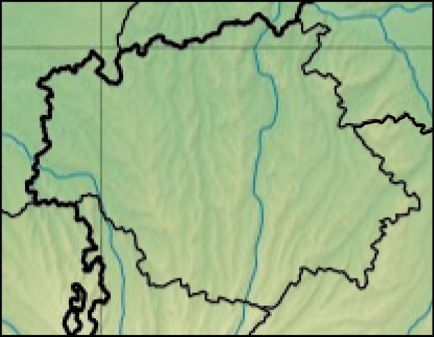
32-Gers-département-fr-carte-R1.jpg (624 × 484 pixels, file size: 156 KB, MIME type: image/jpeg)
File information
Structured data
Captions
Captions
Add a one-line explanation of what this file represents
- Carte 32 Gers département fr carte relief
- source:Travail personnel
- fr:Modèle:Géolocalisation/Gers
- licence:
The map has been created with the Generic Mapping Tools: https://www.generic-mapping-tools.org/ using one or more of these public-domain datasets for the relief:
বাংলা ∙ English ∙ español ∙ français ∙ italiano ∙ 日本語 ∙ македонски ∙ sicilianu ∙ 中文(简体) ∙ 中文(繁體) ∙ +/− |

|
Permission is granted to copy, distribute and/or modify this document under the terms of the GNU Free Documentation License, Version 1.2 or any later version published by the Free Software Foundation; with no Invariant Sections, no Front-Cover Texts, and no Back-Cover Texts. A copy of the license is included in the section entitled GNU Free Documentation License.http://www.gnu.org/copyleft/fdl.htmlGFDLGNU Free Documentation Licensetruetrue |
 This map was improved or created by the Wikigraphists of the Graphic Lab (fr). You can propose images to clean up, improve, create or translate as well.
- projection equirectangulaire
44.125° -0.375° + 1.25° 43.25°
File history
Click on a date/time to view the file as it appeared at that time.
| Date/Time | Thumbnail | Dimensions | User | Comment | |
|---|---|---|---|---|---|
| current | 09:24, 8 January 2013 |  | 624 × 484 (156 KB) | Wikisoft* (talk | contribs) | *Carte 32 Gers département fr carte relief *source:Travail personnel *fr:Modèle:Géolocalisation/Gers *licence:{{GFDL-GMT}} *{{Atelier graphique carte}} *projection equirectangulaire <center>44.125°</center> <center>-0.375° + 1.25°</cente... |
| 09:20, 8 January 2013 |  | 624 × 484 (156 KB) | Wikisoft* (talk | contribs) | *Carte 32 Gers département fr carte relief *source:Travail personnel *fr:Modèle:Géolocalisation/Gers *licence:{{GFDL-GMT}} *{{Atelier graphique carte}} *projection equirectangulaire <center>44.125°</center> <center>-0.375° + 1.25°</cente... |
You cannot overwrite this file.
File usage on Commons
There are no pages that use this file.
