File:2019-12-26 Details of a city - Muntpoort, Dordrecht.jpg
Jump to navigation
Jump to search

Size of this preview: 400 × 600 pixels. Other resolutions: 160 × 240 pixels | 320 × 480 pixels | 512 × 768 pixels | 683 × 1,024 pixels | 1,520 × 2,279 pixels.
Original file (1,520 × 2,279 pixels, file size: 2.58 MB, MIME type: image/jpeg)
Captions
Captions
Add a one-line explanation of what this file represents
Summary[edit]
| Description |
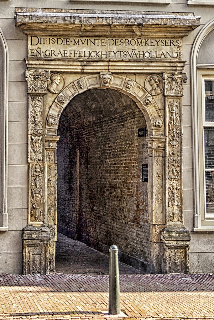
English: Het Muntpoortje naar de achterliggende Keizerlijke Munt aan de Voorstraat te Dordrecht.
The alley to the Imperial Mint in Dordrecht nl.wikipedia.org/wiki/Munt_van_Holland |
| Date | |
| Source | https://www.flickr.com/photos/dordrecht-holland/49525446478/ |
| Author | Paul van de Velde |
| Camera location | | View this and other nearby images on: OpenStreetMap |
|---|
Licensing[edit]
This file is licensed under the Creative Commons Attribution 2.0 Generic license.
- You are free:
- to share – to copy, distribute and transmit the work
- to remix – to adapt the work
- Under the following conditions:
- attribution – You must give appropriate credit, provide a link to the license, and indicate if changes were made. You may do so in any reasonable manner, but not in any way that suggests the licensor endorses you or your use.
| This image was originally posted to Flickr by PAUL (Van de Velde) -Fotografie at https://flickr.com/photos/93438832@N04/49525446478 (archive). It was reviewed on 1 March 2020 by FlickreviewR 2 and was confirmed to be licensed under the terms of the cc-by-2.0. |
File history
Click on a date/time to view the file as it appeared at that time.
| Date/Time | Thumbnail | Dimensions | User | Comment | |
|---|---|---|---|---|---|
| current | 19:12, 1 March 2020 | | 1,520 × 2,279 (2.58 MB) | Eissink (talk | contribs) | User created page with UploadWizard |
You cannot overwrite this file.
File usage on Commons
The following page uses this file: