File:2019-05-14-LSG Nordfriedhof und Ginsterpfad-Gelände -.jpg
Original file (6,023 × 3,388 pixels, file size: 14.47 MB, MIME type: image/jpeg)
Captions
Summary[edit]
Description2019-05-14-LSG Nordfriedhof und Ginsterpfad-Gelände -.jpg |
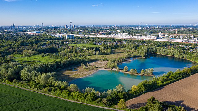
Deutsch: Landschaftsschutzgebiet - (LSG-Nordfriedhof und Ginsterpfad-Gelaende - nw_LSG-5007-0008) und Naturschutzgebiet - (NSG Am Ginsterpfad - nw_K-015). Foto wurde aus 100 m Höhe aufgenommen, der gesamte Flug der Kameradrohne fand außerhalb des Naturschutzgebietes mit ausreichendem Abstand statt. |
Date | |
Source | Own work |
Author | Superbass |
Permission (Reusing this file) |
I have published this image as author under the Creative-Commons-Licence CC-by-SA-4.0.. This means that free usage outside of Wikimedia projects under the following terms of licence is possible:
To generate a licence text and attribution of the author you're welcome to use the Licence Generator: I would be happy to receive a specimen copy or the URL of the website where the image is used. Please write an email to sesams06.hadron@icloud.com, if you
|
Camera location | 50° 59′ 18.6″ N, 6° 55′ 51.52″ E | View this and other nearby images on: OpenStreetMap | 50.988499; 6.930977 |
---|
This image was uploaded as part of Wiki Loves Earth 2019.
aragonés | العربية | asturianu | azərbaycanca | беларуская (тарашкевіца) | български | বাংলা | brezhoneg | català | čeština | Cymraeg | Deutsch | Ελληνικά | English | español | eesti | euskara | فارسی | français | galego | עברית | hrvatski | հայերեն | Bahasa Indonesia | italiano | 日本語 | ქართული | 한국어 | latviešu | македонски | മലയാളം | मराठी | Bahasa Melayu | norsk bokmål | नेपाली | Nederlands | norsk | polski | português | português do Brasil | русский | sicilianu | shqip | slovenščina | српски / srpski | svenska | ไทย | Türkçe | українська | اردو | 中文 | 中文(台灣) | +/− |
This is a picture of the protected area listed at WDPA under the ID 555558463
|
This is a picture of the protected area listed at WDPA under the ID 162151
|
This picture has been taken by members of the community project „Lokal K - Drohnenfotografie“. |
Licensing[edit]
- You are free:
- to share – to copy, distribute and transmit the work
- to remix – to adapt the work
- Under the following conditions:
- attribution – You must give appropriate credit, provide a link to the license, and indicate if changes were made. You may do so in any reasonable manner, but not in any way that suggests the licensor endorses you or your use.
- share alike – If you remix, transform, or build upon the material, you must distribute your contributions under the same or compatible license as the original.
File history
Click on a date/time to view the file as it appeared at that time.
Date/Time | Thumbnail | Dimensions | User | Comment | |
---|---|---|---|---|---|
current | 20:30, 14 May 2019 | 6,023 × 3,388 (14.47 MB) | Superbass (talk | contribs) | Uploaded with LrMediaWiki 0.8.0, LR 8.3 Win |
You cannot overwrite this file.
File usage on Commons
The following 2 pages use this file:
File usage on other wikis
The following other wikis use this file:
- Usage on de.wikipedia.org
- Usage on www.wikidata.org
Metadata
This file contains additional information such as Exif metadata which may have been added by the digital camera, scanner, or software program used to create or digitize it. If the file has been modified from its original state, some details such as the timestamp may not fully reflect those of the original file. The timestamp is only as accurate as the clock in the camera, and it may be completely wrong.
Camera manufacturer | Hasselblad |
---|---|
Camera model | L1D-20c |
Exposure time | 1/320 sec (0.003125) |
F-number | f/5 |
ISO speed rating | 100 |
Date and time of data generation | 07:46, 14 May 2019 |
Lens focal length | 10.26 mm |
Short title |
|
Horizontal resolution | 240 dpi |
Vertical resolution | 240 dpi |
Software used | Adobe Photoshop Lightroom Classic 8.3 (Windows) |
File change date and time | 22:28, 14 May 2019 |
Exposure Program | Normal program |
Exif version | 2.31 |
Date and time of digitizing | 07:46, 14 May 2019 |
APEX shutter speed | 8.321928 |
APEX aperture | 4.643856 |
APEX exposure bias | 0 |
Maximum land aperture | 2.971 APEX (f/2.8) |
Metering mode | Center weighted average |
Light source | Daylight |
Flash | Flash did not fire |
DateTimeOriginal subseconds | 1 |
DateTimeDigitized subseconds | 1 |
Color space | sRGB |
File source | Digital still camera |
Scene type | A directly photographed image |
Exposure mode | Auto exposure |
White balance | Auto white balance |
Digital zoom ratio | 1 |
Focal length in 35 mm film | 28 mm |
Scene capture type | Standard |
Scene control | None |
Contrast | Normal |
Saturation | Normal |
Sharpness | Normal |
Serial number of camera | 0K8TFBV0024143 |
Lens used | 28.0 mm f/2.8 |
Date metadata was last modified | 00:28, 15 May 2019 |
Rating (out of 5) | 3 |
Unique ID of original document | 290E5B8A0D41FED9FB79AFCCDCB59EA5 |
IIM version | 4 |
Structured data
Items portrayed in this file
depicts
14 May 2019
50°59'18.595000003"N, 6°55'51.517999999"E
0.003125 second
10.26 millimetre
100
image/jpeg
9a095d6ed9c366e98000827302e593fc480fe308
15,170,297 byte
3,388 pixel
6,023 pixel
- Files by User:Superbass from de.wikipedia/Köln
- Files with coordinates missing SDC location of creation (50° N, 6° E)
- Images from Wiki Loves Earth 2019
- Images from Wiki Loves Earth 2019 in Germany
- Images from Wiki Loves Earth missing SDC location of creation
- Protected areas with known WDPA-ID
- Kameradrohne Lokal K (DJI Mavic 2 Pro)
- CC-BY-SA-4.0
- Self-published work
- Uploaded with LrMediaWiki
- Images from Wiki Loves Earth 2019, DE-NW
- Uploaded via Campaign:wle-de-nw
- Germany photographs taken on 2019-05-14
- Pages with maps