File:20160507 China 6087 crop Jiayuguan sRGB (29881729872).jpg
Original file (3,397 × 2,551 pixels, file size: 734 KB, MIME type: image/jpeg)
Captions
Captions
Summary[edit]
.jpg&action=edit§ion=1)
| Description |
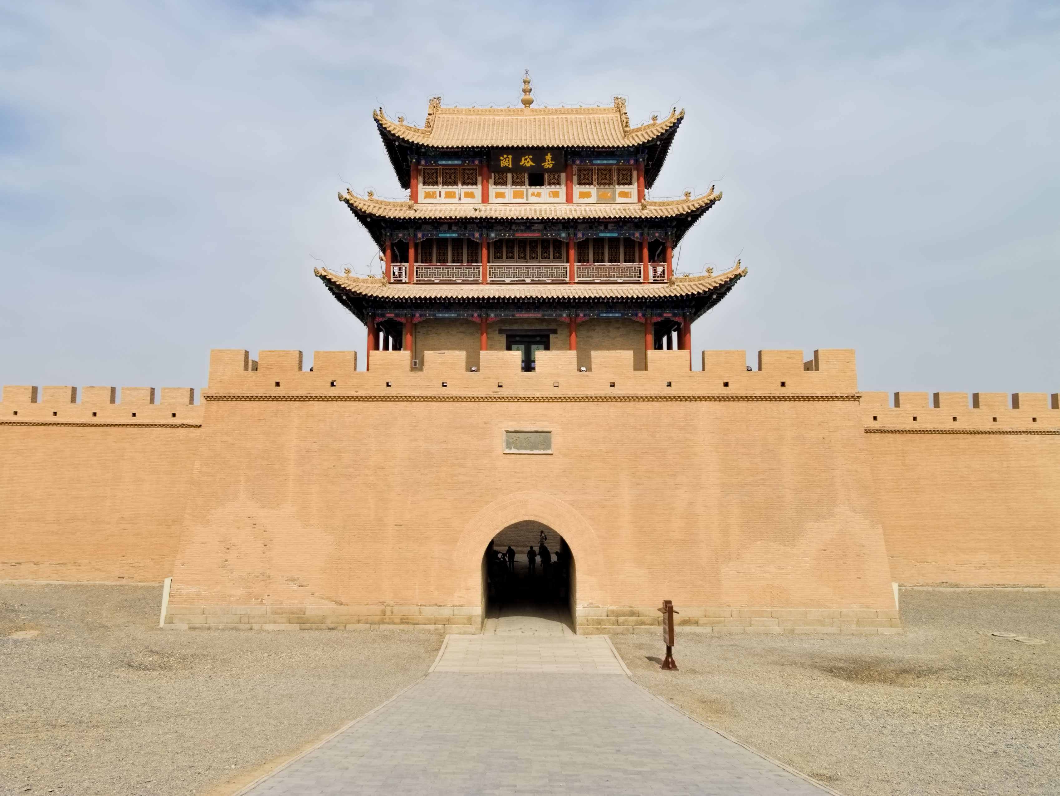
The “front door of China,” the western gate of the restored Jiayu Pass fort. The fort was not only a defense against barbarians but also a means of controlling goods and people in and out of the kingdom. An old tradition for departing travelers was to throw a stone at the fortress wall, a rebound signifying a safe return to China. Construction of the fort began in 1372 and was completed 168 years later in 1540. With walls 11m/36ft high and 733m/2,400ft around, it was known as "The Strongest Pass Under Heaven," The Jiayu Pass was the very western end of the Great Wall during the Ming dynasty (1368-1644) and an important waystation along the Silk Road which passed through here starting in the 1st century BCE. The pass is the narrowest point of the western portion of the Hexi Corridor, a 1,000 km/620 mile-long stretch of oases wedged between the Gobi Desert to the north and the Tibetan Plateau to the south. The Great Wall was declared a UNESCO World Heritage Site in 1987. The Silk Roads: the Routes Network of Chang'an-Tianshan Corridor were declared a UNESCO World Heritage Site in 2014. (Chang'an, now Xi'an, is in eastern China and Tianshan is a system of mountain ranges in the border region of Kazakhstan, Kyrgyzstan, Uzbekistan, and Xinjiang in Northwest China.) [The term ‘Silk Road’ was coined in 1877 by German geographer Ferdinand von Richthofen. The Silk Road contributed not only to the exchange of goods and technologies, but also to the mutual enrichment of cultures and traditions of different peoples. Direct maritime trade between Europe and the Far East ultimately supplanted the overland route.] On Google Earth: Pass Tower at Jiayu Pass Fort 39°48'3.86"N, 98°12'53.30"E |
| Date | |
| Source | 20160507_China_6087 crop Jiayuguan sRGB |
| Author | Dan Lundberg |
| Camera location | | View this and other nearby images on: OpenStreetMap |
|---|
.jpg¶ms=039.801007_N_0098.214071_E_globe:Earth_type:camera_source:Flickr_&language=en)
Licensing[edit]
.jpg&action=edit§ion=2)
- You are free:
- to share – to copy, distribute and transmit the work
- to remix – to adapt the work
- Under the following conditions:
- attribution – You must give appropriate credit, provide a link to the license, and indicate if changes were made. You may do so in any reasonable manner, but not in any way that suggests the licensor endorses you or your use.
- share alike – If you remix, transform, or build upon the material, you must distribute your contributions under the same or compatible license as the original.
| This image was originally posted to Flickr by Dan Lundberg at https://flickr.com/photos/9508280@N07/29881729872. It was reviewed on 4 October 2023 by FlickreviewR 2 and was confirmed to be licensed under the terms of the cc-by-sa-2.0. |
File history
Click on a date/time to view the file as it appeared at that time.
| Date/Time | Thumbnail | Dimensions | User | Comment | |
|---|---|---|---|---|---|
| current | 09:18, 4 October 2023 | | 3,397 × 2,551 (734 KB) | Kcx36 (talk | contribs) | Transferred from Flickr via #flickr2commons |
You cannot overwrite this file.
File usage on Commons
There are no pages that use this file.
.jpg&oldid=808345974)