File:2016-01-22 08 59 22 "Welcome To Maryland" sign on the Woodrow Wilson Bridge (the northbound outer loop of the Capital Beltway (Interstate 95 and Interstate 495)) in National Harbor, Prince Georges County, Maryland.jpg
Jump to navigation
Jump to search
Size of this preview: 800 × 600 pixels. Other resolutions: 320 × 240 pixels | 640 × 480 pixels | 1,024 × 768 pixels | 1,280 × 960 pixels | 2,560 × 1,920 pixels | 3,108 × 2,331 pixels.
Original file (3,108 × 2,331 pixels, file size: 1.27 MB, MIME type: image/jpeg)
Captions
Captions
Add a one-line explanation of what this file represents
Summary[edit]
)_in_National_Harbor,_Prince_Georges_County,_Maryland.jpg&action=edit§ion=1)
| Description |
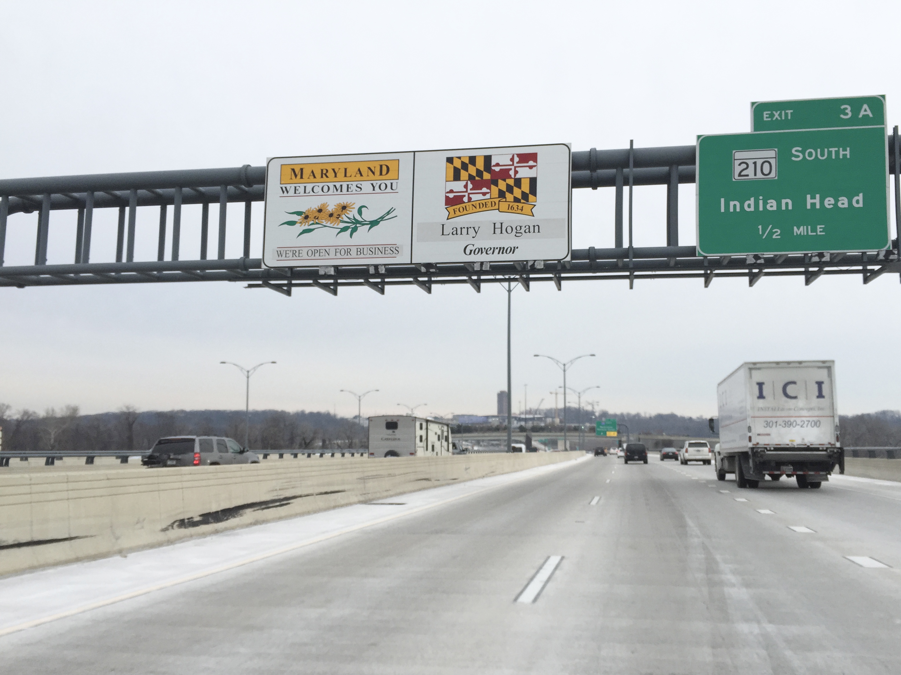
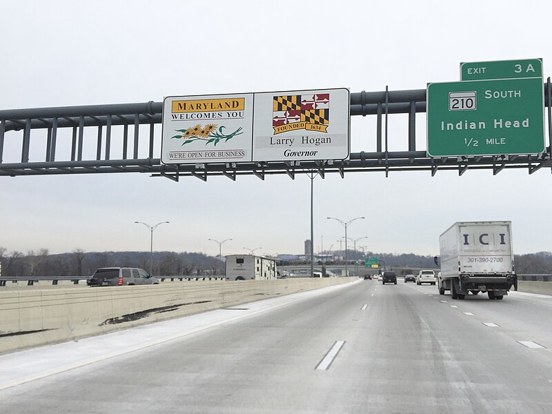
English: "Welcome To Maryland" sign on the Woodrow Wilson Bridge (the northbound outer loop of the Capital Beltway (Interstate 95 and Interstate 495)) in National Harbor, Prince Georges County, Maryland |
| Date | |
| Source | Own work |
| Author | Famartin |
| Camera location | | View this and other nearby images on: OpenStreetMap |
|---|
)_in_National_Harbor,_Prince_Georges_County,_Maryland.jpg¶ms=038.792631_N_-077.028817_E_globe:Earth_type:camera_heading:155.86&language=en)
Licensing[edit]
)_in_National_Harbor,_Prince_Georges_County,_Maryland.jpg&action=edit§ion=2)
I, the copyright holder of this work, hereby publish it under the following license:
This file is licensed under the Creative Commons Attribution-Share Alike 4.0 International license.
- You are free:
- to share – to copy, distribute and transmit the work
- to remix – to adapt the work
- Under the following conditions:
- attribution – You must give appropriate credit, provide a link to the license, and indicate if changes were made. You may do so in any reasonable manner, but not in any way that suggests the licensor endorses you or your use.
- share alike – If you remix, transform, or build upon the material, you must distribute your contributions under the same or compatible license as the original.
File history
Click on a date/time to view the file as it appeared at that time.
| Date/Time | Thumbnail | Dimensions | User | Comment | |
|---|---|---|---|---|---|
| current | 15:17, 12 September 2021 | | 3,108 × 2,331 (1.27 MB) | Famartin (talk | contribs) | Brighter |
| 00:36, 30 October 2016 |  | 3,108 × 2,331 (2.12 MB) | Famartin (talk | contribs) | cropped | |
| 16:46, 7 March 2016 |  | 3,264 × 2,448 (1.43 MB) | Famartin (talk | contribs) | User created page with UploadWizard |
You cannot overwrite this file.
File usage on Commons
The following 3 pages use this file:
- Commons:Files used on the AARoads Wiki/6
- File:2016-01-22 08 59 22 "Welcome To Maryland" sign on the Woodrow Wilson Bridge (the northbound outer loop of the Capital Beltway (Interstate 95 and Interstate 495)) in Fort Washington, Prince Georges County, Maryland.jpg (file redirect)
- File:2016-01-22 08 59 22 IMG 7621 Placeholder for description (I will rename and categorize this as time allows, be patient).JPG (file redirect)
)_in_Fort_Washington,_Prince_Georges_County,_Maryland.jpg&redirect=no)
.JPG&redirect=no)
File usage on other wikis
The following other wikis use this file:
- Usage on en.wikipedia.org
- Usage on zh.wikipedia.org
Metadata
)_in_National_Harbor,_Prince_Georges_County,_Maryland.jpg&oldid=877274453)
Categories:
- Woodrow Wilson Bridge
- Road sign gantries in Prince George's County, Maryland
- State border signs in Maryland
- Road signs for Maryland Route 210 along other roads in Prince George's County
- Road signs along Interstate 95/Interstate 495 in Maryland
- Exits numbered 3 in Maryland
- Road signs for Indian Head, Maryland