File:1cpcp1 June 2019.png
Jump to navigation
Jump to search

Size of this preview: 600 × 600 pixels. Other resolutions: 240 × 240 pixels | 480 × 480 pixels | 768 × 768 pixels | 1,024 × 1,024 pixels | 2,048 × 2,048 pixels | 2,700 × 2,700 pixels.
Original file (2,700 × 2,700 pixels, file size: 290 KB, MIME type: image/png)
Captions
Captions
Add a one-line explanation of what this file represents

|
This map of europe image could be re-created using vector graphics as an SVG file. This has several advantages; see Commons:Media for cleanup for more information. If an SVG form of this image is available, please upload it and afterwards replace this template with
{{vector version available|new image name}}.
It is recommended to name the SVG file “1cpcp1 June 2019.svg”—then the template Vector version available (or Vva) does not need the new image name parameter. |
Summary[edit]
| Description |
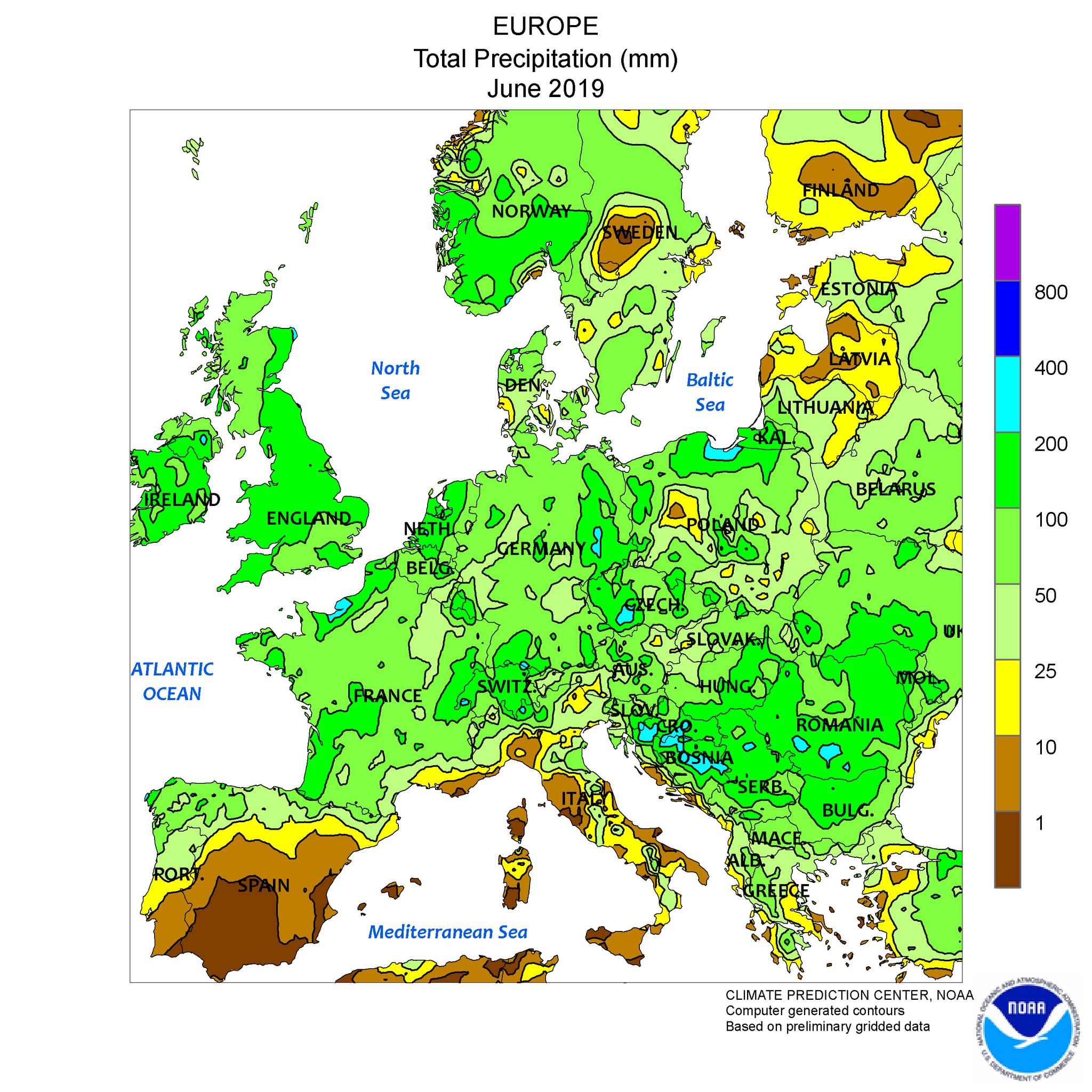
English: Europe: Total Precipitation June 2019, computer generated contours, based on preliminary data; 2019 European heat wave. |
| Date | |
| Source | www.nws.noaa.gov > Monitoring & Data > Global Climate Data > Global Regional Climate Maps > Europe |
| Author | |
| Other versions |
|


Licensing[edit]
This image is in the public domain because it contains materials that originally came from the U.S. National Oceanic and Atmospheric Administration, taken or made as part of an employee's official duties.
|
File history
Click on a date/time to view the file as it appeared at that time.
| Date/Time | Thumbnail | Dimensions | User | Comment | |
|---|---|---|---|---|---|
| current | 09:19, 15 July 2019 | | 2,700 × 2,700 (290 KB) | W!B: (talk | contribs) | =={{int:filedesc}}== {{Information |description={{en|1=Europe: Total Precipitation June 2019, computer generated contours, based on preliminary data;<br />2019 European heat wave.}} |date=2019-07-07 |source=www.nws.noaa.gov > Monitoring & Data > Global Climate Data > Global Regional Climate Maps > Europe (weekly maps see below) |author= * NOAA / National Weather Service – National Centers for Environmental Prediction – Climate Prediction Center * file: [[... |
You cannot overwrite this file.
File usage on Commons
The following 2 pages use this file:
File usage on other wikis
The following other wikis use this file:
- Usage on de.wikipedia.org
- Usage on et.wikipedia.org