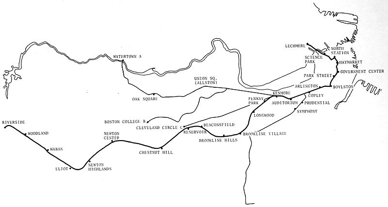
File:1972 MBTA Green Line map with Riverside Line highlighted.jpg
From Wikimedia Commons, the free media repository
Jump to navigation
Jump to search

Size of this preview: 800 × 427 pixels. Other resolutions: 320 × 171 pixels | 640 × 342 pixels | 1,024 × 547 pixels | 1,280 × 684 pixels | 2,872 × 1,534 pixels.
Original file (2,872 × 1,534 pixels, file size: 200 KB, MIME type: image/jpeg)
File information
Structured data
Captions
Captions
Add a one-line explanation of what this file represents
| Description1972 MBTA Green Line map with Riverside Line highlighted.jpg |
English: 1972 map of the MBTA Green Line (including the Watertown Line, then believed to only be temporarily suspended) with the "D" Branch highlighted |
||||
| Date | |||||
| Source | MBTA Green Line Tests: Riverside Lines, December 1972 | ||||
| Author | Transportation System Center, USDOT | ||||
| Permission (Reusing this file) |
|
File history
Click on a date/time to view the file as it appeared at that time.
| Date/Time | Thumbnail | Dimensions | User | Comment | |
|---|---|---|---|---|---|
| current | 07:23, 23 December 2016 |  | 2,872 × 1,534 (200 KB) | Pi.1415926535 (talk | contribs) | {{Information |Description ={{en|1=1972 map of the MBTA Green Line (including the Watertown Line, then believed to only be temporarily suspended) with the "D" Branch highlighted}} |Source =[https://archive.org/stream/mbtagreenlinetes00neat#p... |
You cannot overwrite this file.
File usage on Commons
The following 6 pages use this file:
- User:Chumwa/OgreBot/Potential transport maps/2016 December 21-31
- User:Chumwa/OgreBot/Public transport information/2016 December 21-31
- User:Chumwa/OgreBot/Transport Maps/2016 December 21-31
- User:Chumwa/OgreBot/Travel and communication maps/2016 December 21-31
- User:OgreBot/Watercraft/2016 December 23
- File:MBTA Green Line.svg
Metadata
This file contains additional information such as Exif metadata which may have been added by the digital camera, scanner, or software program used to create or digitize it. If the file has been modified from its original state, some details such as the timestamp may not fully reflect those of the original file. The timestamp is only as accurate as the clock in the camera, and it may be completely wrong.
| Author | Picasa |
|---|---|
| Date and time of data generation | 16:56, 22 December 2016 |
| Software used | Picasa |
| File change date and time | 16:59, 22 December 2016 |
| Exif version | 2.2 |
| Unique image ID | f163efddc74efa3d06e14b5d0793e133 |
| IIM version | 4 |
