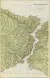
File:1901 maps of The Dardanelles and the Troad and The Bosphorus and Constantinople.jpg

From Wikimedia Commons, the free media repository
Jump to navigation Jump to search

Original file(8,657 × 6,820 pixels, file size: 11.09 MB, MIME type: image/jpeg)

Captions

Captions

1901 maps of The Dardanelles and the Troad and The Bosphorus and Constantinople

Summary[edit]

Warning The original file is very high-resolution. It might not load properly or could cause your browser to freeze when opened at full size.
Description
English: The Dardanelles and the Troad. The Bosphorus and Constantinople.
Türkçe: Boğazlar
Date
Source https://searchworks.stanford.edu/view/qw129tv7494
Author Edward Stanford Ltd.
Edward Stanford  (1827–1904)  wikidata:Q3655695
 
Alternative names
Edward Stanford Ltd.
Description British cartographer and businessman
Date of birth/death 27 May 1827 Edit this at Wikidata 3 November 1904 Edit this at Wikidata
Location of birth London
Authority file
creator QS:P170,Q3655695
Other versions

Licensing[edit]

Public domain

This work is in the public domain in its country of origin and other countries and areas where the copyright term is the author's life plus 70 years or fewer.


This work is in the public domain in the United States because it was published (or registered with the U.S. Copyright Office) before January 1, 1929.

File history

Click on a date/time to view the file as it appeared at that time.

Date/TimeThumbnailDimensionsUserComment
current20:49, 27 August 2022Thumbnail for version as of 20:49, 27 August 20228,657 × 6,820 (11.09 MB)Enyavar (talk | contribs)Cropped 31 % horizontally, 19 % vertically using CropTool with precise mode.
08:27, 4 March 2019Thumbnail for version as of 08:27, 4 March 201912,473 × 8,376 (14.31 MB)Balkanique (talk | contribs)User created page with UploadWizard

File usage on other wikis

The following other wikis use this file: