File:1895 Massachusetts railroad map.png
Jump to navigation
Jump to search

Size of this preview: 800 × 597 pixels. Other resolutions: 320 × 239 pixels | 640 × 477 pixels | 1,024 × 764 pixels | 1,280 × 955 pixels | 2,560 × 1,910 pixels | 4,692 × 3,500 pixels.
Original file (4,692 × 3,500 pixels, file size: 20.45 MB, MIME type: image/png)
Captions
Captions
Add a one-line explanation of what this file represents
Summary[edit]
| Description |
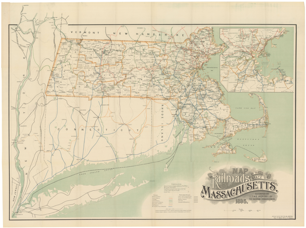
English: 1895 map of railroads in Massachusetts |
|||
| Date | ||||
| Source | Ward Maps | |||
| Author | Geo. H. Walker & Co. | |||
| Permission (Reusing this file) |
|

File history
Click on a date/time to view the file as it appeared at that time.
| Date/Time | Thumbnail | Dimensions | User | Comment | |
|---|---|---|---|---|---|
| current | 22:59, 12 June 2020 | | 4,692 × 3,500 (20.45 MB) | Pi.1415926535 (talk | contribs) | {{Information |description ={{en|1=1895 map of railroads in Massachusetts}} |date =1895 |source =[https://www.wardmaps.com/viewasset.php?aid=20860 Ward Maps] |author =Geo. H. Walker & Co. |permission ={{PD-scan|PD-US-expired}} }} Category:1895 maps of Massachusetts Category:1895 in rail transport in the United States Category:Rail transport maps of Massachusetts Category:Other images uploaded by User:Pi.1415926535 |
You cannot overwrite this file.
File usage on Commons
The following 3 pages use this file: