File:1862 Mitchell's Map of Vermont and New Hampshire - Geographicus - VTNH-m-63.jpg
Jump to navigation
Jump to search

Size of this preview: 498 × 600 pixels. Other resolutions: 199 × 240 pixels | 399 × 480 pixels | 638 × 768 pixels | 851 × 1,024 pixels | 2,492 × 3,000 pixels.
Original file (2,492 × 3,000 pixels, file size: 2.29 MB, MIME type: image/jpeg)
Captions
Captions
Add a one-line explanation of what this file represents
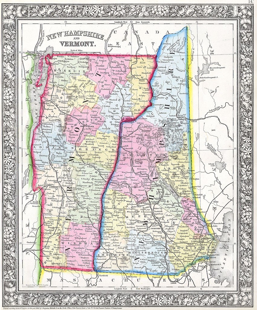
| Samuel Augustus Mitchell: Vermont and New Hampshire.
( |
||||||||||||||||||||
|---|---|---|---|---|---|---|---|---|---|---|---|---|---|---|---|---|---|---|---|---|
| Artist |
|
|||||||||||||||||||
| Title |
Vermont and New Hampshire. |
|||||||||||||||||||
| Description |
English: This hand colored antique map of Vermont & New Hampshire is a lithographic engraving dating to 1862 by the legendary American map publisher Samuel Augustus Mitchell Jr. Detailed to the county level with attention to trains, roadways and cities. . Features the floral border typical of Mitchell maps from the 1860-65 period. Prepared by W. H. Gamble for inclusion as plate 14 in the 1864 issue of Mitchell’s New General Atlas . Dated and copyrighted, “Entered according to Act of Congress in the Year 1862 by S. Augustus Mitchell Jr. in the Clerk’s Office of the District Court of the U.S. for the Eastern District of Pennsylvania. |
|||||||||||||||||||
| Date | 1862 (dated) | |||||||||||||||||||
| Dimensions | height: 12 in (30.4 cm); width: 14 in (35.5 cm) | |||||||||||||||||||
| Accession number |
Geographicus link: VTNH-m-63 |
|||||||||||||||||||
| Source/Photographer |
|
|||||||||||||||||||
| Permission (Reusing this file) |
|
|||||||||||||||||||
File history
Click on a date/time to view the file as it appeared at that time.
| Date/Time | Thumbnail | Dimensions | User | Comment | |
|---|---|---|---|---|---|
| current | 09:11, 16 March 2011 | | 2,492 × 3,000 (2.29 MB) | BotMultichill (talk | contribs) | {{subst:User:Multichill/Geographicus |link=http://www.geographicus.com/P/AntiqueMap/VTNH-m-63 |product_name=1862 Mitchell's Map of Vermont and New Hampshire |map_title=Vermont and New Hampshire. |description=This hand colored antique map of Vermont & |
You cannot overwrite this file.
File usage on Commons
The following page uses this file: