File:1862 Johnson Map of Wisconsin and Michigan - Geographicus - MIWI-j-62.jpg
Jump to navigation
Jump to search

Size of this preview: 800 × 583 pixels. Other resolutions: 320 × 233 pixels | 640 × 466 pixels | 1,024 × 746 pixels | 1,280 × 933 pixels | 2,560 × 1,865 pixels | 3,500 × 2,550 pixels.
Original file (3,500 × 2,550 pixels, file size: 3.01 MB, MIME type: image/jpeg)
Captions
Captions
Add a one-line explanation of what this file represents
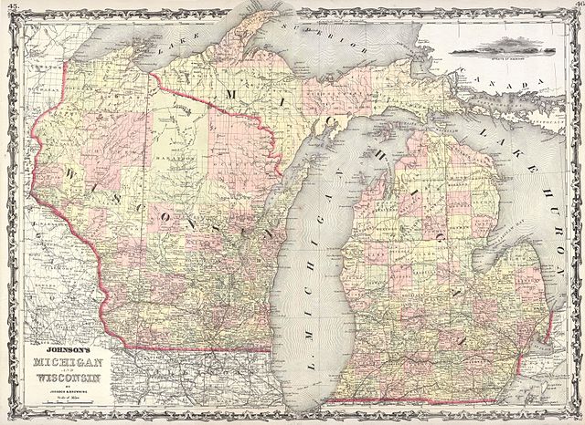
| Alvin Jewett Johnson: Johnson’s Michigan and Wisconsin.
( |
|||||||||||||||||||||||
|---|---|---|---|---|---|---|---|---|---|---|---|---|---|---|---|---|---|---|---|---|---|---|---|
| Artist |
|
||||||||||||||||||||||
| Title |
Johnson’s Michigan and Wisconsin. |
||||||||||||||||||||||
| Description |
English: This is a beautifully hand colored 1861 lithograph map of Michigan and Wisconsin. Includes a beautiful inset engraving of the Straits of Mackinaw which divide the northern peninsula of Michigan from the main landmass to the south. |
||||||||||||||||||||||
| Date | 1862 | ||||||||||||||||||||||
| Dimensions | height: 17 in (43.1 cm); width: 24 in (60.9 cm) | ||||||||||||||||||||||
| Accession number |
Geographicus link: MIWI-j-62 |
||||||||||||||||||||||
| Source/Photographer |
|
||||||||||||||||||||||
| Permission (Reusing this file) |
|
||||||||||||||||||||||
File history
Click on a date/time to view the file as it appeared at that time.
| Date/Time | Thumbnail | Dimensions | User | Comment | |
|---|---|---|---|---|---|
| current | 11:10, 16 March 2011 | | 3,500 × 2,550 (3.01 MB) | BotMultichill (talk | contribs) | {{subst:User:Multichill/Geographicus |link=http://www.geographicus.com/P/AntiqueMap/MIWI-j-62 |product_name=1862 Johnson Map of Wisconsin and Michigan |map_title=Johnson’s Michigan and Wisconsin. |description=This is a beautifully hand colored 1861 li |
You cannot overwrite this file.
File usage on Commons
The following page uses this file: