File:1860 Mitchell Map of Michigan and Wisconsin ( first edition ) - Geographicus - MIWI-mitchell-1860.jpg
Jump to navigation
Jump to search

Size of this preview: 741 × 599 pixels. Other resolutions: 297 × 240 pixels | 593 × 480 pixels | 949 × 768 pixels | 1,266 × 1,024 pixels | 2,532 × 2,048 pixels | 3,000 × 2,427 pixels.
Original file (3,000 × 2,427 pixels, file size: 2.71 MB, MIME type: image/jpeg)
Captions
Captions
Add a one-line explanation of what this file represents
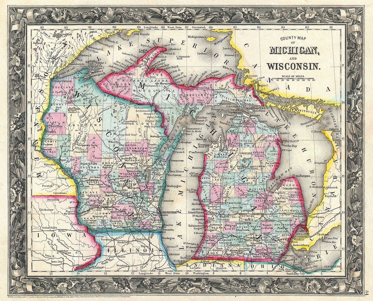
| Samuel Augustus Mitchell: County Map of Michigan and Wisconsin.
( |
||||||||||||||||||||
|---|---|---|---|---|---|---|---|---|---|---|---|---|---|---|---|---|---|---|---|---|
| Artist |
|
|||||||||||||||||||
| Title |
County Map of Michigan and Wisconsin. |
|||||||||||||||||||
| Description |
English: A beautiful example of the first edition of S. A. Mitchell’s 1860 map of Michigan and Wisconsin. Depicts both states in considerable detail with color coding at the county level. Also includes all of Lake Michigan and Lake Huron as well as parts of Lake Superior and Lake Erie. Surrounded by the attractive floral border common to Mitchell atlases issued between 1860 and 1865. In later editions of his atlas, Mitchell would update this map by increasing the scale and layout. One of the more attractive atlas maps of New York to appear in the mid 19th century. Prepared by S. A. Mitchell Jr. for inclusion as plate 34 in the 1860 issue of Mitchell’s New General Atlas . Dated and copyrighted, “Entered according to Act of Congress in the Year 1860 by S. Augustus Mitchell Jr. in the Clerk’s Office of the District Court of the U.S. for the Eastern District of Pennsylvania. |
|||||||||||||||||||
| Date | 1860 (dated) | |||||||||||||||||||
| Dimensions | height: 11 in (27.9 cm); width: 13.5 in (34.2 cm) | |||||||||||||||||||
| Accession number |
Geographicus link: MIWI-mitchell-1860 |
|||||||||||||||||||
| Source/Photographer |
Mitchell Jr., S. A., Mitchell's New General Atlas, Containing Maps Of The Various Countries Of The World, Plans Of Cities, Etc. Embraced In Forty-Seven Quarto Maps, Forming A Series Of Seventy-Six Maps And Plans, Together With Valuable Statistical Tables, (1860 first edition).
|
|||||||||||||||||||
| Permission (Reusing this file) |
|
|||||||||||||||||||
File history
Click on a date/time to view the file as it appeared at that time.
| Date/Time | Thumbnail | Dimensions | User | Comment | |
|---|---|---|---|---|---|
| current | 16:57, 22 March 2011 | | 3,000 × 2,427 (2.71 MB) | BotMultichillT (talk | contribs) | {{subst:User:Multichill/Geographicus |link=http://www.geographicus.com/P/AntiqueMap/MIWI-mitchell-1860 |product_name=1860 Mitchell Map of Michigan and Wisconsin ( first edition ) |map_title=County Map of Michigan and Wisconsin. |description=A beautiful ex |
You cannot overwrite this file.
File usage on Commons
The following page uses this file:
_-_Geographicus_-_MIWI-mitchell-1860.jpg)
_-_Geographicus_-_MIWI-mitchell-1860.jpg&oldid=874606558)