File:1837 Western Railroad map, Worcester to Springfield.jpg
Jump to navigation
Jump to search

Size of this preview: 780 × 600 pixels. Other resolutions: 312 × 240 pixels | 624 × 480 pixels | 999 × 768 pixels | 1,280 × 984 pixels | 2,560 × 1,968 pixels | 13,348 × 10,263 pixels.
Original file (13,348 × 10,263 pixels, file size: 19.91 MB, MIME type: image/jpeg)
Captions
Captions
Add a one-line explanation of what this file represents
Summary[edit]
| Warning | The original file is very high-resolution. It might not load properly or could cause your browser to freeze when opened at full size. |
|---|
| Description |
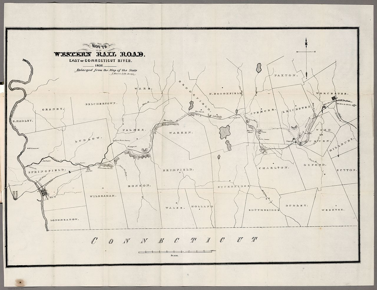
English: 1837 map of the Western Railroad as it was built two years later from Worcester to Springfield |
| Date | |
| Source | David Rumsey Map Collection |
| Author | Western Rail Road Corporation |
| Other versions |
 |
Licensing[edit]
|
This work is in the public domain in its country of origin and other countries and areas where the copyright term is the author's life plus 100 years or fewer. This work is in the public domain in the United States because it was published (or registered with the U.S. Copyright Office) before January 1, 1929. | |
| This file has been identified as being free of known restrictions under copyright law, including all related and neighboring rights. | |
File history
Click on a date/time to view the file as it appeared at that time.
| Date/Time | Thumbnail | Dimensions | User | Comment | |
|---|---|---|---|---|---|
| current | 04:11, 27 August 2013 | | 13,348 × 10,263 (19.91 MB) | Pi.1415926535 (talk | contribs) | {{Information |Description ={{en|1=1837 map of the Western Railroad as it was built two years later from Worcester to Springfield}} |Source =[http://www.davidrumsey.com/luna/servlet/s/7qu223 David Rumsey Map Collection] |Author =West... |
You cannot overwrite this file.
File usage on Commons
The following page uses this file:
File usage on other wikis
The following other wikis use this file:
- Usage on en.wikipedia.org