File:1837 Malte-Brun Map of India, Burma and Southeast Asia (Siam , Vietnam ) - Geographicus - India-mb-1837.jpg
Original file (2,500 × 1,875 pixels, file size: 1.07 MB, MIME type: image/jpeg)
Captions
Captions
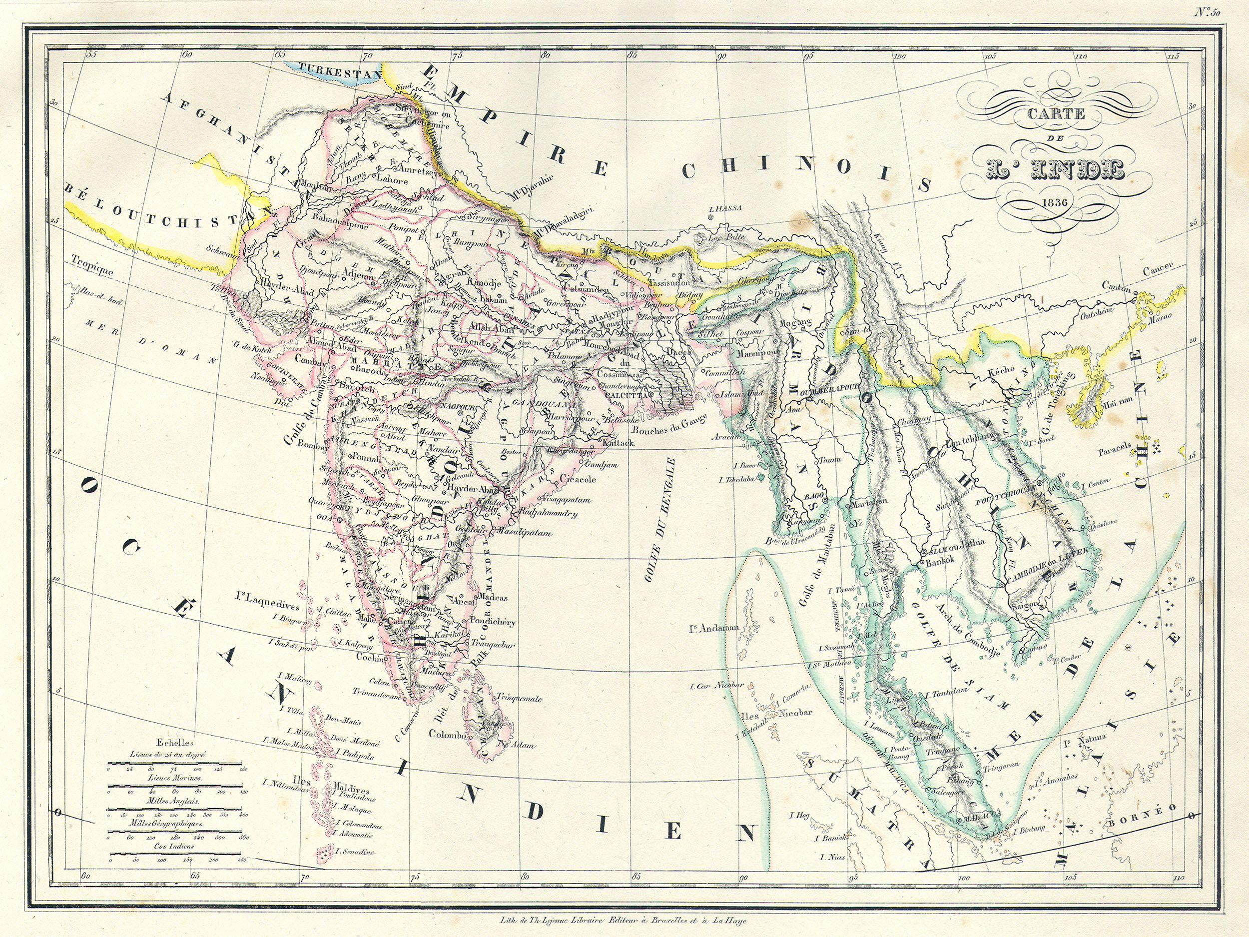
| Carte de L'Inde. | ||||||
|---|---|---|---|---|---|---|
| Artist | ||||||
| Title |
Carte de L'Inde. |
|||||
| Description |
English: This is a beautiful 1836 copperplate lithograph map of India and Southeast Asia by French cartographer Malte-Brun. Includes the modern day nations of India, Bangladesh, Burma (Myanmar), Thailand, Cambodia, Vietnam, Malaysia, and Singapore. Also shows the 19th century kingdoms of Tonquin and Cochin in modern day Vietnam. Straits of Singapore or Sincapour noted. All text is in French. |
|||||
| Date | 1836 | |||||
| Dimensions | height: 9.5 in (24.1 cm); width: 12 in (30.4 cm) | |||||
| Accession number |
Geographicus link: India-mb-1837 |
|||||
| Source/Photographer |
|
|||||
| Permission (Reusing this file) |
|
|||||
| Other versions | ||||||
.jpg)
File history
Click on a date/time to view the file as it appeared at that time.
| Date/Time | Thumbnail | Dimensions | User | Comment | |
|---|---|---|---|---|---|
| current | 11:26, 16 March 2011 | | 2,500 × 1,875 (1.07 MB) | BotMultichill (talk | contribs) | {{subst:User:Multichill/Geographicus |link=http://www.geographicus.com/P/AntiqueMap/India-mb-1837 |product_name=1837 Malte-Brun Map of India, Burma and Southeast Asia (Siam , Vietnam ) |map_title=Carte de L'Inde. |description=This is a beautiful 1837 copp |
You cannot overwrite this file.
File usage on Commons
The following 3 pages use this file:
.png)
_-_Geographicus_-_India-mb-1837.jpg)
_-_Geographicus_-_India-mb-1837.jpg&oldid=819748581)