File:1805 cary.jpg
Jump to navigation
Jump to search
Size of this preview: 669 × 600 pixels. Other resolutions: 268 × 240 pixels | 536 × 480 pixels | 857 × 768 pixels | 1,142 × 1,024 pixels | 2,163 × 1,939 pixels.
Original file (2,163 × 1,939 pixels, file size: 5.08 MB, MIME type: image/jpeg)
Captions
Captions
Add a one-line explanation of what this file represents
Summary[edit]
| Description |
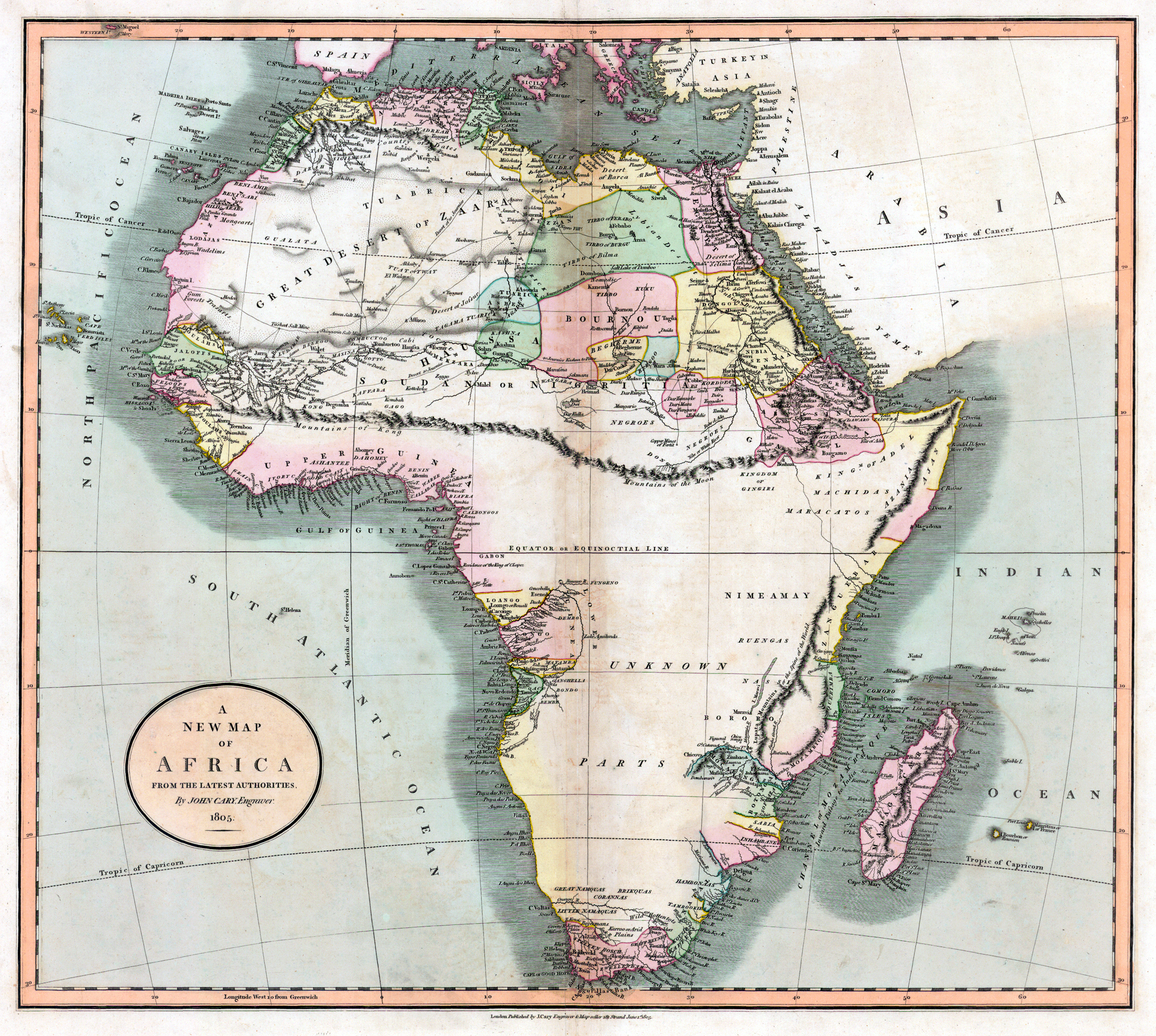
Deutsch: Alte Landkarte von Afrika. Die fiktiven "Kong-Berge" sind eingezeichnet.
English: Old map from Africa, made by John Cary in 1805. The map shows the non exisiting "Mountains of Kong". |
|||||||||||||||||||||||||
| Date | ||||||||||||||||||||||||||
| Source | http://libweb5.princeton.edu/visual_materials/maps/websites/africa/maps-central/central.html | |||||||||||||||||||||||||
| Author |
|
|||||||||||||||||||||||||
| Other versions |
 |
|||||||||||||||||||||||||
Licensing[edit]
|
This is a faithful photographic reproduction of a two-dimensional, public domain work of art. The work of art itself is in the public domain for the following reason:
The official position taken by the Wikimedia Foundation is that "faithful reproductions of two-dimensional public domain works of art are public domain".
This photographic reproduction is therefore also considered to be in the public domain in the United States. In other jurisdictions, re-use of this content may be restricted; see Reuse of PD-Art photographs for details. | ||||
File history
Click on a date/time to view the file as it appeared at that time.
| Date/Time | Thumbnail | Dimensions | User | Comment | |
|---|---|---|---|---|---|
| current | 13:02, 21 June 2009 | | 2,163 × 1,939 (5.08 MB) | Kuebi (talk | contribs) | {{Information |Description= {{de|Alte Landkarte von Afrika von John Cary aus dem Jahr 1805. Die fiktiven "Kong-Berge" sind eingezeichnet.}} {{en|Old map from Africa, made by John Cary in 1805. The map shows the non exisiting "Mountains of Kong".}} |Source |
You cannot overwrite this file.
File usage on Commons
The following 2 pages use this file:
File usage on other wikis
The following other wikis use this file:
- Usage on ast.wikipedia.org
- Usage on bn.wikipedia.org
- Usage on da.wikipedia.org
- Usage on de.wikipedia.org
- Usage on en.wikipedia.org
- Usage on es.wikipedia.org
- Usage on fr.wikipedia.org
- Usage on it.wikipedia.org
- Usage on ja.wikipedia.org
- Usage on mk.wikipedia.org
- Usage on pl.wikipedia.org
- Usage on pt.wikipedia.org
- Usage on vi.wikipedia.org
- Usage on www.wikidata.org