File:1804 Jeffreys and Kitchin Map of Ireland - Geographicus - Ireland-weimar-1804.jpg
Jump to navigation
Jump to search
Size of this preview: 501 × 600 pixels. Other resolutions: 200 × 240 pixels | 401 × 480 pixels | 641 × 768 pixels | 855 × 1,024 pixels | 1,711 × 2,048 pixels | 4,000 × 4,789 pixels.
Original file (4,000 × 4,789 pixels, file size: 6.55 MB, MIME type: image/jpeg)
Captions
Captions
Add a one-line explanation of what this file represents
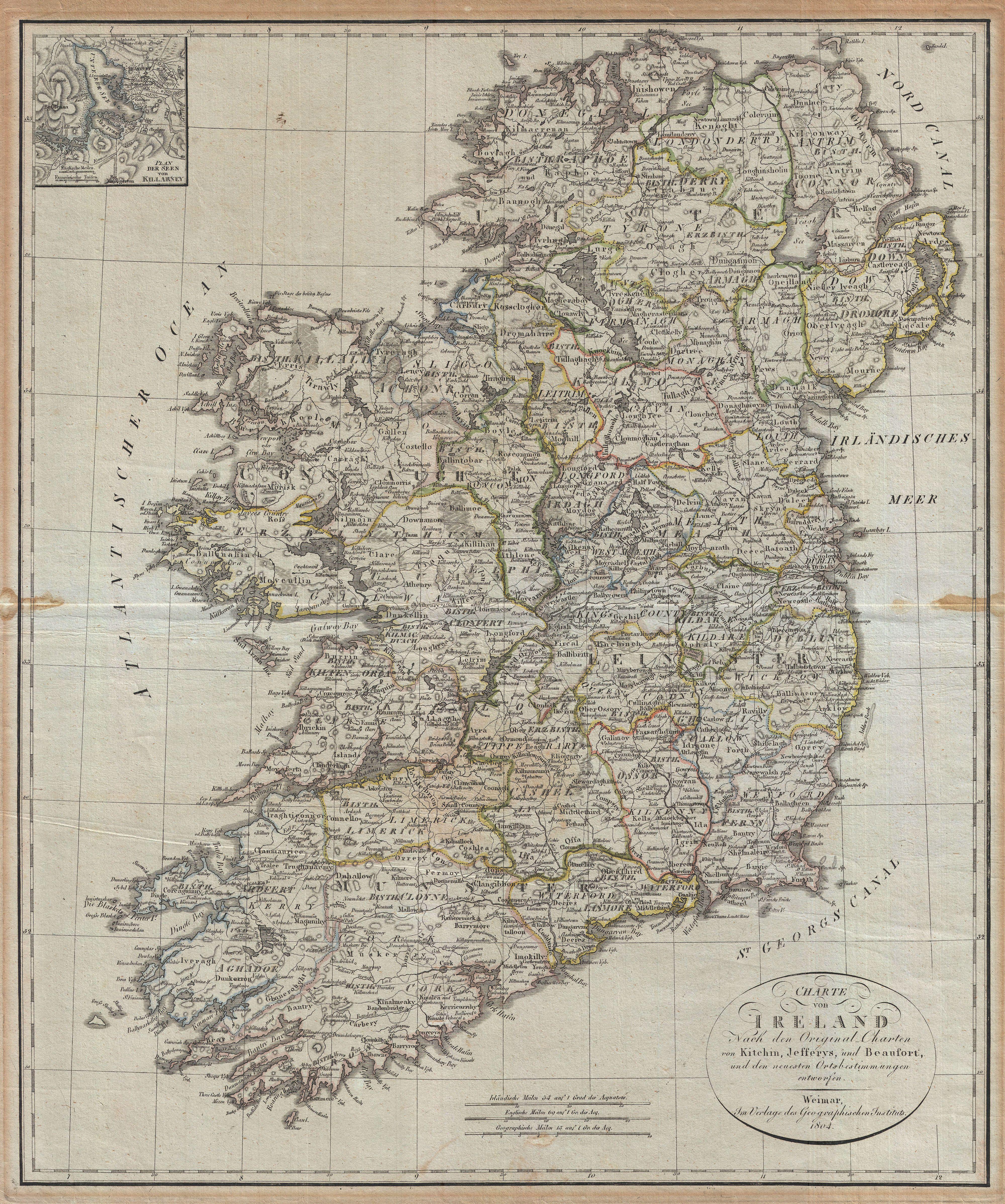
| Charte von Ireland Nach den Original-Charten von Kitchin, Jefferys, und Beaufort, und den neuesten Ortsbestimmungen entworfen. | ||||||
|---|---|---|---|---|---|---|
| Artist | ||||||
| Title |
Charte von Ireland Nach den Original-Charten von Kitchin, Jefferys, und Beaufort, und den neuesten Ortsbestimmungen entworfen. |
|||||
| Description |
English: An uncommon map of Ireland dating to 1804. Though published by the German Geographical Institute, this map references the earlier work of Thomas Kitchin, Thomas Jefferys, and Daniel Beaufort. Covers the entirety of Ireland with exceptional detail throughout. Color coded in outline form at the county level. An inset of Killarney appears in the upper left quadrant. Text in English and German. |
|||||
| Date | 1804 (dated) | |||||
| Dimensions | height: 23 in (58.4 cm); width: 19 in (48.2 cm) | |||||
| Accession number |
Geographicus link: Ireland-weimar-1804 |
|||||
| Source/Photographer |
|
|||||
| Permission (Reusing this file) |
|
|||||
File history
Click on a date/time to view the file as it appeared at that time.
| Date/Time | Thumbnail | Dimensions | User | Comment | |
|---|---|---|---|---|---|
| current | 07:16, 25 March 2011 | | 4,000 × 4,789 (6.55 MB) | BotMultichillT (talk | contribs) | {{subst:User:Multichill/Geographicus |link=http://www.geographicus.com/P/AntiqueMap/Ireland-weimar-1804 |product_name=1804 Jeffreys and Kitchin Map of Ireland |map_title=Charte von Ireland Nach den Original-Charten von Kitchin, Jefferys, und Beaufort, und |
You cannot overwrite this file.
File usage on Commons
The following page uses this file: