File:1794 Anville Map of England in ancient Roman times. - Geographicus - England-horsley-1794.jpg
Jump to navigation
Jump to search
Size of this preview: 551 × 599 pixels. Other resolutions: 221 × 240 pixels | 441 × 480 pixels | 706 × 768 pixels | 941 × 1,024 pixels | 1,883 × 2,048 pixels | 4,597 × 5,000 pixels.
Original file (4,597 × 5,000 pixels, file size: 5.59 MB, MIME type: image/jpeg)
Captions
Captions
Add a one-line explanation of what this file represents
| Britanniae Antiquae Tabula Geographica ex. Evi Romani Monumentis… | ||||||
|---|---|---|---|---|---|---|
| Artist | ||||||
| Title |
Britanniae Antiquae Tabula Geographica ex. Evi Romani Monumentis… |
|||||
| Description |
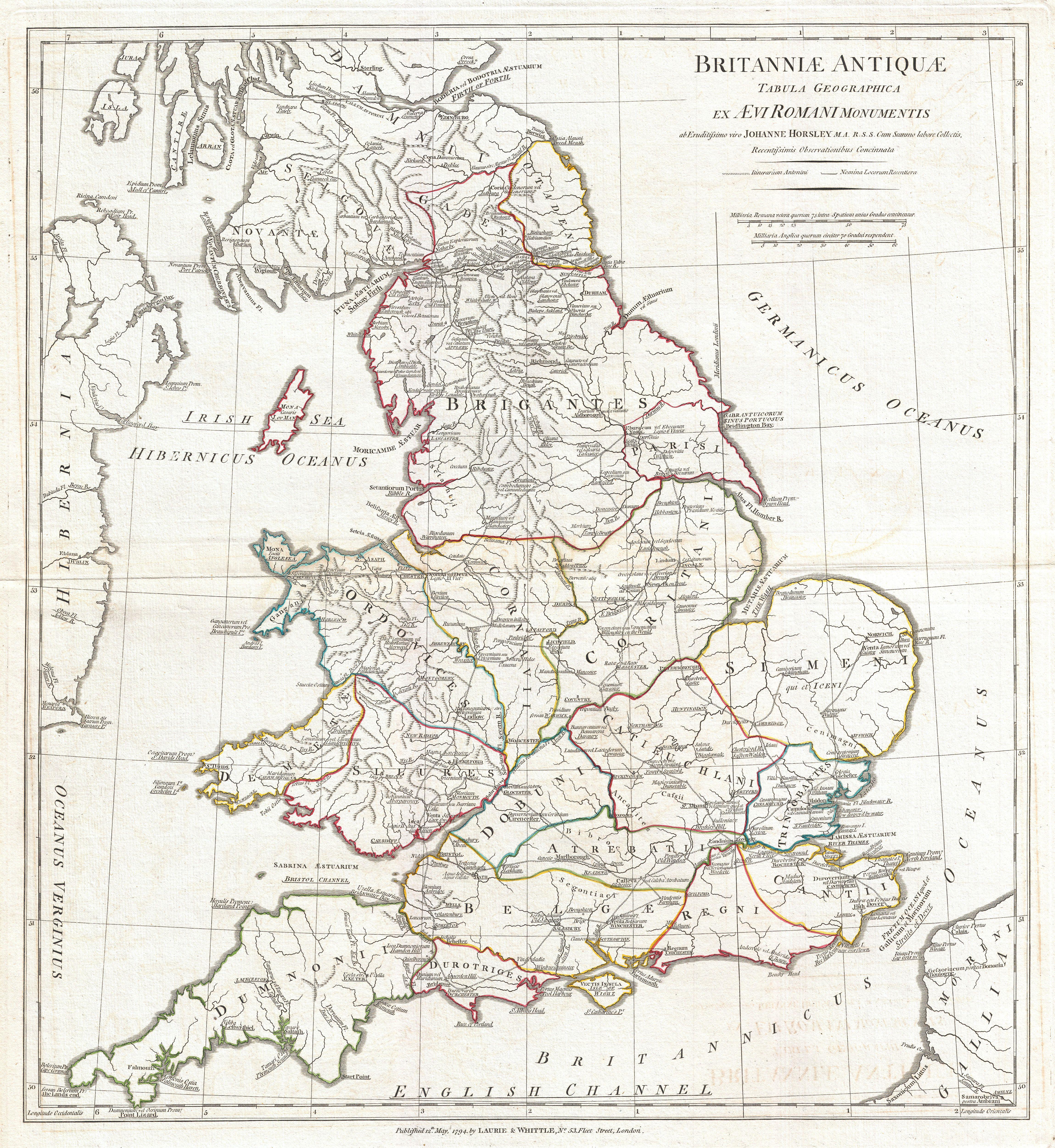
English: A large and dramatic 1794 map of England under Roman Rule. Covers all of England (Province of Britanniae) as well as adjacent parts of Scotland, Ireland (Hibernia), and France (Gallia). Features both ancient and contemporary place names, ie. Londinium and London, for each destination - an invaluable resource or scholars of antiquity. Details mountains, rivers, cities, roadways, and lakes with political divisions highlighted in outline color. Title area appears in a in the upper right quadrant. Includes two distance scales, bottom right, referencing distance measurement systems common in antiquity. Text in Latin and English. Drawn by John Horsley in 1732 and published in 1794 by Laurie and Whittle, London. |
|||||
| Date | 1794 (dated) | |||||
| Dimensions | height: 22 in (55.8 cm); width: 20 in (50.8 cm) | |||||
| Accession number |
Geographicus link: England-horsley-1794 |
|||||
| Source/Photographer |
D'Anville, J. B. B., Complete Body of Ancient Geography, Laurie and Whittle, London, 1795.
|
|||||
| Permission (Reusing this file) |
|
|||||
File history
Click on a date/time to view the file as it appeared at that time.
| Date/Time | Thumbnail | Dimensions | User | Comment | |
|---|---|---|---|---|---|
| current | 14:38, 23 March 2011 | | 4,597 × 5,000 (5.59 MB) | BotMultichillT (talk | contribs) | {{subst:User:Multichill/Geographicus |link=http://www.geographicus.com/P/AntiqueMap/England-horsley-1794 |product_name=1794 Anville Map of England in ancient Roman times. |map_title=Britanniae Antiquae Tabula Geographica ex. Evi Romani Monumentis… |desc |
You cannot overwrite this file.
File usage on Commons
The following page uses this file: