File:1750 Homann Heirs Map of Israel - Palestine - Holy Land (12 Tribes) - Geographicus - Palestina-homannheirs-1750.jpg
Jump to navigation
Jump to search
Size of this preview: 662 × 599 pixels. Other resolutions: 265 × 240 pixels | 530 × 480 pixels | 848 × 768 pixels | 1,131 × 1,024 pixels | 2,262 × 2,048 pixels | 4,000 × 3,622 pixels.
Original file (4,000 × 3,622 pixels, file size: 3.02 MB, MIME type: image/jpeg)
Captions
Captions
Add a one-line explanation of what this file represents
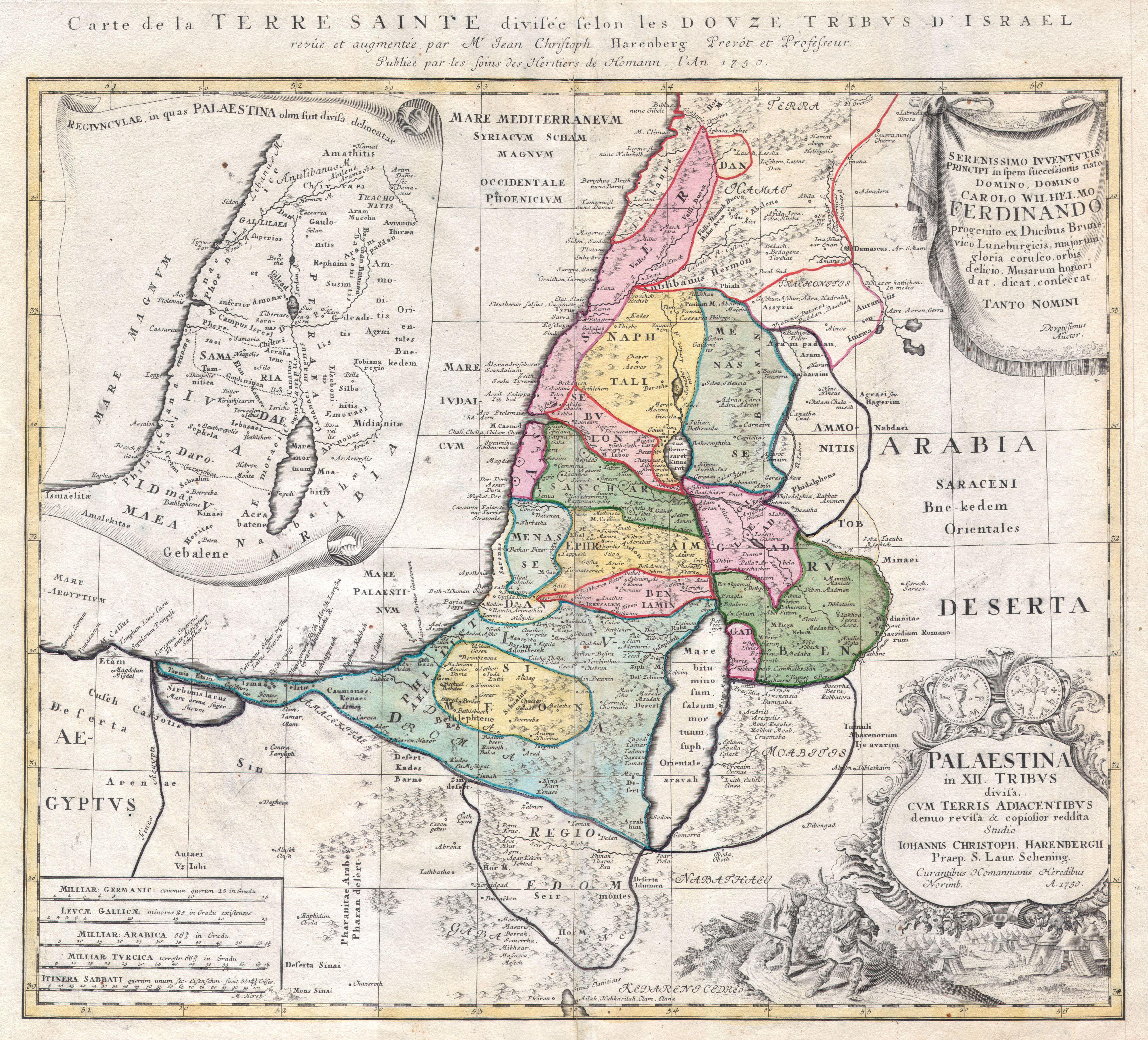
| Palaestina in XII Tribus divisa cum Terris Adiacentibus… | ||||||
|---|---|---|---|---|---|---|
| Artist | ||||||
| Title |
Palaestina in XII Tribus divisa cum Terris Adiacentibus… |
|||||
| Description |
English: This is one of the Homann Heirs finest and most appealing maps of Palestine / Israel / The Holy Land. Depicts the region divided into the 12 Tribes of Israel. In the right hand corners there are two title cartouches. The lower is exceptionally decorative and depicts with two spies of Moses bearing the fruit from the Promised Land to the Hebrew camp, as well as the front and back of an ancient shekel coin. The upper left quadrant offers an overview of the region as a whole. The upper right features a dedication from the mapmaker to Karl Wilhelm Ferdinand, the future Duke of Braunschweig-Wolfenbüttel and Braunschweig-Lüneburg (from 1773). This map was drawn by Johann Christoph Harenberg.for inclusion the 1752 Homann Heirs Maior Atlas Scholasticus ex Triginta Sex Generalibus et Specialibus…. Most early Homann atlases were “made to order” or compiled of individual maps at the request of the buyer. However, this rare atlas, composed of 37 maps and charts, was issued as a “suggested collection” of essential Homann Heirs maps. A fine copy of an important map. |
|||||
| Date | 1750 | |||||
| Dimensions | height: 19 in (48.2 cm); width: 21 in (53.3 cm) | |||||
| Accession number |
Geographicus link: Palestina-homannheirs-1750 |
|||||
| Source/Photographer |
|
|||||
| Permission (Reusing this file) |
|
|||||
File history
Click on a date/time to view the file as it appeared at that time.
| Date/Time | Thumbnail | Dimensions | User | Comment | |
|---|---|---|---|---|---|
| current | 12:06, 24 March 2011 | | 4,000 × 3,622 (3.02 MB) | BotMultichillT (talk | contribs) | {{subst:User:Multichill/Geographicus |link=http://www.geographicus.com/P/AntiqueMap/Palestina-homannheirs-1750 |product_name=1750 Homann Heirs Map of Israel / Palestine / Holy Land (12 Tribes) |map_title=Palaestina in XII Tribus divisa cum Terris Adiacent |
You cannot overwrite this file.
File usage on Commons
The following page uses this file:
_-_Geographicus_-_Palestina-homannheirs-1750.jpg)
File usage on other wikis
The following other wikis use this file:
- Usage on es.wikipedia.org
- Usage on gl.wikipedia.org
_-_Geographicus_-_Palestina-homannheirs-1750.jpg&oldid=744698142)