File:1732 Lima detail Map of Terra Firma Peru, Amazone-land, Brasil & La Plata by Moll BPL 14301.png
Jump to navigation
Jump to search
Size of this preview: 800 × 562 pixels. Other resolutions: 320 × 225 pixels | 640 × 449 pixels | 1,061 × 745 pixels.
Original file (1,061 × 745 pixels, file size: 1.81 MB, MIME type: image/png)
Captions
Captions
Add a one-line explanation of what this file represents
| Description |
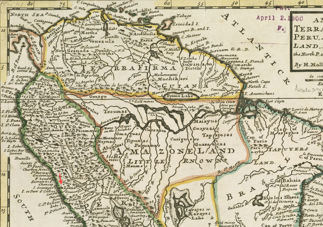
Detail of: A map of Terra Firma Peru, Amazone-land, Brasil & the north p[art] of La Plata Author: Moll, Herman Publisher: Bowles, Thomas Date: 1732 Scale: [1:18,000,000] |
|||||||||||||||||||||||
| Date | ||||||||||||||||||||||||
| Source | Boston Public Library, Map Center (Boston, Massachusetts, USA) / http://maps.bpl.org/id/14301 | |||||||||||||||||||||||
| Author |
|
|||||||||||||||||||||||

|
This work is in the public domain in its country of origin and other countries and areas where the copyright term is the author's life plus 100 years or fewer. | |
| This file has been identified as being free of known restrictions under copyright law, including all related and neighboring rights. | |
File history
Click on a date/time to view the file as it appeared at that time.
| Date/Time | Thumbnail | Dimensions | User | Comment | |
|---|---|---|---|---|---|
| current | 15:16, 9 March 2013 | | 1,061 × 745 (1.81 MB) | M2545 (talk | contribs) | {{Information |Description=Detail of: A map of Terra Firma Peru, Amazone-land, Brasil & the north p[art] of La Plata Author: Moll, Herman Publisher: Bowles, Thomas Date: 1732 Scale: [1:18,000,000] |Source=Boston Public Library, Map Center (Boston,... |
You cannot overwrite this file.
File usage on Commons
There are no pages that use this file.