File:1584 Ortelius Map of Crete (Candia) and 10 Greek Islands - Geographicus - CandiaInsula-ortelius-1584.jpg
Jump to navigation
Jump to search
Size of this preview: 800 × 579 pixels. Other resolutions: 320 × 232 pixels | 640 × 463 pixels | 1,024 × 741 pixels | 1,280 × 926 pixels | 2,560 × 1,853 pixels | 4,000 × 2,895 pixels.
Original file (4,000 × 2,895 pixels, file size: 2.94 MB, MIME type: image/jpeg)
Captions
Captions
Add a one-line explanation of what this file represents
| Abraham Ortelius: Candia Insula - Archipelagi Insularum Aliquot Descrip.
( |
||||||||||||||||||||||||
|---|---|---|---|---|---|---|---|---|---|---|---|---|---|---|---|---|---|---|---|---|---|---|---|---|
| Artist |
|
|||||||||||||||||||||||
| Title |
Candia Insula - Archipelagi Insularum Aliquot Descrip. |
|||||||||||||||||||||||
| Description |
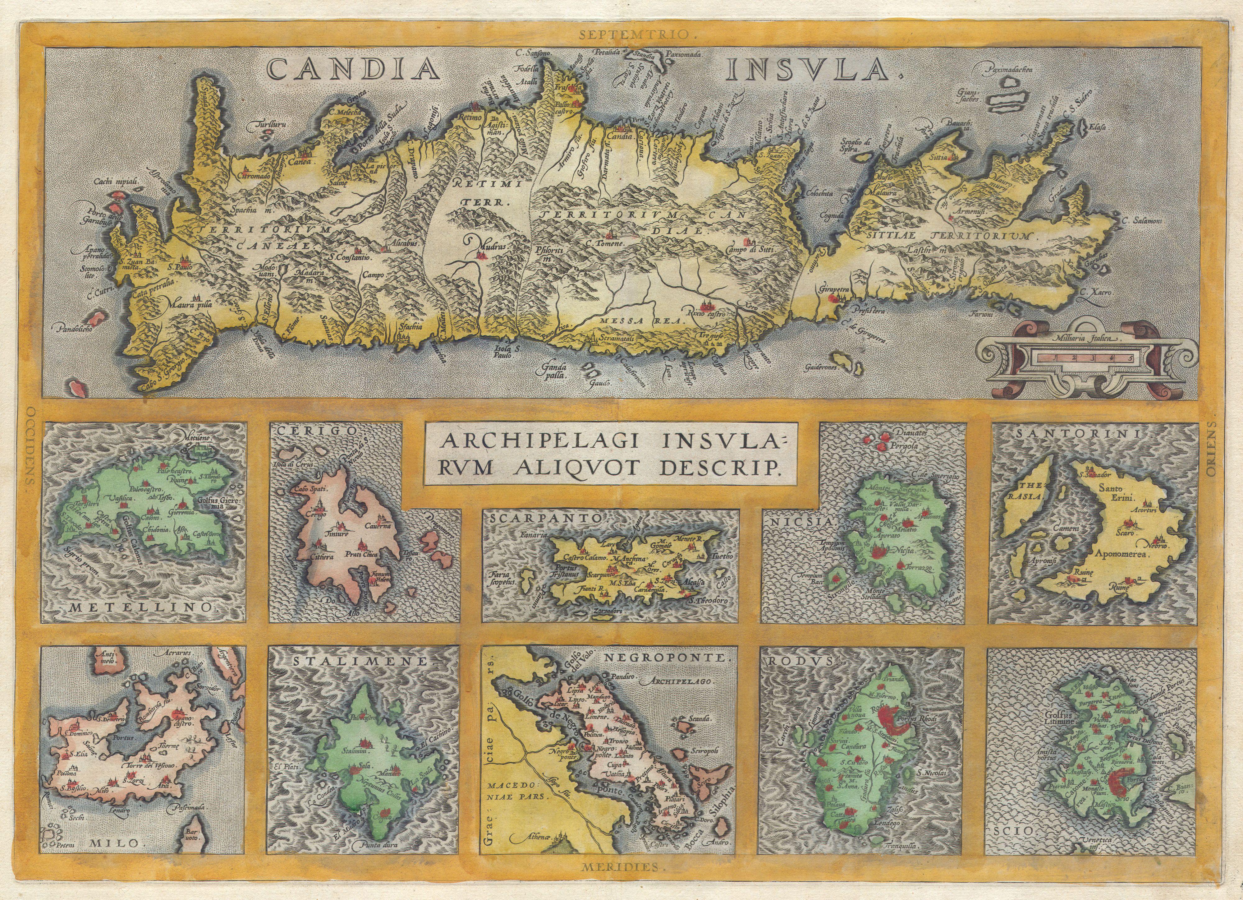
English: A rare and beautiful 1584 Abraham Ortelius map of Crete and ten other Greek islands: Metellino (Mitiline, Lesbos), Cerigo, Scarpanto (Karpathos), Nicsia (Naxos), Santorini, Milo, Stalimene (Limnos), Negroponte (Euboea), Rodus (Rhodes, home of the Colossus of Rhodes), and Scio (Chios). Beautiful, rich, hand color. |
|||||||||||||||||||||||
| Date | 1584 | |||||||||||||||||||||||
| Dimensions | height: 14.5 in (36.8 cm); width: 20 in (50.8 cm) | |||||||||||||||||||||||
| Accession number |
Geographicus link: CandiaInsula-ortelius-1584 |
|||||||||||||||||||||||
| Source/Photographer |
|
|||||||||||||||||||||||
| Permission (Reusing this file) |
|
|||||||||||||||||||||||
| Other versions | ||||||||||||||||||||||||

_and_10_Greek_Islands_-_Geographicus_-_CandiaInsula-ortelius-1584_(cropped).jpg)
File history
Click on a date/time to view the file as it appeared at that time.
| Date/Time | Thumbnail | Dimensions | User | Comment | |
|---|---|---|---|---|---|
| current | 08:46, 24 March 2011 | | 4,000 × 2,895 (2.94 MB) | BotMultichillT (talk | contribs) | {{subst:User:Multichill/Geographicus |link=http://www.geographicus.com/P/AntiqueMap/CandiaInsula-ortelius-1584 |product_name=1584 Ortelius Map of Crete (Candia) and 10 Greek Islands |map_title=Candia Insula - Archipelagi Insularum Aliquot Descrip. |descri |
You cannot overwrite this file.
File usage on Commons
The following 3 pages use this file:
_and_10_Greek_Islands_-_Geographicus_-_CandiaInsula-ortelius-1584.jpg)
File usage on other wikis
The following other wikis use this file:
- Usage on en.wikipedia.org
- Usage on fr.wikipedia.org
- Usage on nl.wikipedia.org
_and_10_Greek_Islands_-_Geographicus_-_CandiaInsula-ortelius-1584.jpg&oldid=856512206)