File:さい沼.jpg
Jump to navigation
Jump to search

Size of this preview: 800 × 448 pixels. Other resolutions: 320 × 179 pixels | 640 × 359 pixels | 1,024 × 574 pixels | 1,280 × 717 pixels | 2,560 × 1,435 pixels | 3,804 × 2,132 pixels.
Original file (3,804 × 2,132 pixels, file size: 5.11 MB, MIME type: image/jpeg)
Captions
Captions
Add a one-line explanation of what this file represents
Summary[edit]
| Description |
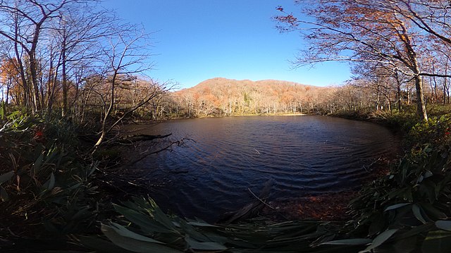
日本語: 青森県東津軽郡外ヶ浜町 さい沼 丸屋形岳県自然環境保全地域 東北自然歩道 |
||
| Date | Taken on 4 November 2018 | ||
| Source |
オリジナル (original source on jawp: ja:File:さい沼.jpg) |
||
| Author | あおもりくま at Japanese Wikipedia | ||
| Permission (Reusing this file) |
I, the copyright holder of this work, hereby publish it under the following licenses:
This file is licensed under the Creative Commons Attribution-Share Alike 3.0 Unported license.
You may select the license of your choice. |
| Camera location | | View this and other nearby images on: OpenStreetMap |
|---|
Licensing[edit]
I, the copyright holder of this work, hereby publish it under the following licenses:

|
Permission is granted to copy, distribute and/or modify this document under the terms of the GNU Free Documentation License, Version 1.2 or any later version published by the Free Software Foundation; with no Invariant Sections, no Front-Cover Texts, and no Back-Cover Texts. A copy of the license is included in the section entitled GNU Free Documentation License. |
This file is licensed under the Creative Commons Attribution-Share Alike 3.0 Unported license.
- You are free:
- to share – to copy, distribute and transmit the work
- to remix – to adapt the work
- Under the following conditions:
- attribution – You must give appropriate credit, provide a link to the license, and indicate if changes were made. You may do so in any reasonable manner, but not in any way that suggests the licensor endorses you or your use.
- share alike – If you remix, transform, or build upon the material, you must distribute your contributions under the same or compatible license as the original.
You may select the license of your choice.
File history
Click on a date/time to view the file as it appeared at that time.
| Date/Time | Thumbnail | Dimensions | User | Comment | |
|---|---|---|---|---|---|
| current | 14:00, 4 November 2018 | | 3,804 × 2,132 (5.11 MB) | あおもりくま (talk | contribs) | {{Information |Description=青森県東津軽郡外ヶ浜町 さい沼 丸屋形岳県自然環境保全地域 東北自然歩道 |Source=オリジナル |Date=2018/11/04 |Location=@41.1440636,140.6004162 |Author=あおもりくま |Permission={{self|GFDL|Cc-by-sa-3.0}} |other_versions=not }} |
You cannot overwrite this file.
File usage on Commons
There are no pages that use this file.
File usage on other wikis
The following other wikis use this file:
- Usage on ja.wikipedia.org
- Usage on ko.wikipedia.org