File:Таймыр.jpg
Jump to navigation
Jump to search

Size of this preview: 800 × 538 pixels. Other resolutions: 320 × 215 pixels | 640 × 430 pixels | 1,024 × 689 pixels | 1,393 × 937 pixels.
Original file (1,393 × 937 pixels, file size: 373 KB, MIME type: image/jpeg)
Captions
Captions
Add a one-line explanation of what this file represents
Summary[edit]
| Description |
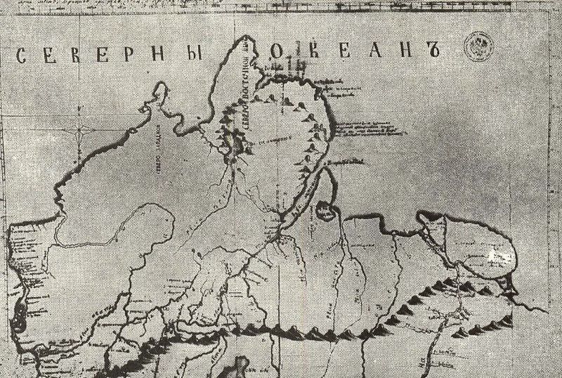
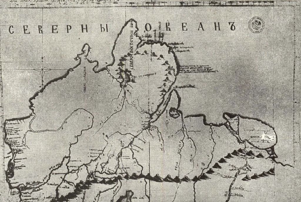
English: This is Map of Taymyr Peninsula was made by Russian Arctic explorer Khariton Laptev in 1742 year. This map was first publication in «Записки гидрографического департамента, т. IX. СПб., 1851, с. 59».
Русский: Это карта полуострова Таймыр, составлена русским полярным исследователем Великой Северной экспедиции Харитоном Лаптевым в 1742 году и является частью «Записок Харитона Лаптева», представленых им для отчета о экспедиции. |
| Date | |
| Source | http://www.mediahouse.ru/catalogue.html?sel=1133165120#1133165120 |
| Author | Khariton Laptev |
Licensing[edit]
|
This work is in the public domain in its country of origin and other countries and areas where the copyright term is the author's life plus 100 years or fewer. | |
| This file has been identified as being free of known restrictions under copyright law, including all related and neighboring rights. | |
File history
Click on a date/time to view the file as it appeared at that time.
| Date/Time | Thumbnail | Dimensions | User | Comment | |
|---|---|---|---|---|---|
| current | 09:23, 25 November 2009 | | 1,393 × 937 (373 KB) | Kontiger (talk | contribs) | {{Information |Description={{en|1=This is Map of Taymyr Peninsula was made by Russian Arctic explorer Khariton Laptev in 1742 year. This map was first publication in «Записки гидрографического департамента, т. IX. С� |
You cannot overwrite this file.
File usage on Commons
There are no pages that use this file.
File usage on other wikis
The following other wikis use this file:
- Usage on avk.wikipedia.org
- Usage on bg.wikipedia.org
- Usage on cs.wikipedia.org
- Usage on eo.wikipedia.org
- Usage on es.wikipedia.org
- Usage on gl.wikipedia.org
- Usage on it.wikipedia.org
- Usage on la.wikipedia.org
- Usage on lt.wikipedia.org
- Usage on nl.wikipedia.org
- Usage on ru.wikipedia.org