File:Дорожня карта України та суміжних держав, 1918 (1).jpg
Jump to navigation
Jump to search
Size of this preview: 800 × 578 pixels. Other resolutions: 320 × 231 pixels | 640 × 463 pixels | 1,024 × 740 pixels | 1,280 × 925 pixels | 2,200 × 1,590 pixels.
Original file (2,200 × 1,590 pixels, file size: 1.28 MB, MIME type: image/jpeg)
Captions
Captions
Add a one-line explanation of what this file represents
Summary[edit]
.jpg&action=edit§ion=1)
| Description |
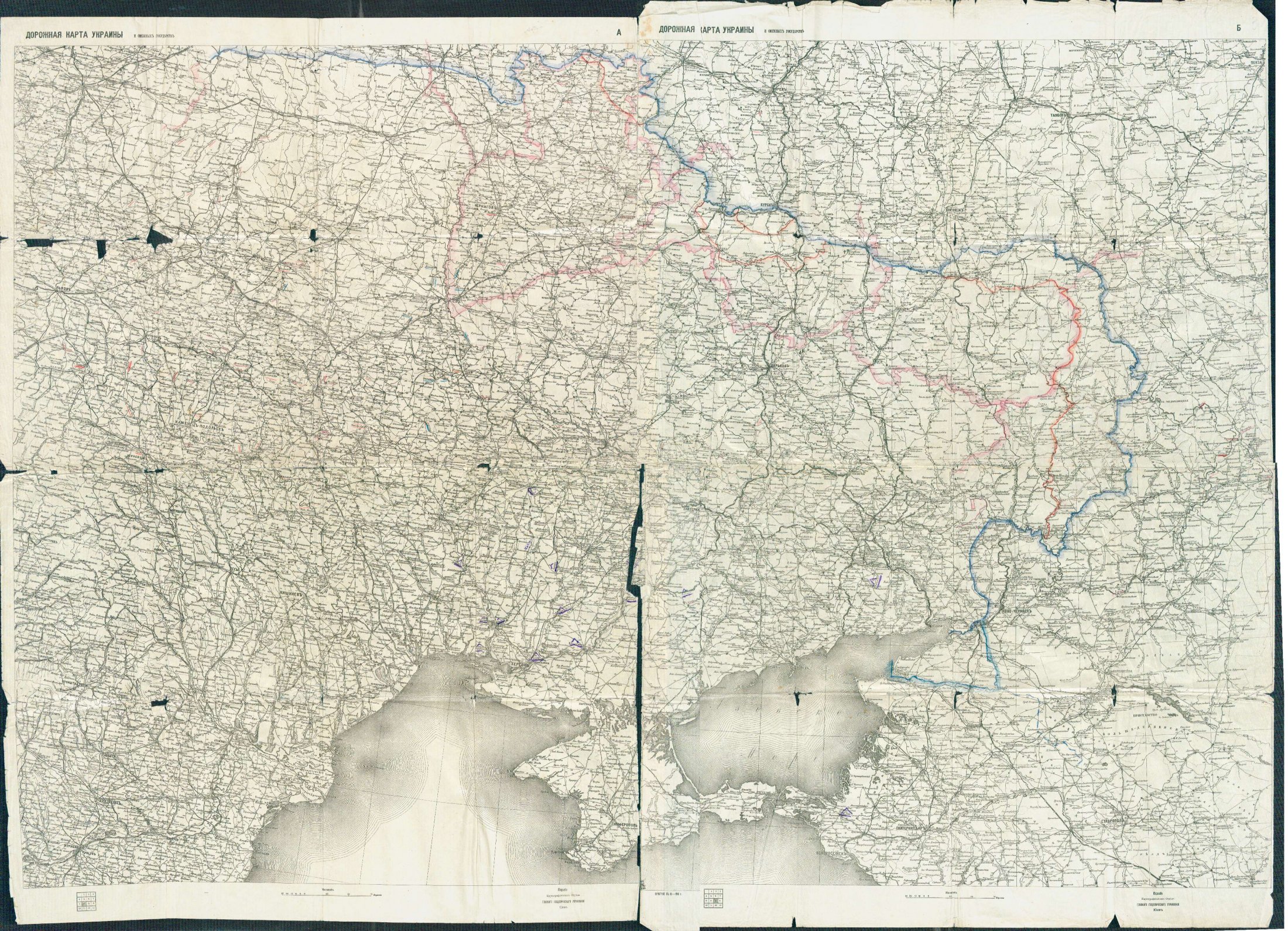
Українська: Дорожна карта України та суміжних держав, видана Картографічним відділом Головного геодезичного управління. Київ, березень 1918 р. Карта долучена до документів фонду особового походження Сергія Шелухіна, який у 1918 р. очолював делегацію України на переговорах з РРФСР. На ній нанесено розмежування територій за етнічним складом населення.
English: A map of Ukraine, published by The Cartographic Department of the Main Geodetic Administration in Kyiv in March 1918. Lines show ethnic borders. |
| Date | |
| Source | Central State Archives of Higher Authorities and Governance of Ukraine |
| Author | Картографічний відділ Головного геодезичного управління |
Licensing[edit]
.jpg&action=edit§ion=2)
This file is a Ukrainian or Ukrainian SSR work and it is presently in the public domain in Ukraine, because it was published before January 1, 1954, and the creator (if known) died before that date (details).
|
 |
File history
Click on a date/time to view the file as it appeared at that time.
| Date/Time | Thumbnail | Dimensions | User | Comment | |
|---|---|---|---|---|---|
| current | 19:20, 26 August 2022 | | 2,200 × 1,590 (1.28 MB) | ZxcvU (talk | contribs) | Uploaded a work by Картографічний відділ Головного геодезичного управління from [https://tsdavo.gov.ua/novyny/do-dnya-nezalezhnosti-ukrayiny-ukrayina-na-mapah-vid-davnih-chasiv-do-sogodennya/ Central State Archives of Higher Authorities and Governance of Ukraine] with UploadWizard |
You cannot overwrite this file.
File usage on Commons
There are no pages that use this file.
.jpg&oldid=693790854)