File:Φραγκοκάστελο.jpg
Jump to navigation
Jump to search
Size of this preview: 667 × 600 pixels. Other resolutions: 267 × 240 pixels | 534 × 480 pixels | 855 × 768 pixels | 1,139 × 1,024 pixels | 2,279 × 2,048 pixels | 4,724 × 4,246 pixels.
Original file (4,724 × 4,246 pixels, file size: 14.15 MB, MIME type: image/jpeg)
Captions
Captions
Add a one-line explanation of what this file represents
Summary[edit]
| Description |
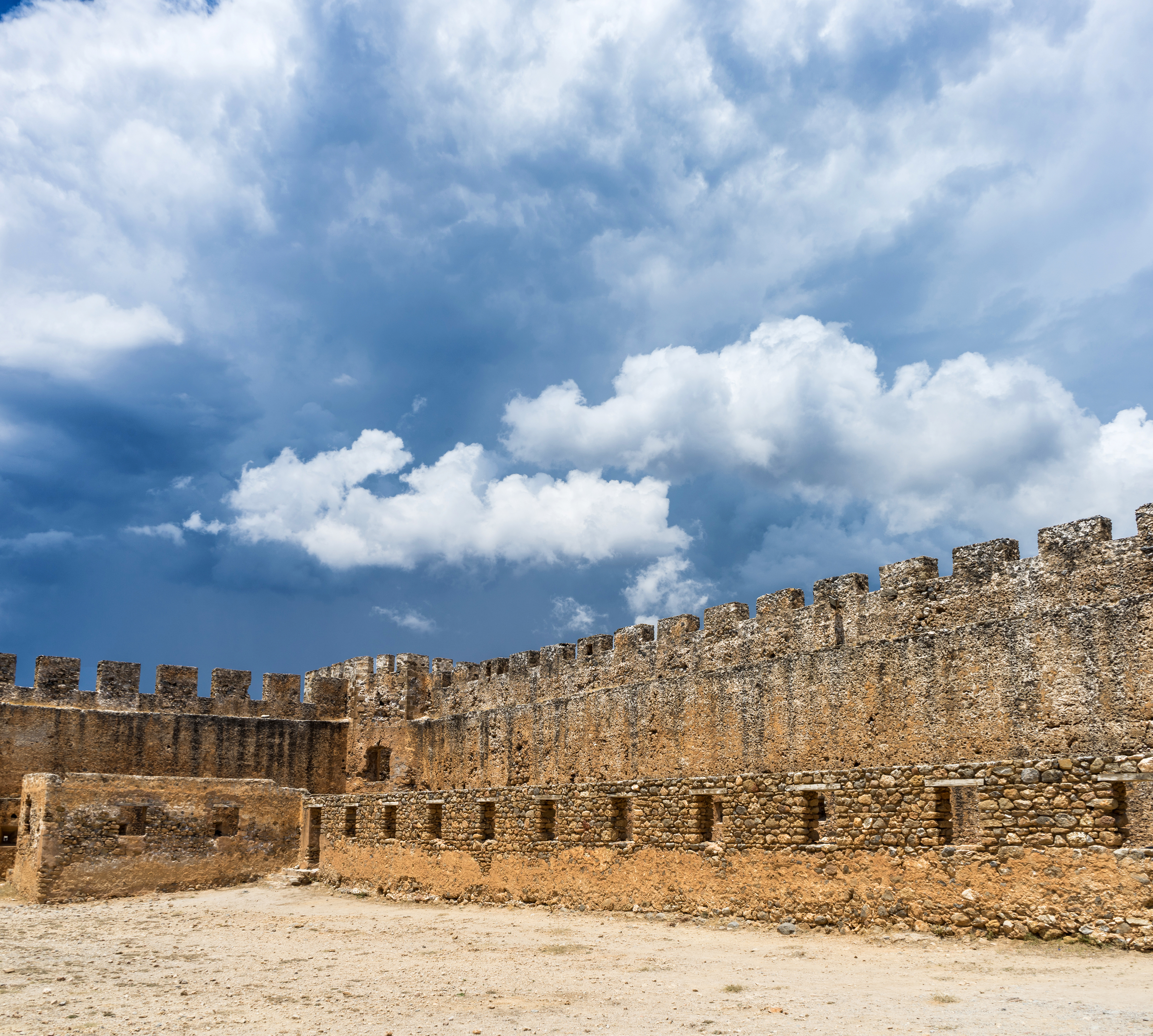
Ελληνικά: Φρούριο Φραγκοκάστελλο. Το Φραγκοκάστελο είναι φρούριο που βρίσκεται στα δυτικά της νότιας ακτής του νομού Χανίων της Κρήτης, στην περιοχή των Σφακίων.
Το 1371, ξεκίνησε η κατασκευή του κάστρου από τους Βενετούς, με πέτρες από τα ερείπια αρχαίου κοντινού οικισμού. Το 1828, κατά την διάρκεια της ελληνικής επανάστασης ο οπλαρχηγός Χατζημιχάλης Νταλιάνης οχυρώθηκε στο κάστρο μαζί με 700 αντρες. Στις 18 Μαΐου 1828 διεξήχθη άγρια μάχη μεταξύ των οχυρωμένων Ελλήνων και των οθωμανικών δυνάμεων του Μουσταφά Ναϊλή Πασά. Οι Έλληνες ηττήθηκαν πέφτοντας μεγάλο μέρος από αυτούς νεκροί. Μετά την μάχη ο Ναϊλής Πασάς κατέστρεψε προσωρινά το κάστρο για να μην ξαναχρησιμοποιηθεί από τους εξεγερμένους ντόπιους, αλλά αργότερα το επισκεύασε.[3] Το κάστρο δεν ξαναχρησιμοποιήθηκε τα επόμενα χρόνια. Η φονική αυτή μάχη συνδέθηκε με το σπάνιο φαινόμενο που παρατηρείται στην περιοχή και είναι γνωστό ως Δροσουλίτες. Κάθε χρόνο μεταξύ Μαΐου και Ιουνίου κατά τις πρωινές ώρες, παρατηρούνται στον κάμπο γύρω από το κάστρο σκιές που θυμίζουν φιγούρες ιππέων ή πολεμιστών. Η παράδοση αναφέρει πως πρόκειται για τα φαντάσματα των στρατιωτών που σκοτώθηκαν στην φονική μάχη που διεξήχθη τέτοια εποχή.«Φρούριο Φραγκοκάστελλο»
|
|||
| Date | ||||
| Source |
Own work
|
|||
| Author | Violeta Meleti | |||
| Permission (Reusing this file) |
I, the copyright holder of this work, hereby publish it under the following license: This file is licensed under the Creative Commons Attribution-Share Alike 4.0 International license.
|


| Camera location | | View this and other nearby images on: OpenStreetMap |
|---|
File history
Click on a date/time to view the file as it appeared at that time.
| Date/Time | Thumbnail | Dimensions | User | Comment | |
|---|---|---|---|---|---|
| current | 12:15, 19 October 2020 | | 4,724 × 4,246 (14.15 MB) | Violeta Meleti (talk | contribs) | Uploaded own work with UploadWizard |
You cannot overwrite this file.
File usage on Commons
There are no pages that use this file.