File:Észak-Macedónia régiói számokkal.png
Jump to navigation
Jump to search

Size of this preview: 771 × 599 pixels. Other resolutions: 309 × 240 pixels | 618 × 480 pixels | 988 × 768 pixels | 1,280 × 995 pixels | 1,374 × 1,068 pixels.
Original file (1,374 × 1,068 pixels, file size: 290 KB, MIME type: image/png)
Captions
Captions
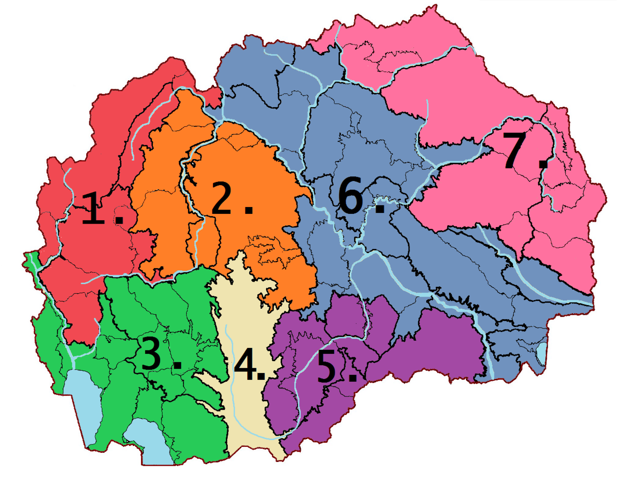
North Macedonia regional level 1 - with numbers
Summary[edit]
| Description |
English: 1. ЗАПАДНИ ПЛАНИНИ - ZAPADNI PLANINI - WESTERN MOUNTAINS 2. ЦЕНТРАЛНИ ПЛАНИНИ - CENTRALNI PLANINI - CENTRAL MOUNTAINS 3. ЈУГОЗАПАДЕН ЕЗЕРСКИ РЕГИОН - JUGOZAPADEN EZERSKI REGION - SOUTHWEST LAKE AREA 4. ПЕЛАГОНИЈА - PELAGONIJA - PELAGONIJAplateau 5. ЈУЖНИ ПЛАНИНИ - JUŽNI PLANINI - SOUTHERN MOUNTAINS 6. ВАРДАРСКА ЗОНА - VARDARSKA ZONA - VARDAR ZONE 7. ИСТОЧНИ ПЛАНИНИ - ISTOČNI PLANINI - EASTERN MOUNTAINS |
| Date | |
| Source | Own work |
| Author | Kiss Veronika |
| Other versions |
|

Licensing[edit]
I, the copyright holder of this work, hereby publish it under the following license:
This file is licensed under the Creative Commons Attribution-Share Alike 4.0 International license.
- You are free:
- to share – to copy, distribute and transmit the work
- to remix – to adapt the work
- Under the following conditions:
- attribution – You must give appropriate credit, provide a link to the license, and indicate if changes were made. You may do so in any reasonable manner, but not in any way that suggests the licensor endorses you or your use.
- share alike – If you remix, transform, or build upon the material, you must distribute your contributions under the same or compatible license as the original.
File history
Click on a date/time to view the file as it appeared at that time.
| Date/Time | Thumbnail | Dimensions | User | Comment | |
|---|---|---|---|---|---|
| current | 09:33, 23 January 2020 | | 1,374 × 1,068 (290 KB) | KAIRSESV (talk | contribs) | User created page with UploadWizard |
You cannot overwrite this file.
File usage on Commons
The following page uses this file:
File usage on other wikis
The following other wikis use this file:
- Usage on hu.wikipedia.org