File:"LOCATION DIAGRAM FOR NH 46-14" "SERIES L500" within Tibet, Sikang, India in 1954 map detail, from- Txu-oclc-10552568-nh46-14 (cropped).jpg
Jump to navigation
Jump to search

No higher resolution available.
"LOCATION_DIAGRAM_FOR_NH_46-14"_"SERIES_L500"_within_Tibet,_Sikang,_India_in_1954_map_detail,_from-_Txu-oclc-10552568-nh46-14_(cropped).jpg (475 × 376 pixels, file size: 43 KB, MIME type: image/jpeg)
Captions
Captions
Add a one-line explanation of what this file represents
Summary[edit]
| Description |
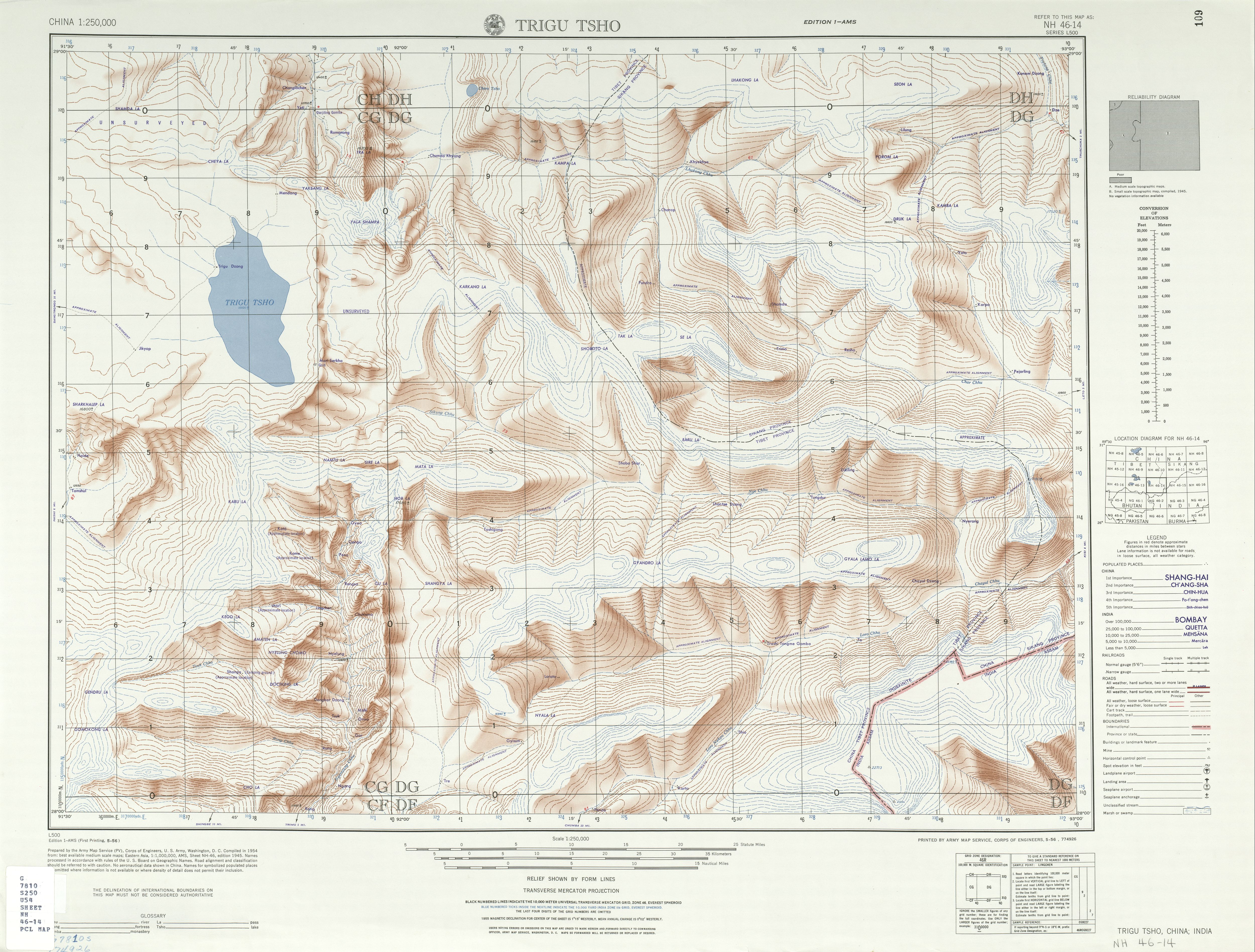
English: Map of Trigu Tsho area, Tibet |
| Date | |
| Source | http://legacy.lib.utexas.edu/maps/ams/china/txu-oclc-10552568-nh46-14.jpg |
| Author | Army Map Service (PV), Corps of Engineers 1954 |
| Other versions |
|


-
 Index Map

.jpg&action=edit§ion=1)
Licensing[edit]
.jpg&action=edit§ion=2)
This work is in the public domain in the United States because it is a work prepared by an officer or employee of the United States Government as part of that person’s official duties under the terms of Title 17, Chapter 1, Section 105 of the US Code.
Note: This only applies to original works of the Federal Government and not to the work of any individual U.S. state, territory, commonwealth, county, municipality, or any other subdivision. This template also does not apply to postage stamp designs published by the United States Postal Service since 1978. (See § 313.6(C)(1) of Compendium of U.S. Copyright Office Practices). It also does not apply to certain US coins; see The US Mint Terms of Use.
|
 | |
| This file has been identified as being free of known restrictions under copyright law, including all related and neighboring rights. | ||
File history
Click on a date/time to view the file as it appeared at that time.
| Date/Time | Thumbnail | Dimensions | User | Comment | |
|---|---|---|---|---|---|
| current | 05:04, 6 July 2020 | | 475 × 376 (43 KB) | Tibet Nation (talk | contribs) | File:Txu-oclc-10552568-nh46-14.jpg cropped 91 % horizontally, 90 % vertically using CropTool with lossless mode. |
You cannot overwrite this file.
File usage on Commons
The following 2 pages use this file:
.jpg&oldid=827777485)