Category:Maps of Plzeň
Jump to navigation
Jump to search
Wikimedia category | |||||
| Upload media | |||||
| Instance of | |||||
|---|---|---|---|---|---|
| Category combines topics | |||||
| Plzeň | |||||
Czech city       | |||||
| Instance of |
| ||||
| Location | Plzeň-City District, Plzeň Region, Czechia | ||||
| Located in or next to body of water | |||||
| Head of government |
| ||||
| Headquarters location |
| ||||
| Legal form | |||||
| Inception |
| ||||
| Significant event | |||||
| Population |
| ||||
| Area |
| ||||
| Elevation above sea level |
| ||||
| Different from | |||||
| official website | |||||
 | |||||
Subcategories
This category has the following 3 subcategories, out of 3 total.
Media in category "Maps of Plzeň"
The following 28 files are in this category, out of 28 total.
-
 Plzen PM CZ.png 439 × 430; 11 KB
-
 Bilahora.png 1,920 × 974; 1.85 MB
-
 Bolevecka naves map.jpg 7,363 × 4,913; 1.47 MB
-
 CZRefMap - Plzen.png 256 × 150; 57 KB
-
 Katastrální mapa Plzně.PNG 810 × 751; 47 KB
-
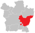
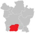
 Location map municipal district Plzen 1.png 389 × 371; 6 KB
-
 Location map municipal district Plzen 10.png 389 × 371; 6 KB
-
 Location map municipal district Plzen 2.png 389 × 371; 6 KB
-
 Location map municipal district Plzen 3.png 389 × 371; 6 KB
-
 Location map municipal district Plzen 4.png 389 × 371; 6 KB
-
 Location map municipal district Plzen 5.png 389 × 371; 6 KB
-
 Location map municipal district Plzen 6.png 389 × 371; 6 KB
-
 Location map municipal district Plzen 7.png 389 × 371; 6 KB
-
 Location map municipal district Plzen 8.png 389 × 371; 6 KB
-
 Location map municipal district Plzen 9.png 389 × 371; 6 KB
-
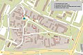
 Mapy.cz - turistická - křižovatka U Práce.png 600 × 625; 117 KB
-
 Měřický náčrt.jpg 583 × 500; 21 KB
-
 Nákres náměstí.pdf 1,275 × 1,750; 173 KB
-
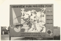 Orientacni plan prujezdu Plzni 1960.png 1,118 × 768; 685 KB
-
 Pilsen (CZE) - location.svg 3,417 × 1,956; 169 KB
-
 Pilsner Urquell Brewery - panoramio.jpg 1,600 × 1,200; 652 KB
-
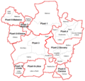
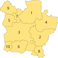 Plzen Districts 1.svg 581 × 581; 18 KB
-
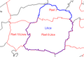
 Plzen-Rokycany locator map.svg 1,563 × 726; 24.29 MB
-
 Plzeň location map.png 1,779 × 1,681; 3.92 MB
-
 PM mapa.png 647 × 620; 38 KB
-
 Schemalitice.png 391 × 263; 5 KB
-
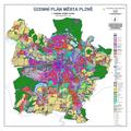
 Uzemni plan mesto Plzen 2010.jpg 7,086 × 7,086; 27.19 MB
-
 Uzemni plan mesto Plzen 2010.pdf 5,314 × 5,314; 6.73 MB


_-_location.svg)


