File:Tectonic plates hotspots he.jpg
Jump to navigation
Jump to search
Size of this preview: 800 × 546 pixels. Other resolutions: 320 × 218 pixels | 640 × 436 pixels | 1,024 × 698 pixels | 1,280 × 873 pixels | 2,000 × 1,364 pixels.
Original file (2,000 × 1,364 pixels, file size: 413 KB, MIME type: image/jpeg)
Captions
Captions
Add a one-line explanation of what this file represents
| Description |
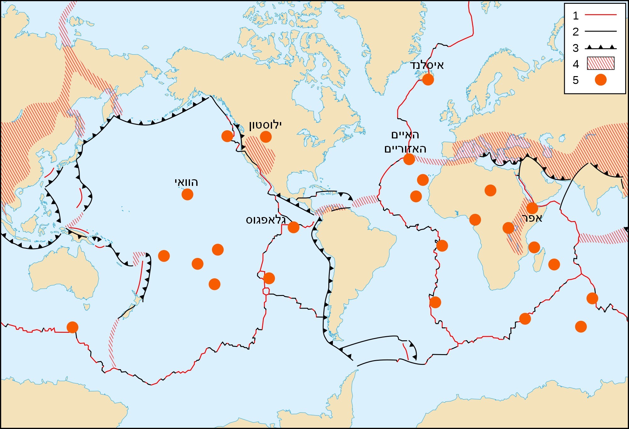
English: World map in English of selected prominent geological hotspots. Français : Carte en anglais des principaux points chauds géologiques mondiaux. עברית: מפה עולמית של לוחות טקטוניים ונקודות חמות |
| Date | (UTC) |
| Source | |
| Author |
|
This image is in the public domain in the United States because it only contains materials that originally came from the United States Geological Survey, an agency of the United States Department of the Interior. For more information, see the official USGS copyright policy.
|
| This work was previously under Public Domain, or a Free License. It has been digitally enhanced and/or modified. This derivative work has been (or is hereby) released into the public domain by its author, [[:{{{1}}}:User:{{{3}}}|{{{3}}}]] at the [[:{{{1}}}:|{{{2}}}]] project. This applies worldwide. In some countries this is not legally possible; if so:
|
Original upload log
[edit]
This image is a derivative work of the following images:
- File:Tectonic_plates_hotspots-en.svg licensed with PD-USGov-USGS, PD-retouched-user-w
- 2008-06-02T21:38:19Z Sting 1100x750 (381552 Bytes) Display bug correction
- 2008-03-02T08:58:28Z QWerk 1100x750 (186026 Bytes) Cleaned code. Lets see does it work now.
- 2006-10-21T23:25:55Z Sting 0x0 (406117 Bytes) * '''Key :''' :'''1 :''' Divergent plate boundaries ; :'''2 :''' Convergent plate boundaries ; :'''3 :''' Transform plate boundaries ; :'''4 :''' Plate boundary zones ; :'''5 :''' Selected prominent hotspots. {{Information
Uploaded with derivativeFX
File history
Click on a date/time to view the file as it appeared at that time.
| Date/Time | Thumbnail | Dimensions | User | Comment | |
|---|---|---|---|---|---|
| current | 13:27, 4 October 2010 | | 2,000 × 1,364 (413 KB) | דקי (talk | contribs) | {{Information |Description={{en|World map in English of selected prominent geological hotspots.}} {{fr|Carte en anglais des principaux points chauds géologiques mondiaux.}} {{he|מפה עולמית של לוחות טקטוניים ונקודות חמות |
You cannot overwrite this file.
File usage on Commons
There are no pages that use this file.
File usage on other wikis
The following other wikis use this file:
- Usage on he.wikipedia.org