File:SouthernCaribbeanIslands.PNG
Jump to navigation
Jump to search
Size of this preview: 800 × 405 pixels. Other resolutions: 320 × 162 pixels | 840 × 425 pixels.
Original file (840 × 425 pixels, file size: 175 KB, MIME type: image/png)
Captions
Captions
Add a one-line explanation of what this file represents
Summary[edit]
| Description |
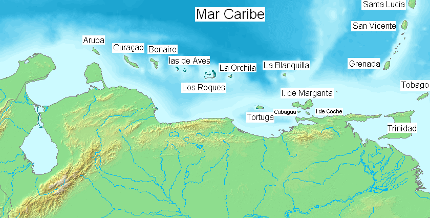
English: Major islands of the southern Caribbean Sea. Español: Pricipales islas en el mar Caribe sur. |
| Date | |
| Source | Own work ( Edited over former map File:Map of Venezuela Demis.png ) |
| Author | Claudio Elias |
This image is in the public domain because it came from the site https://www.demis.nl/products/web-map-server/examples/ and was released by the copyright holder. Permission is granted to copy, distribute and/or modify this map since it is based on free of copyright images from: www.demis.nl. See also approval email on de.wp and its clarification.
|
| This work has been released into the public domain by its copyright holder, www.demis.nl. This applies worldwide. In some countries this may not be legally possible; if so: www.demis.nl grants anyone the right to use this work for any purpose, without any conditions, unless such conditions are required by law.
|
Licensing[edit]
| I, the copyright holder of this work, release this work into the public domain. This applies worldwide. In some countries this may not be legally possible; if so: I grant anyone the right to use this work for any purpose, without any conditions, unless such conditions are required by law. |
File history
Click on a date/time to view the file as it appeared at that time.
| Date/Time | Thumbnail | Dimensions | User | Comment | |
|---|---|---|---|---|---|
| current | 07:46, 9 April 2018 | | 840 × 425 (175 KB) | ديفيد عادل وهبة خليل 2 (talk | contribs) | Cropped 1 % horizontally, 1 % vertically using CropTool with precise mode. Removed border. |
| 00:32, 6 April 2014 |  | 846 × 431 (173 KB) | Capmo (talk | contribs) | Orchilla > Orchila | |
| 18:50, 23 August 2007 |  | 846 × 431 (129 KB) | Claudio Elias (talk | contribs) | {{Information |Description=EN: Mayors islands on southern Caribbean sea. ES: pricipales islas en en el mar Caribe sur. ( Edited over former map Map of Venezuela Demis.png . |Source=self-made |Date=august 2007 |Author= [[User:Claudio Elias|Claudio Eli |
You cannot overwrite this file.
File usage on Commons
The following page uses this file:
File usage on other wikis
The following other wikis use this file:
- Usage on el.wikipedia.org
- Usage on en.wikipedia.org
- Usage on es.wikipedia.org
- Usage on es.wikibooks.org
- Usage on fa.wikipedia.org
- Usage on gl.wikipedia.org
- Usage on hr.wikipedia.org
- Usage on hu.wikipedia.org
- Usage on it.wikipedia.org
- Usage on ja.wikipedia.org
- Usage on ms.wikipedia.org
- Usage on pt.wikipedia.org
- Usage on zh.wikipedia.org