File:Argentina (orthographic projection).png
Jump to navigation
Jump to search
No higher resolution available.
Argentina_(orthographic_projection).png (541 × 541 pixels, file size: 88 KB, MIME type: image/png)
Captions
Captions
Add a one-line explanation of what this file represents

|
File:Argentina (orthographic projection).svg is a vector version of this file. It should be used in place of this PNG file.
File:Argentina (orthographic projection).png → File:Argentina (orthographic projection).svg
For more information, see Help:SVG. |
.svg) |
| Description |
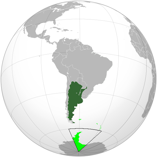
Español: Argentina en proyección ortográfica. English: Argentina in orthographic projection. |
||||
| Date | |||||
| Source |
Español: Trabajo propio. English: Own work by uploader. Aquarius.geomar.de
|
||||
| Author | Alakasam. |

Mapas en protección ortográfica. Orthographic projection maps.
.svg)
.svg)
.svg)
.svg)
.svg)
.svg)
.svg)
.svg)
.svg)
.svg)
.svg)
.svg)
.svg)
.svg)
.svg)
.svg)
.svg)
.svg)
.svg)
.svg)
.svg)
.svg)
.svg)
.svg)
.svg)
.svg)
.svg)
.svg)
.svg)
.svg)
.svg)
.svg)
.svg)
.svg)
.svg)
.svg)
.svg)
.svg)
.svg)
.svg)
.svg)
.svg)
.svg)
.svg)
.svg)
.svg)
.svg)
.svg)
.svg)
.svg)
.svg)
.svg)
.svg)
.svg)
.svg)
.svg)
.svg)
.svg)
.svg)
.svg)
.svg)
.svg)
.svg)
.svg)
.svg)
.svg)
.svg)
.svg)
.svg)
.svg)
.svg)
.svg)
.svg)
.svg)

.svg)

.svg)

.svg)
.svg)
.svg)
.svg)
.svg)
.svg)
.svg)


.svg)
.svg)
.svg)
.svg)
.svg)
.svg)
.svg)

.svg)
.svg)
.svg)
.svg)
.svg)
.svg)
.svg)
.svg)
.svg)
.svg)

.svg)
.svg)
.svg)
.svg)
.svg)
.svg)
.svg)
_without_national_boundaries.svg)
.svg)
.svg)
.svg)
.svg)
.svg)
.svg)

.svg)
.svg)
.png)
.svg)
.svg)
.svg)
.svg)

.svg)
.svg)
.svg)
.svg)
.svg)
.svg)
.svg)
.svg)
.svg)
.svg)
.svg)

.svg)
.svg)
.svg)
.svg)
.svg)
.svg)
.svg)
.svg)
.svg)

.svg)
.svg)

.svg)
.svg)
.svg)
.svg)
.svg)
.svg)
.svg)
.svg)
.svg)
.svg)
.svg)
.svg)
.svg)
.svg)
.svg)
.svg)
.svg)
.svg)
.svg)
.svg)
.svg)
.svg)
.svg)
.svg)
.svg)
.svg)
.svg)
_-_Crimea_disputed.svg)
.svg)
.svg)
.svg)
.svg)
.svg)
.svg)
.svg)
.svg)
.svg)
.svg)
.svg)
_political.svg)
.svg)
.svg)
.svg)
.svg)
_-_Crimea_disputed_-_no_borders.svg)
.svg)
.svg)
.svg)
.svg)
.svg)
.svg)
.svg)
.svg)
.svg)
.svg)
.svg)

.svg)
.svg)
.svg)

.png)
.svg)
.svg)
.svg)
.svg)
.svg)
.svg)
.svg)
.svg)
.svg)
.svg)
.svg)
.svg)
.svg)
.svg)
.svg)
.svg)
.svg)
.svg)
.svg)
.svg)
.svg)
.svg)
.svg)
.svg)
.svg)
.svg)
.svg)
.svg)
.svg)
.svg)
.svg)
.svg)
.svg)
.svg)
.png)
.svg)
.svg)
.svg)
_(orthographic_projection).png)
.svg)
| Orthographic projections maps created by Ssolbergj |
|---|
| Orthographic projections maps created by Ssolbergj: |
.svg)
I, the copyright holder of this work, hereby publish it under the following license:
This file is licensed under the Creative Commons Attribution 3.0 Unported license.
- You are free:
- to share – to copy, distribute and transmit the work
- to remix – to adapt the work
- Under the following conditions:
- attribution – You must give appropriate credit, provide a link to the license, and indicate if changes were made. You may do so in any reasonable manner, but not in any way that suggests the licensor endorses you or your use.
File history
Click on a date/time to view the file as it appeared at that time.
| Date/Time | Thumbnail | Dimensions | User | Comment | |
|---|---|---|---|---|---|
| current | 00:14, 19 April 2009 | | 541 × 541 (88 KB) | Poiche (talk | contribs) | Small changes in argentine antartica. |
| 23:40, 15 April 2009 |  | 541 × 541 (89 KB) | Poiche (talk | contribs) | Small changes in antartica. | |
| 22:57, 12 April 2009 |  | 541 × 541 (89 KB) | Poiche (talk | contribs) | Small changes in antartica. | |
| 15:24, 9 April 2009 |  | 541 × 541 (187 KB) | Poiche (talk | contribs) | {{es|1=Incluidos territorios reclamados.}}{{en|1=Including claimed territories.}} | |
| 18:26, 2 April 2009 |  | 541 × 541 (89 KB) | Poiche (talk | contribs) | {{Information |Description={{es|1=Argentina en proyección ortográfica.}}{{en|1=Argentina in orthographic projection.}} |Source={{es|1=Trabajo propio.}}{{en|1=Own work by uploader.}}[http://www.aquarius.geomar.de/omc/make_map.html Aquarius.geomar.de]<br |
You cannot overwrite this file.
File usage on Commons
There are no pages that use this file.
File usage on other wikis
The following other wikis use this file:
- Usage on es.wikipedia.org
.png&oldid=811998419)